Country:
 USA
USARegion:
City:
Latitude and Longitude:
Time Zone:
Postal Code:
IP information under different IP Channel
ip-api
Country
Region
City
ASN
Time Zone
ISP
Blacklist
Proxy
Latitude
Longitude
Postal
Route
IPinfo
Country
Region
City
ASN
Time Zone
ISP
Blacklist
Proxy
Latitude
Longitude
Postal
Route
MaxMind
Country
Region
City
ASN
Time Zone
ISP
Blacklist
Proxy
Latitude
Longitude
Postal
Route
Luminati
Country
USRegion
tx
City
pearland
ASN
Time Zone
America/Chicago
ISP
SWITCH-LTD
Latitude
Longitude
Postal
db-ip
Country
Region
City
ASN
Time Zone
ISP
Blacklist
Proxy
Latitude
Longitude
Postal
Route
ipdata
Country
Region
City
ASN
Time Zone
ISP
Blacklist
Proxy
Latitude
Longitude
Postal
Route
Popular places and events near this IP address
Brookside Village, Texas
City in Brazoria County, Texas, United States
Distance: Approx. 5051 meters
Latitude and longitude: 29.59083333,-95.31805556
Brookside Village is a city in Brazoria County, Texas, United States. The population of the city was 1,548 at the 2020 U.S. census, an increase over the figure of 1,523 tabulated in the 2010 U.S. census. The city of Brookside Village is part of the Houston–The Woodlands–Sugar Land metropolitan statistical area.
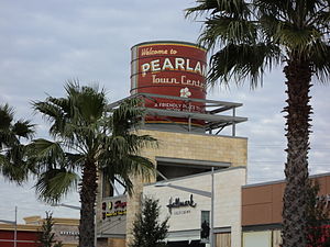
Pearland, Texas
City in Brazoria County, Texas, United States
Distance: Approx. 2394 meters
Latitude and longitude: 29.55444444,-95.29583333
Pearland ( PEAR-land) is a city in Brazoria County, with portions extending into Fort Bend and Harris counties, in Texas, United States. The city of Pearland is a principal city within the Houston–The Woodlands–Sugar Land metropolitan statistical area. At the 2020 U.S. census, the city's population was 125,828, up from a population of 91,252 at the 2010 census.

Pearland High School
Public school in Texas, United States
Distance: Approx. 2975 meters
Latitude and longitude: 29.53917,-95.27013
Pearland High School (PHS) is an American public high school, located in Pearland, Texas, south of Houston. It is one of three high schools in the Pearland Independent School District, and serves parts of Pearland and most of the city of Brookside Village. U.S. News & World Report ranks it 242nd in Texas and 2,689th nationally.
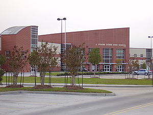
Dobie High School
Public high school in the United States
Distance: Approx. 3784 meters
Latitude and longitude: 29.5918,-95.2498
J. Frank Dobie High School is a public secondary school located in Houston, Texas. Founded in 1968, it is named after the Texas writer of the same name. It houses grades 10-12.
Pearland Stadium
Distance: Approx. 3083 meters
Latitude and longitude: 29.538683,-95.267193
Pearland Stadium (nicknamed The Rig when Pearland is home and The Nest when Dawson is home) is an American multi-use stadium in Pearland, Texas (near Houston). The 12,000-capacity stadium is on the campus of Pearland High School and serves as home to the school's football, soccer, and track and field teams. It also serves as home to the Dawson High School Eagles football team.
Pearland Regional Airport
Airport in Pearland, Texas
Distance: Approx. 5841 meters
Latitude and longitude: 29.52138889,-95.24222222
Pearland Regional Airport (ICAO: KLVJ, FAA LID: LVJ) is in Brazoria County, Texas, near Pearland in Greater Houston, 17 miles (27 km) south of Downtown Houston. It was formerly Clover Field. Most U.S. airports use the same three-letter location identifier for the FAA and IATA, but Pearland Regional Airport is LVJ to the FAA and has no IATA code.

Mykawa, Houston
Distance: Approx. 7197 meters
Latitude and longitude: 29.6208,-95.3134
Mykawa ( mi-KAH-wə) is an area within Houston, Texas, United States that was formerly a distinct unincorporated community in Harris County.

Brio Superfund site
Distance: Approx. 6406 meters
Latitude and longitude: 29.5743,-95.2093
The Brio Superfund site is a former industrial location in Harris County, Texas, at the intersection of Beamer Road and Dixie Farm Road, about 16 miles (26 km) southeast of downtown Houston and adjacent to the Dixie Oil Processors Superfund site. It is a federal Superfund site, although it was deleted from the National Priorities List in December 2006. A neighboring residential subdivision called South Bend, now abandoned was located along and north of the northern boundary of Brio North.
Clear Horizons Early College High School
Public school in Texas, United States
Distance: Approx. 6931 meters
Latitude and longitude: 29.57899,-95.204792
Clear Horizons Early College High School is a public secondary school located in Houston, Texas, United States. In this program, {{citation needed span|an associate degree is completed simultaneously within the student's four years of high school. The program requires all its students to be on either the Distinguished Achievement Plan or the Distinguished Level of Achievement Plan.
Sheryl Searcy Ninth Grade Center
Public school in Pearland, Texas
Distance: Approx. 2803 meters
Latitude and longitude: 29.54055556,-95.27166667
Sheryl Searcy Ninth Grade Center is a state-operated secondary school in Pearland, Texas, United States.
Sagemont, Houston
Distance: Approx. 6488 meters
Latitude and longitude: 29.5989,-95.2197
Sagemont is a neighborhood in far southeast Houston, Texas, south of Beltway 8. The Sagemont Civic Club serves residents. According to a 2010 Houston Chronicle article, some area residents prefer Sagemont because residents do not have to pay municipal utility district (MUD) taxes as Sagemont is in the Houston city limits.

Sri Meenakshi Temple (Pearland, Texas)
Hindu temple in Texas, United States
Distance: Approx. 5244 meters
Latitude and longitude: 29.52291914,-95.297626
The Sri Meenakshi Temple (also called the Sri Meenakshi Devasthanam) is a Hindu temple located in Pearland, Brazoria County, Texas, in the Houston metropolitan area. The temple's presiding deity is the goddess Meenakshi, an aspect of Parvati whose consort is Sundareswarar, an aspect of Shiva. The Sri Meenakshi Temple in Pearland is the only temple outside of India that is dedicated to Meenakshi and it is a replica of the Meenakshi Temple in Madurai, Tamil Nadu, India.
Weather in this IP's area
haze
26 Celsius
26 Celsius
25 Celsius
27 Celsius
1015 hPa
84 %
1015 hPa
1013 hPa
10000 meters
4.12 m/s
110 degree
100 %
07:16:45
19:01:40