Country:
 USA
USARegion:
City:
Latitude and Longitude:
Time Zone:
Postal Code:
IP information under different IP Channel
ip-api
Country
Region
City
ASN
Time Zone
ISP
Blacklist
Proxy
Latitude
Longitude
Postal
Route
IPinfo
Country
Region
City
ASN
Time Zone
ISP
Blacklist
Proxy
Latitude
Longitude
Postal
Route
MaxMind
Country
Region
City
ASN
Time Zone
ISP
Blacklist
Proxy
Latitude
Longitude
Postal
Route
Luminati
Country
USRegion
tx
City
leaguecity
ASN
Time Zone
America/Chicago
ISP
SWITCH-LTD
Latitude
Longitude
Postal
db-ip
Country
Region
City
ASN
Time Zone
ISP
Blacklist
Proxy
Latitude
Longitude
Postal
Route
ipdata
Country
Region
City
ASN
Time Zone
ISP
Blacklist
Proxy
Latitude
Longitude
Postal
Route
Popular places and events near this IP address

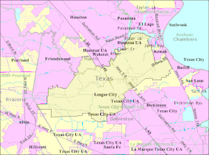
Nassau Bay, Texas
City in Texas, United States
Distance: Approx. 3018 meters
Latitude and longitude: 29.54444444,-95.08944444
Nassau Bay is a city in Harris County, Texas, United States, bordering the outermost southeastern edge of the city of Houston. It is located in the Clear Lake Area near Galveston Bay, directly adjacent to the Lyndon B. Johnson Space Center. The population was 5,347 at the 2020 census.

Webster, Texas
City in Texas, United States
Distance: Approx. 3090 meters
Latitude and longitude: 29.53861111,-95.11944444
Webster is a city in the U.S. state of Texas located in Harris County, within the Houston–The Woodlands–Sugar Land metropolitan area. Its population was 12,499 at the 2020 U.S. census.

League City, Texas
City in Texas, United States
Distance: Approx. 2208 meters
Latitude and longitude: 29.49972222,-95.08972222
League City is a city in the U.S. state of Texas, in Galveston County, within the Greater Houston metropolitan area. The population 114,392 at the 2020 census. The city of League City has a small portion north of Clear Creek within Harris County zoned for residential and commercial uses.

Clear Creek High School (League City, Texas)
Public school in Texas, United States
Distance: Approx. 2679 meters
Latitude and longitude: 29.5249,-95.0711
Clear Creek High School is located in League City, Texas, in the Clear Creek Independent School District. The school serves most of League City and the cities of Kemah, Clear Lake Shores, Nassau Bay, and Webster. The school colors are maroon and white.
Clear Path Alternative School
Public school in Webster, Texas, United States
Distance: Approx. 2460 meters
Latitude and longitude: 29.525316,-95.12178
Clear Path is a secondary alternative school located in Webster, Texas, in the Clear Creek Independent School District for 6th to 12th grade. At Clear Path, students are "placed" and moved to the school at administrative request for various reasons. The majority are at risk of dropping out of school.
Clear View High School
Public high school in Webster, Texas, United States
Distance: Approx. 2712 meters
Latitude and longitude: 29.5322,-95.1207
Clear View High School is a secondary school located in Webster, Texas, in the Clear Creek Independent School District. The school serves all of CCISD, including the cities of Kemah, Clear Lake Shores, Nassau Bay, Webster, El Lago, and Taylor Lake Village and portions of Houston, Pasadena, Friendswood, and League City. The school colors are black and gold and the school mascot is the tiger.
Wildcat Field (League City, Texas)
Baseball field in League City, Texas, US
Distance: Approx. 2307 meters
Latitude and longitude: 29.52375,-95.07472
Wildcat Field is a baseball field on the campus of Clear Creek High School in League City, Texas. It is named after the school's mascot, the "Wildcats." It is located adjacent to the Clear Creek Independent School District Stadium. It is the home of the Clear Creek High School Wildcats baseball team and was home to the Bay Area Toros of the Continental Baseball League in 2007.
Galveston Bay Area
Region in Texas, United States of America
Distance: Approx. 2198 meters
Latitude and longitude: 29.499797,-95.089784
The Galveston Bay Area, also known as Bay Area Houston or simply the Bay Area, is a region that surrounds the Galveston Bay estuary of Southeast Texas in the United States, within Houston–The Woodlands–Sugar Land metropolitan area. Normally the term refers to the mainland communities around the bay and excludes Galveston as well as most of Houston. Originally part of the pirate kingdom of Jean Lafitte, this area played a role in the early history of Texas having been the site of some early rebellions against Mexican rule and the site of the victory of the Texas army over the Mexican army during the Texas Revolution.

History of the Galveston Bay Area
Distance: Approx. 2198 meters
Latitude and longitude: 29.499797,-95.089784
For a period of over 7000 years, humans have inhabited the Galveston Bay Area in what is now the United States. Through their history the communities in the region have been influenced by the once competing sister cities of Houston and Galveston, but still have their own distinct history. Though never truly a single, unified community, the histories of the Bay Area communities have had many common threads.
Veterans Memorial Stadium (League City)
Distance: Approx. 2562 meters
Latitude and longitude: 29.52666667,-95.07305556
Veterans Memorial Stadium, often referred to simply as District Stadium, is a multi-purpose stadium located in League City, Texas on the campus of Clear Creek High School. It is currently one of two stadiums in the Clear Creek Independent School District (CCISD) and supports five 6A high schools in the district primarily for football games. The stadium also hosts some of the district's soccer, frisbee, and golf practice games.
Texas Killing Fields
Location in Texas, scene of 30+ murders
Distance: Approx. 2316 meters
Latitude and longitude: 29.49972222,-95.08694444
The Texas Killing Fields is a title used to roughly denote the area surrounding the Interstate Highway 45 corridor southeast of Houston, where since the early 1970s, more than 30 bodies have been found, and specifically to a 25-acre patch of land in League City, Texas where four women were found between 1983 and 1991. The bodies along the corridor were mainly of girls or young women. Furthermore, many additional young girls have disappeared from this area who are still missing.

Houston Methodist Clear Lake Hospital
Hospital in Texas, United States
Distance: Approx. 3658 meters
Latitude and longitude: 29.549606,-95.086216
Houston Methodist Clear Lake Hospital, located in Nassau Bay, Texas, across from Johnson Space Center, is one of seven community hospitals that are part of Houston Methodist. It employs about 900 people, has an estimated 700 affiliated doctors and admits more than 5,700 patients annually. The hospital serves the Greater Bay area.
Weather in this IP's area
haze
27 Celsius
27 Celsius
25 Celsius
28 Celsius
1015 hPa
83 %
1015 hPa
1014 hPa
8047 meters
4.12 m/s
110 degree
75 %
07:16:02
19:00:59