Country:
 USA
USARegion:
City:
Latitude and Longitude:
Time Zone:
Postal Code:
IP information under different IP Channel
ip-api
Country
Region
City
ASN
Time Zone
ISP
Blacklist
Proxy
Latitude
Longitude
Postal
Route
IPinfo
Country
Region
City
ASN
Time Zone
ISP
Blacklist
Proxy
Latitude
Longitude
Postal
Route
MaxMind
Country
Region
City
ASN
Time Zone
ISP
Blacklist
Proxy
Latitude
Longitude
Postal
Route
Luminati
Country
USRegion
ca
City
losangeles
ASN
Time Zone
America/Los_Angeles
ISP
TEXASNET-ASN
Latitude
Longitude
Postal
db-ip
Country
Region
City
ASN
Time Zone
ISP
Blacklist
Proxy
Latitude
Longitude
Postal
Route
ipdata
Country
Region
City
ASN
Time Zone
ISP
Blacklist
Proxy
Latitude
Longitude
Postal
Route
Popular places and events near this IP address
Loyola Law School
Law school of Loyola Marymount University
Distance: Approx. 311 meters
Latitude and longitude: 34.04861111,-118.27083333
Loyola Law School is the law school of Loyola Marymount University, a private Catholic university in Los Angeles, California. Loyola was established in 1920.
People's College of Law
Distance: Approx. 617 meters
Latitude and longitude: 34.05638889,-118.27361111
The Peoples College of Law (PCL) was an unaccredited private law school located in the downtown Los Angeles community of Westlake-MacArthur Park. PCL offered a part-time, four-year evening law program centered on work in the public interest. As of December 2023, there were seven students.
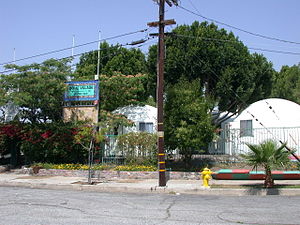
Dome Village
Community in Los Angeles, California, USA
Distance: Approx. 448 meters
Latitude and longitude: 34.0487,-118.2671
Dome Village was a self-governing community of "people unable or [...] unwilling to live in traditional [homeless] shelters". Located in Downtown Los Angeles at 847 Golden Avenue, the complex consisted of 20 geodesic domes and was inhabited by "up to 34 individuals and their family members". Operated by Justiceville/Homeless USA, a non-profit organization, members of Dome Village were politically active in homelessness, nonviolence, and environmental issues.
Good Samaritan Hospital (Los Angeles)
Hospital in California, United States
Distance: Approx. 604 meters
Latitude and longitude: 34.05444444,-118.26527778
PIH Health Good Samaritan Hospital is a hospital in Los Angeles, California. The hospital has 408 beds. In 2019 Good Samaritan joined the PIH Health network.
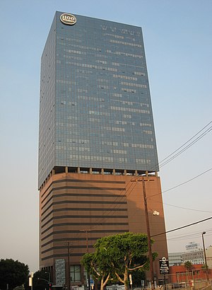
1100 Wilshire
37-story residential and commercial skyscraper in Los Angeles, California
Distance: Approx. 643 meters
Latitude and longitude: 34.0522,-118.2638
1100 Wilshire is a 37-story, 151.18 m (496.0 ft) residential and commercial skyscraper completed in 1987 in the Central City West neighborhood of Los Angeles. It is the 35th tallest building in the city, the 2nd tallest residential building in the entire Southern California region, and the 4th tallest residential building in the state of California. The 35,262 m2 (379,560 sq ft) tower was designed by AC Martin Partners.

Wilmington Branch
United States historic place
Distance: Approx. 329 meters
Latitude and longitude: 34.05361111,-118.26833333
Wilmington Branch is a branch library of the Los Angeles Public Library located in the Wilmington section of Los Angeles, California. It was built in 1927 based on a Spanish Colonial Revival design by architect W.E. McAllister. In 1987, the Wilmington Branch and several other branch libraries in Los Angeles were added to the National Register of Historic Places as part of a thematic group submission.

Frederick Mitchell Mooers House
Historic house in California, United States
Distance: Approx. 502 meters
Latitude and longitude: 34.05319444,-118.27569444
The Frederick Mitchell Mooers House, also known as the Wright-Mooers House, is an ornately detailed Victorian house built in 1894 at 818 South Bonnie Brae Street in the Westlake area of Los Angeles, California. It is named after the wealthy gold miner who owned the house from 1898 to 1900. The house has been designated as a Los Angeles Historic-Cultural Monument and is listed in the National Register of Historic Places.

Young's Market Company Building
United States historic place
Distance: Approx. 277 meters
Latitude and longitude: 34.05388889,-118.27055556
Young's Market Company Building built in 1924 is a historic building located at 1610 West 7th Street, corner South Union Avenue, in the Westlake neighborhood of Los Angeles, California. It was originally a retail market and office building, designed by architect Charles F. Plummer. The Spanish Renaissance Revival style building features marble columns and a terra-cotta frieze.

South Bonnie Brae Tract Historic District
Historic district in California, United States
Distance: Approx. 646 meters
Latitude and longitude: 34.05,-118.2775
The South Bonnie Brae Tract Historic District is a historic district of Victorian houses in Los Angeles, California, along the 1000 block of South Bonnie Brae Street and the 1800 block of West 11th Street in the Pico Union section of the city. The homes in the district date to the 1890s and reflect Queen Anne and Colonial Revival architecture. Based on its well-preserved period architecture, the district was added to the National Register of Historic Places in 1988.

Central City West, Los Angeles
Neighborhood of Los Angeles in California, United States
Distance: Approx. 582 meters
Latitude and longitude: 34.046386,-118.272485
Central City West, sometimes known as City West or The West Bank, is a neighborhood in Downtown Los Angeles.
Quality Cafe (diner)
Distance: Approx. 362 meters
Latitude and longitude: 34.052057,-118.266857
The Quality Cafe (also known as Quality Diner) was a diner at 1236 West 7th Street in Los Angeles, California. The restaurant ceased to function as a diner in late 2006 but has appeared as a location featured in a number of Hollywood films, including Million Dollar Baby, Training Day, Old School, Se7en, Ghost World, Gone in 60 Seconds, The Stepfather, What's Love Got to Do with It, Sex and Death 101, and Catch Me If You Can. It was also featured in Season 1 of the 2007 television series Mad Men, in the episode "5G".

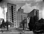
Mayfair Hotel (Los Angeles)
Historic hotel in Los Angeles, California
Distance: Approx. 296 meters
Latitude and longitude: 34.05217868,-118.26763283
The Mayfair Hotel is a historic hotel in the Westlake neighborhood of Los Angeles, California. The Sun Realty Company commissioned the building in 1926 and architectural firm Curlett & Beelman designed it in the Renaissance Revival style. The hotel opened on February 1, 1927.
Weather in this IP's area
mist
20 Celsius
20 Celsius
17 Celsius
28 Celsius
1014 hPa
84 %
1014 hPa
1004 hPa
6437 meters
3.09 m/s
260 degree
100 %
06:50:46
18:31:35