64.88.185.107 - IP Lookup: Free IP Address Lookup, Postal Code Lookup, IP Location Lookup, IP ASN, Public IP
Country:
Region:
City:
Location:
Time Zone:
Postal Code:
ISP:
ASN:
language:
User-Agent:
Proxy IP:
Blacklist:
IP information under different IP Channel
ip-api
Country
Region
City
ASN
Time Zone
ISP
Blacklist
Proxy
Latitude
Longitude
Postal
Route
db-ip
Country
Region
City
ASN
Time Zone
ISP
Blacklist
Proxy
Latitude
Longitude
Postal
Route
IPinfo
Country
Region
City
ASN
Time Zone
ISP
Blacklist
Proxy
Latitude
Longitude
Postal
Route
IP2Location
64.88.185.107Country
Region
georgia
City
atlanta
Time Zone
America/New_York
ISP
Language
User-Agent
Latitude
Longitude
Postal
ipdata
Country
Region
City
ASN
Time Zone
ISP
Blacklist
Proxy
Latitude
Longitude
Postal
Route
Popular places and events near this IP address
WCW Power Plant
American professional wrestling school
Distance: Approx. 1572 meters
Latitude and longitude: 33.8019,-84.4383
The WCW Power Plant was a professional wrestling school in Atlanta, Georgia, owned and operated by World Championship Wrestling (WCW), a subsidairy of Time Warner. The school was founded by wrestler Jody Hamilton, who opened the training center in 1989 in Lovejoy, Georgia. In 1991, it became the official school of WCW and relocated to Jonesboro, Georgia.
Grove Park, Atlanta
Neighborhood of Atlanta, Georgia
Distance: Approx. 1747 meters
Latitude and longitude: 33.772984,-84.446848
Grove Park is a neighborhood in northwest Atlanta, Georgia, inside the perimeter and bounded by: Center Hill on the west Dixie Hills, West Lake, and Hunter Hills on the south Bankhead on the east Almond Park, West Highlands, and Rockdale to the north.

Westside Park
Park in Atlanta, Georgia
Distance: Approx. 1062 meters
Latitude and longitude: 33.7809,-84.4362
Westside Park at Bellwood Quarry is a park in the City of Atlanta located on the site of the former Bellwood Quarry. The park is between Johnson Road and Donald Lee Hollowell Parkway and between the neighborhoods of Bankhead, Grove Park, and Knight Park/Howell Station. A large portion of the park falls within the Grove Park boundaries.
Bankhead station
MARTA rail station
Distance: Approx. 2273 meters
Latitude and longitude: 33.77189,-84.42884
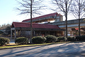
Bankhead is an elevated subway station in Atlanta, Georgia, the western terminus of the Green Line in the Metropolitan Atlanta Rapid Transit Authority (MARTA) rail system. Bankhead station is located in the Grove Park Neighborhood due to a recent neighborhood expansion. This station primarily serves the neighborhoods of Grove Park, Bankhead, West Lake, Howell Station, and other Westside residents.
Maddox Park
Distance: Approx. 2455 meters
Latitude and longitude: 33.771,-84.427
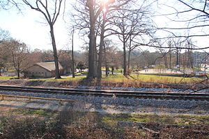
Maddox Park is a 51.5-acre (208,000 m2) community park located in the west side of Atlanta (in the Bankhead neighborhood), across Donald Lee Hollowell Parkway from Bankhead MARTA station. It is approximately 1.5 miles (2.4 km) west of Georgia Tech. The park has an existing rail line running through it, which is part of the proposed route of the Belt Line.
Knight Park–Howell Station
United States historic place
Distance: Approx. 2214 meters
Latitude and longitude: 33.785,-84.41972222
Knight Park–Howell Station, also known as Howell Station Historic District, is a National historic district and neighborhood in, Atlanta, Georgia. Almost all buildings in the area were destroyed in the American Civil War, in Sherman's March to the Sea, and all of the buildings in the district were built after 1864. The neighborhood was listed on the National Register of Historic Places in 1997.
The B.E.S.T. Academy
Public, single-gender (boys) school in Atlanta, Georgia, United States
Distance: Approx. 1593 meters
Latitude and longitude: 33.77461389,-84.44793333
The B.E.S.T. Academy is a STEM certified all-boys school serving grade 6-12 students in Carey Park, Atlanta, Georgia. The school was opened in 2007, and for a short time was referred to as the boys single gender academy, but was later named by its first principal, Curt R. Green, in honor of neurosurgeon Ben Carson. B.E.S.T. is an acronym for Business, Engineering, Science, and Technology.
Blandtown
Neighborhood of Atlanta, Georgia
Distance: Approx. 2071 meters
Latitude and longitude: 33.79,-84.421
Blandtown is a neighborhood of the West Midtown area of Atlanta, Georgia. It is located along either side of Huff Road from Howell Mill Road west to Marietta Blvd. It was one of the first black settlements around Atlanta after the Civil War, named for a Black man who owned property.
Howard School (Atlanta)
School in Atlanta, Georgia, United States
Distance: Approx. 2453 meters
Latitude and longitude: 33.787131,-84.416833
The Howard School (THS) is located in Atlanta, Georgia, United States. It was founded by Marian Howard in 1950 to give students alternative approaches to learning. Students with language-based learning disabilities and learning differences from grades K-12 may attend the school.

Huff House
Distance: Approx. 1614 meters
Latitude and longitude: 33.7894,-84.4259
The Huff House was for decades the oldest house in the city of Atlanta. It was located at the northeast corner of Huff Road and Ellsworth Industrial Avenue. at 1133 Huff Road NW (old numbering, 70 Huff Road NW) in Blandtown, part of what is today West Midtown, overlooking the site of the Battle of Peachtree Creek.
Fulton County Jail
Prison in Atlanta, Georgia, United States
Distance: Approx. 2107 meters
Latitude and longitude: 33.77888889,-84.42361111
The Fulton County Jail, also referred to as Rice Street, is a prison in Atlanta, Georgia. It was built to hold up to 1,125 prisoners in 1989 but now houses over 3,000. The US Department of Justice found in 2024 that conditions in the jail were unconstitutionally "inhumane, violent and hazardous".
Bacchanalia (restaurant)
Restaurant in Atlanta, Georgia, U.S.
Distance: Approx. 1646 meters
Latitude and longitude: 33.79472222,-84.42722222
Bacchanalia is a restaurant in Atlanta, Georgia. The fine dining restaurant serves American cuisine. It received one star as well as a green star in the Michelin Guide in 2023.
Weather in this IP's area
clear sky
-2 Celsius
-7 Celsius
-3 Celsius
-1 Celsius
1028 hPa
68 %
1028 hPa
992 hPa
10000 meters
5.66 m/s
9.26 m/s
300 degree


