Country:
 USA
USARegion:
City:
Latitude and Longitude:
Time Zone:
Postal Code:
IP information under different IP Channel
ip-api
Country
Region
City
ASN
Time Zone
ISP
Blacklist
Proxy
Latitude
Longitude
Postal
Route
IPinfo
Country
Region
City
ASN
Time Zone
ISP
Blacklist
Proxy
Latitude
Longitude
Postal
Route
MaxMind
Country
Region
City
ASN
Time Zone
ISP
Blacklist
Proxy
Latitude
Longitude
Postal
Route
Luminati
Country
USASN
Time Zone
America/Chicago
ISP
INTERNAP-BLK3
Latitude
Longitude
Postal
db-ip
Country
Region
City
ASN
Time Zone
ISP
Blacklist
Proxy
Latitude
Longitude
Postal
Route
ipdata
Country
Region
City
ASN
Time Zone
ISP
Blacklist
Proxy
Latitude
Longitude
Postal
Route
Popular places and events near this IP address

Harrington Park, New Jersey
Borough in Bergen County, New Jersey, US
Distance: Approx. 432 meters
Latitude and longitude: 40.991681,-73.980202
Harrington Park is a borough in Bergen County, in the U.S. state of New Jersey. As of the 2020 United States census, the borough's population was 4,741, an increase of 77 (+1.7%) from the 2010 census count of 4,664, which in turn reflected a decrease of 76 (−1.6%) from the 4,740 counted in the 2000 census. Harrington Park was formed on March 29, 1904, from portions of Harrington Township and Washington Township, and parts of the borough of Closter.
Eastwood, New Jersey
Borough in Bergen County, New Jersey
Distance: Approx. 1850 meters
Latitude and longitude: 40.995,-74.006
Eastwood (June 6, 1894 – March 20, 1896) was a borough that existed for a brief period of time in Bergen County, New Jersey, United States. It was formed at the height of the "boroughitis" fever that led to the creation of 26 new municipalities in the county during 1894. Eastwood was formed largely from a portion of Washington Township in what is now the southern half of present-day River Vale, with a small section of what is now Westwood and bits of Harrington Township, New Jersey that are now in Harrington Park and Old Tappan, with a center on the intersection of CR 53 and CR 110.
Harrington Park School District
School district in Bergen County, New Jersey, US
Distance: Approx. 965 meters
Latitude and longitude: 40.985656,-73.98312
The Harrington Park School District is a community public school district that serves students in pre-kindergarten through eighth grade from Harrington Park, in Bergen County, in the U.S. state of New Jersey. As of the 2022–23 school year, the district, comprised of one school, had an enrollment of 645 students and 58.7 classroom teachers (on an FTE basis), for a student–teacher ratio of 11.0:1. The district is classified by the New Jersey Department of Education as being in District Factor Group "I", the second-highest of eight groupings.

Northeast megalopolis
Megaregion of the United States
Distance: Approx. 1487 meters
Latitude and longitude: 41,-74
The Northeast megalopolis, also known as the Northeast Corridor, Acela Corridor, Boston–Washington corridor, BosWash, or BosNYWash, is the world's largest megalopolis by economic output and the most populous megalopolis exclusively within the United States, with slightly over 50 million residents as of 2022. Located primarily on the Atlantic Coast in the Northeastern United States, the Northeast megalopolis extends from the northern suburbs of Boston to Washington, D.C., running roughly southwesterly along a section of U.S. Route 1, Interstate 95, and the Northeast Corridor train line. It is sometimes defined more broadly to include other urban regions, including the Richmond and Hampton Roads regions to the south; Portland, Maine, and Manchester, New Hampshire, to the north; and Harrisburg, Pennsylvania, to the west.

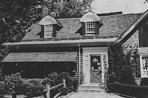
Blanch–Haring House
Historic house in New Jersey, United States
Distance: Approx. 787 meters
Latitude and longitude: 40.99083333,-73.97583333
The Blanch–Haring House is located at 341 Lafayette Road in the borough of Harrington Park in Bergen County, New Jersey, United States. The historic stone house was added to the National Register of Historic Places on January 9, 1983, for its significance in architecture and exploration/settlement. It was listed as part of the Early Stone Houses of Bergen County Multiple Property Submission (MPS).

Blauvelt House (Harrington Park, New Jersey)
Historic house in New Jersey, United States
Distance: Approx. 1005 meters
Latitude and longitude: 41,-73.97472222
The Blauvelt House is located at 622 Lafayette Road in the borough of Harrington Park in Bergen County, New Jersey, United States. The historic stone house was added to the National Register of Historic Places on January 9, 1983, for its significance in architecture and exploration/settlement. It was listed as part of the Early Stone Houses of Bergen County Multiple Property Submission (MPS).

Terhune House (Paramus, New Jersey)
Historic house in New Jersey, United States
Distance: Approx. 1802 meters
Latitude and longitude: 40.99666667,-73.96277778
Rutan-Terhune-Bidwell House is located in Paramus, Bergen County, New Jersey, United States. The house was added to the National Register of Historic Places on February 28, 1996.
Capt. Thomas Blanch House
Historic house in New Jersey, United States
Distance: Approx. 1573 meters
Latitude and longitude: 40.99416667,-73.96527778
The Capt. Thomas Blanch House was a historic house at 130 Tappan Road in Norwood, Bergen County, New Jersey, United States. The house was built in 1790 and was added to the National Register of Historic Places on January 10, 1983.

John Jacob Bogert House
Historic house in New Jersey, United States
Distance: Approx. 1289 meters
Latitude and longitude: 40.98472222,-73.99261111
John Jacob Bogert House is located in Harrington Park, Bergen County, New Jersey, United States. The house was built in 1830 and was added to the National Register of Historic Places on November 26, 2004.

Haring–Vervalen House
Historic house in New Jersey, United States
Distance: Approx. 1802 meters
Latitude and longitude: 40.99666667,-73.96277778
The Haring–Vervalen House was located at 200 Tappan Road in the borough of Norwood in Bergen County, New Jersey, United States. The historic stone house was built around 1757 based on history and architectural evidence. It was added to the National Register of Historic Places on January 10, 1983, for its significance in architecture.

John Westervelt House
United States historic place
Distance: Approx. 1116 meters
Latitude and longitude: 40.98638889,-73.97583333
The John Westervelt House is located at 29 The Parkway in the borough of Harrington Park in Bergen County, New Jersey, United States. The historic stone house was added to the National Register of Historic Places on January 9, 1983, for its significance in architecture and exploration/settlement. It was listed as part of the Early Stone Houses of Bergen County Multiple Property Submission (MPS).

Blauvelt House (Norwood, New Jersey)
United States historic place
Distance: Approx. 1493 meters
Latitude and longitude: 40.9925,-73.96638889
The Blauvelt House is located at 54 Tappan Road in the borough of Norwood in Bergen County, New Jersey, United States. The historic stone house was added to the National Register of Historic Places on January 10, 1983, for its significance in architecture. It was listed as part of the Early Stone Houses of Bergen County Multiple Property Submission (MPS).
Weather in this IP's area
light rain
19 Celsius
19 Celsius
17 Celsius
20 Celsius
1009 hPa
77 %
1009 hPa
1008 hPa
10000 meters
2.06 m/s
250 degree
100 %
06:59:05
18:27:51