64.74.184.161 - IP Lookup: Free IP Address Lookup, Postal Code Lookup, IP Location Lookup, IP ASN, Public IP
Country:
Region:
City:
Location:
Time Zone:
Postal Code:
ISP:
ASN:
language:
User-Agent:
Proxy IP:
Blacklist:
IP information under different IP Channel
ip-api
Country
Region
City
ASN
Time Zone
ISP
Blacklist
Proxy
Latitude
Longitude
Postal
Route
db-ip
Country
Region
City
ASN
Time Zone
ISP
Blacklist
Proxy
Latitude
Longitude
Postal
Route
IPinfo
Country
Region
City
ASN
Time Zone
ISP
Blacklist
Proxy
Latitude
Longitude
Postal
Route
IP2Location
64.74.184.161Country
Region
colorado
City
crested butte
Time Zone
America/Denver
ISP
Language
User-Agent
Latitude
Longitude
Postal
ipdata
Country
Region
City
ASN
Time Zone
ISP
Blacklist
Proxy
Latitude
Longitude
Postal
Route
Popular places and events near this IP address

Cedaredge, Colorado
Town in Colorado, United States
Distance: Approx. 9437 meters
Latitude and longitude: 38.89416667,-107.09222222
Cedaredge is a home rule municipality located in Delta County, Colorado, United States. It is a small, agricultural community with 2,279 residents as of 2020, producing beef cattle, elk, apples, and peaches. Cedaredge is also home to several of the 19 wineries in Delta County, produced from the region's few basic vineyards.

Crested Butte, Colorado
Town in Colorado, United States
Distance: Approx. 1022 meters
Latitude and longitude: 38.87527778,-106.97805556
Crested Butte is a home rule municipality located in Gunnison County, Colorado, United States. The town population was 1,639 at the 2020 United States Census. A former coal mining town nestled in the Slate River Valley, Crested Butte is now known as a destination for skiing, mountain biking, and outdoor activities.
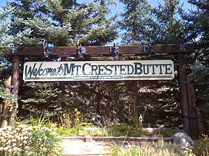
Mount Crested Butte, Colorado
Town in Colorado, United States
Distance: Approx. 4867 meters
Latitude and longitude: 38.90833333,-106.96055556
Mt. Crested Butte is a home rule municipality in Gunnison County, Colorado, United States. Mount Crested Butte is the home of the Crested Butte Mountain Resort.
Crested Butte
Mountain in the state of Colorado
Distance: Approx. 4099 meters
Latitude and longitude: 38.8833256,-106.9436547
Crested Butte is a prominent mountain summit in the Elk Mountains range of the Rocky Mountains of North America. The 12,168-foot (3,709 m) peak is in Gunnison National Forest, 2.1 miles (3.4 km) northeast by east (bearing 59°) of the Town of Crested Butte in Gunnison County, Colorado, United States. Ski lifts and runs of the Crested Butte Mountain Resort occupy the north side of the mountain.
Crested Butte Wildflower Festival
Distance: Approx. 21 meters
Latitude and longitude: 38.87,-106.988
The Crested Butte Wild Flower Festival is a week-long event that takes place annually in July in Crested Butte, Colorado, USA. Established in 1986, the flower-focused festival includes hikes, tours, workshops and performances, and raises awareness of environmental issues, including the importance of preserving wild flowers in the city. Thousands of artists, vendors and people from all over the world gather in the town of Crested Butte for a weekend of art, food, dancing and music. There was no festival in 2020.

Whetstone Mountain
Mountain in Colorado, United States
Distance: Approx. 5365 meters
Latitude and longitude: 38.8223016,-106.9798991
Whetstone Mountain, elevation 12,527 ft (3,818 m), is a summit in the Gunnison National Forest of western Colorado. The mountain is located 3 mi (4.8 km) south of Crested Butte in Gunnison County. Whetstone Mountain is one of several prominent laccoliths found in the West Elk Mountains.

Gothic Mountain
Mountain in Colorado, United States
Distance: Approx. 9806 meters
Latitude and longitude: 38.9563802,-107.0106015
Gothic Mountain is a prominent mountain summit in the Elk Mountains range of the Rocky Mountains of North America. The 12,631-foot (3,850 m) peak is located in Gunnison National Forest, 1.1 miles (1.8 km) west by south (bearing 260°) of the ghost town of Gothic in Gunnison County, Colorado, United States. Gothic Mountain takes its name from its pinnacles said to resemble Gothic architecture.

Carbon Peak
Mountain in Colorado, United States
Distance: Approx. 9716 meters
Latitude and longitude: 38.79416667,-107.04305556
Carbon Peak, elevation 12,088 ft (3,684 m), is a summit in the West Elk Mountains of Colorado. The peak is southwest of Crested Butte in the Gunnison National Forest. Carbon Peak is one of several prominent laccoliths found in the West Elk Mountains.
Mount Emmons (Colorado)
Mountain in the American state of Colorado
Distance: Approx. 5781 meters
Latitude and longitude: 38.8864059,-107.0511295
Mount Emmons is a mountain summit in the Elk Mountains range of the Rocky Mountains in north-central Gunnison County, Colorado, United States.

Oh-be-joyful Creek
Stream in Gunnison County, Colorado, U.S.
Distance: Approx. 5275 meters
Latitude and longitude: 38.90777778,-107.02472222
Oh-be-joyful Creek is a stream in Gunnison County, Colorado, in the United States. Oh-be-joyful Creek was so named in the 19th century after valuable ore was discovered in the gulch. The creek's headwaters form on the east slope of the Ruby Range in the vicinity of Oh-be-joyful Peak and Afley Peak.
Crested Butte Community School
Public school in Crested Butte, Colorado, United States
Distance: Approx. 1162 meters
Latitude and longitude: 38.8653,-106.9759
Crested Butte Community School (CBCS) is a K-12 school in Crested Butte, Colorado serving Crested Butte, Mt. Crested Butte, and many areas of unincorporated Gunnison County.

1966 NCAA skiing championships
American college skiing competition
Distance: Approx. 3871 meters
Latitude and longitude: 38.9,-106.965
The 1966 NCAA Skiing Championships were contested at the Crested Butte ski area in Created Butte, Colorado at the thirteenth annual NCAA-sanctioned ski tournament to determine the individual and team national champions of men's collegiate alpine skiing, cross-country skiing, and ski jumping in the United States. Denver, coached by Willy Schaeffler, captured their tenth, and sixth consecutive, national championship, edging out locals Western State in the team standings. The Pioneers' sole individual win was by Terje Øverland in downhill.
Weather in this IP's area
clear sky
-25 Celsius
-32 Celsius
-25 Celsius
-25 Celsius
1048 hPa
84 %
1048 hPa
683 hPa
10000 meters
3.21 m/s
2.98 m/s
332 degree

