64.57.110.137 - IP Lookup: Free IP Address Lookup, Postal Code Lookup, IP Location Lookup, IP ASN, Public IP
Country:
Region:
City:
Location:
Time Zone:
Postal Code:
ISP:
ASN:
language:
User-Agent:
Proxy IP:
Blacklist:
IP information under different IP Channel
ip-api
Country
Region
City
ASN
Time Zone
ISP
Blacklist
Proxy
Latitude
Longitude
Postal
Route
db-ip
Country
Region
City
ASN
Time Zone
ISP
Blacklist
Proxy
Latitude
Longitude
Postal
Route
IPinfo
Country
Region
City
ASN
Time Zone
ISP
Blacklist
Proxy
Latitude
Longitude
Postal
Route
IP2Location
64.57.110.137Country
Region
california
City
rancho cordova
Time Zone
America/Los_Angeles
ISP
Language
User-Agent
Latitude
Longitude
Postal
ipdata
Country
Region
City
ASN
Time Zone
ISP
Blacklist
Proxy
Latitude
Longitude
Postal
Route
Popular places and events near this IP address

Gold River, California
Census-designated place in California, United States
Distance: Approx. 5813 meters
Latitude and longitude: 38.62333333,-121.24777778
Gold River is a census-designated place (CDP) in Sacramento County, California. The population was 7,812 at the 2010 census, down from 8,023 at the 2000 census. Gold River is part of the Sacramento–Arden-Arcade–Roseville Metropolitan Statistical Area.

California Emergency Medical Services Authority
California State government agency
Distance: Approx. 6752 meters
Latitude and longitude: 38.592448,-121.27941
The California Emergency Medical Services Authority (EMSA or EMS Authority) is an agency of California State government. The California EMS Authority is one of the thirteen departments within the California Health and Human Services Agency. The director is required to be a physician with substantial experience in emergency medicine.

Sacramento California Temple
LDS temple
Distance: Approx. 5627 meters
Latitude and longitude: 38.63511111,-121.19391667
The Sacramento California Temple is the 123rd operating temple of the Church of Jesus Christ of Latter-day Saints. The intent to build the temple was announced in a news release by the First Presidency on April 21, 2001. The temple was the seventh built by the church in California, more than any state except Utah.
Nimbus Dam
Dam in Sacramento County, California
Distance: Approx. 5886 meters
Latitude and longitude: 38.636095,-121.219806
The Nimbus Dam is a base load hydroelectric dam on the American River near Folsom, California. Approximately 8,700 acre-feet (10,700 dam3) of water is retained by the dam. It is responsible for the impoundment of water from the American River to create the Lake Natoma reservoir.

Sunrise station
Light rail station in Rancho Cordova, California, United States
Distance: Approx. 6089 meters
Latitude and longitude: 38.60666667,-121.26666667
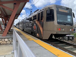
Sunrise station is a side-platformed SacRT light rail station in Rancho Cordova, California, United States. The station was opened on June 11, 2004, and is operated by the Sacramento Regional Transit District. It is served by the Gold Line.

Hazel station
SacRT light rail station
Distance: Approx. 5112 meters
Latitude and longitude: 38.63027778,-121.21222222
Hazel station is a side platformed SacRT light rail station near Gold River, California, United States. The station was opened on October 15, 2005, and is operated by the Sacramento Regional Transit District. It is served by the Gold Line.

Iron Point station
SacRT light rail station
Distance: Approx. 6731 meters
Latitude and longitude: 38.64472222,-121.19027778
Iron Point station is a side platformed SacRT light rail station in Folsom, California, United States. The station was opened on October 15, 2005, and is operated by the Sacramento Regional Transit District. It is served by the Gold Line.
Northern California TRACON
Air traffic contril center in Mather, CA
Distance: Approx. 5478 meters
Latitude and longitude: 38.5608,-121.2572
Northern California TRACON (NCT) (Terminal Radar Approach Control), or NorCal TRACON for short (pronounced "nor-cal tray-con"), also known as NorCal Approach, is an air traffic control facility that provides safety alerts, separation, and sequencing of air traffic arriving, departing, and transiting the airspace and airports in Northern California, United States. Located in Mather about 10 miles east of downtown Sacramento, NCT controls airspace over 19,000 square miles (49,000 km2), and serves Reno International Airport, Sacramento International Airport, San Jose International Airport, Oakland International Airport, and San Francisco International Airport, plus 19 other smaller airports with airport traffic control towers. NCT is the 3rd busiest TRACON in the US. NorCal TRACON is the step between local control and an Air Route Traffic Control Center (ARTCC), in this case, Oakland Center.

American River Grange Hall No. 172
United States historic place
Distance: Approx. 6565 meters
Latitude and longitude: 38.60072,-121.27512
The American River Grange Hall in Rancho Cordova, California, is an 1882 wooden Grange Hall building. The American River Grange was incorporated in January 1873 and met in Fifteen Mile House until having this building built. As of 1996, the American River Grange Hall has been in continuous use ever since and is the oldest of eight Granges active in Sacramento County, California.
Kinney High School
School in Rancho Cordova, California
Distance: Approx. 6611 meters
Latitude and longitude: 38.6012,-121.2755
Kinney High School is a public high school (grades 9–12) located in Rancho Cordova, California.
Nimbus Fish Hatchery
Fish hatchery in California, United States
Distance: Approx. 5731 meters
Latitude and longitude: 38.6333,-121.2252
The Nimbus Fish Hatchery is located in eastern Sacramento County, built on the downstream side of the Nimbus Dam. It is one of the 21 fish hatcheries the California Department of Fish and Wildlife oversees. Chinook salmon and steelhead are raised, and about 4 million Chinook salmon and 430,000 steelheads released each year.

Emery Worldwide Airlines Flight 17
2000 aviation accident in California
Distance: Approx. 5004 meters
Latitude and longitude: 38.56111111,-121.25111111
Emery Worldwide Airlines Flight 17 was a regularly scheduled United States domestic cargo flight, flying from Reno, Nevada to Dayton, Ohio with an intermediate stopover at Rancho Cordova, California. On February 16, 2000, the DC-8-71F operating the flight crashed onto an automobile salvage yard shortly after taking off from Sacramento Mather Airport, resulting in the deaths of all three crew members on board. The crew reported control problems during takeoff and attempted unsuccessfully to return to Mather airport.
Weather in this IP's area
clear sky
9 Celsius
7 Celsius
8 Celsius
11 Celsius
1020 hPa
57 %
1020 hPa
1014 hPa
10000 meters
4.12 m/s
150 degree
