Country:
Region:
City:
Latitude and Longitude:
Time Zone:
Postal Code:
IP information under different IP Channel
ip-api
Country
Region
City
ASN
Time Zone
ISP
Blacklist
Proxy
Latitude
Longitude
Postal
Route
Luminati
Country
Region
ab
City
calgary
ASN
Time Zone
America/Edmonton
ISP
ASN-WIBAND-1
Latitude
Longitude
Postal
IPinfo
Country
Region
City
ASN
Time Zone
ISP
Blacklist
Proxy
Latitude
Longitude
Postal
Route
db-ip
Country
Region
City
ASN
Time Zone
ISP
Blacklist
Proxy
Latitude
Longitude
Postal
Route
ipdata
Country
Region
City
ASN
Time Zone
ISP
Blacklist
Proxy
Latitude
Longitude
Postal
Route
Popular places and events near this IP address

Calgary-East
Provincial electoral district in Alberta, Canada
Distance: Approx. 506 meters
Latitude and longitude: 51.05,-113.97
Calgary-East (formally styled Calgary East) is a provincial electoral district in Alberta, Canada. The district is mandated to return a single member to the Legislative Assembly of Alberta. Calgary-East has existed twice, the first incarnation was created from Calgary North East in the redistribution of 1963.
Calgary-Forest Lawn
Defunct provincial electoral district in Alberta, Canada
Distance: Approx. 1036 meters
Latitude and longitude: 51.04,-113.97
Calgary-Forest Lawn was a provincial electoral district in Calgary, Alberta, Canada, mandated to return a single member to the Legislative Assembly of Alberta using the first past the post method of voting from 1979 to 1993.

International Avenue, Calgary
Business Revitalization Zone in Alberta, Canada
Distance: Approx. 1191 meters
Latitude and longitude: 51.0378,-113.96
International Avenue is a Business Revitalization Zone (BRZ) in Calgary, Alberta. The district is centered on 17 Avenue SE in the neighbourhood of Forest Lawn in the east of the city. The district was created in 1993 to celebrate the rich cultural diversity that exists in east central Calgary.

Marlborough Mall
Shopping mall in Calgary, Alberta, Canada
Distance: Approx. 1272 meters
Latitude and longitude: 51.05472222,-113.97833333
Marlborough Mall is a shopping mall located in Calgary, Alberta, Canada. Opened in November 1971, the mall has expanded several times and today includes approximately 100 stores and services, and encompasses 570,837 square feet (53,032.5 m2) of retail floor space. The mall also featured a Safeway until the 1990s, when the store moved to its own location west of 36th Street.

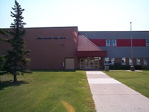
Father Lacombe High School
High school in Calgary, Alberta, Canada
Distance: Approx. 1449 meters
Latitude and longitude: 51.048,-113.984
Father Lacombe High School is a Catholic senior high school in Calgary, Alberta, Canada, named after Father Albert Lacombe. It has classes for grades 10 to 12 and is located in the southeast quadrant community of Radisson Heights, Calgary.

Forest Lawn High School
High school in Calgary, Alberta, Canada
Distance: Approx. 938 meters
Latitude and longitude: 51.041,-113.97
Forest Lawn High School is a high school in Calgary, Alberta, Canada in the southeast community of Forest Lawn. The senior high school has sports teams, who are known as the Titans, drama productions, dance, band, and choir. The school is located on 44th street, and is near Ernest Morrow Junior High, Jack James Senior High, Bob Bahan Memorial Pool, and Ernie Star Arena.

Forest Lawn, Calgary
Neighbourhood in Calgary, Alberta, Canada
Distance: Approx. 928 meters
Latitude and longitude: 51.04111111,-113.97
Forest Lawn is a neighbourhood and former town in the southeast quadrant of the city of Calgary, Alberta, Canada. The neighbourhood is bound by 26 Avenue SE to the south, 36 Street SE to the west, 8 Avenue SE to the north and portions of 52 Street SE and 48 Street SE to the east. The former town comprises the entire current Forest Lawn neighbourhood as well as portions of Southview and Albert Park/Radisson Heights to the west, and portions of Penbrooke Meadows and Forest Lawn Industrial to the east.
Marlborough, Calgary
Neighbourhood in Calgary, Alberta, Canada
Distance: Approx. 1284 meters
Latitude and longitude: 51.05944444,-113.96805556
Marlborough is a residential neighbourhood in the northeast quadrant of Calgary, Alberta. It is bounded by the 16 Avenue NE (Trans-Canada Highway) to the north, 52 Street NE to the east, Memorial Drive to the south and 36 Street NE to the west. The community is served by the Marlborough station of the C-Train LRT system, and Marlborough Mall is located in the southwest corner of the neighbourhood.
Penbrooke Meadows, Calgary
Neighbourhood in Calgary, Alberta, Canada
Distance: Approx. 1174 meters
Latitude and longitude: 51.04527778,-113.94722222
Penbrooke Meadows is a residential neighbourhood in the southeast quadrant of Calgary, Alberta. It is bounded by Memorial Drive to the north, 68 Street E to the east, 52 Street E to the west and 17 Avenue SE to the south and is part of the International Avenue Business Revitalization Zone. The area was annexed by Calgary in 1961 and Penbrooke Meadows was established in 1969.
Marlborough Park, Calgary
Neighbourhood in Calgary, Alberta, Canada
Distance: Approx. 1708 meters
Latitude and longitude: 51.06027778,-113.94805556
Marlborough Park is a residential neighbourhood in the northeast quadrant of Calgary, Alberta. It is bounded by 68 Street E to the east, 52 Street E to the west, Trans-Canada Highway to the north and Memorial Drive to the south. The homonymous park is located at the center of the community.
Hub Oil explosion
1999 industrial accident in Calgary
Distance: Approx. 1638 meters
Latitude and longitude: 51.037,-113.9483
The Hub Oil explosion was an industrial accident that took place on August 9, 1999 in Calgary, Alberta and caused two fatalities. The Hub Oil refinery was located at 5805 17 Avenue SE, near the eastern edge of Calgary and immediately south of the residential community of Penbrooke.
East Calgary, Alberta
Former village in Alberta, Canada
Distance: Approx. 1668 meters
Latitude and longitude: 51.043,-113.941
East Calgary is a former village in Alberta, Canada that is now within the City of Calgary. Located on the north side of 17 Avenue SE (Highway 1A) between 60 Street SE and 84 Street SE, East Calgary held village status for just over three years between 1916 and 1919.
Weather in this IP's area
light rain
1 Celsius
-5 Celsius
-0 Celsius
2 Celsius
1020 hPa
79 %
1020 hPa
895 hPa
10000 meters
8.23 m/s
340 degree
75 %
07:36:10
17:02:46