Country:
 Canada
Region:
City:
Latitude and Longitude:
Time Zone:
Postal Code:
IP information under different IP Channel
ip-api
Country
Region
City
ASN
Time Zone
ISP
Blacklist
Proxy
Latitude
Longitude
Postal
Route
IPinfo
Country
Region
City
ASN
Time Zone
ISP
Blacklist
Proxy
Latitude
Longitude
Postal
Route
MaxMind
Country
Region
City
ASN
Time Zone
ISP
Blacklist
Proxy
Latitude
Longitude
Postal
Route
Luminati
Country
CARegion
mb
City
winnipeg
ASN
Time Zone
America/Winnipeg
ISP
ASN-WIBAND-1
Latitude
Longitude
Postal
db-ip
Country
Region
City
ASN
Time Zone
ISP
Blacklist
Proxy
Latitude
Longitude
Postal
Route
ipdata
Country
Region
City
ASN
Time Zone
ISP
Blacklist
Proxy
Latitude
Longitude
Postal
Route
Popular places and events near this IP address

Fort Whyte
Provincial electoral district in Manitoba, Canada
Distance: Approx. 1818 meters
Latitude and longitude: 49.83,-97.197
Fort Whyte is a provincial electoral division in the Canadian province of Manitoba. It was created in 1999, after the provincial electoral boundaries commission determined that southwestern Winnipeg had experienced enough population growth to deserve an extra seat. Fort Whyte was created from territory formerly belonging to the divisions of Tuxedo, Fort Garry and St.
Canadian Mennonite University
Private university in Manitoba, Canada
Distance: Approx. 2569 meters
Latitude and longitude: 49.85739167,-97.23176111
Canadian Mennonite University (CMU) is a private Mennonite university located in Winnipeg, Manitoba, Canada. It is affiliated with Mennonite Church Canada and the Mennonite Brethren Church of Manitoba. It has an enrolment of 1,607 students.
St. Paul's High School (Winnipeg)
Private school in Manitoba
Distance: Approx. 2407 meters
Latitude and longitude: 49.8567,-97.2267
St. Paul's High School is a Jesuit Roman Catholic all-boys university preparatory high school in Winnipeg, Manitoba. The school has more than 600 students and has an active alumni community numbering more than 12,000.
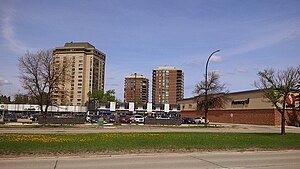
Tuxedo, Winnipeg
Suburb of Winnipeg, Canada
Distance: Approx. 2956 meters
Latitude and longitude: 49.86194444,-97.22194444
Tuxedo is a residential suburb of Winnipeg, Manitoba. It is located about 7 kilometres (4.5 miles) southwest of downtown Winnipeg, and borders the Assiniboine River and Assiniboine Park on the north, Shaftesbury Boulevard on the west, Route 90 to the East and McGillvary Boulevard to the South. Prior to 1972, the community was incorporated as the Town of Tuxedo.

Division No. 11, Manitoba
Census division in Manitoba, Canada
Distance: Approx. 1859 meters
Latitude and longitude: 49.85,-97.20833333
Census Division No. 11 (Winnipeg) is a census division centred on the Winnipeg Capital Region of the Province of Manitoba, Canada. Unlike in some other provinces, census divisions do not reflect the organization of local government in Manitoba.
Shaftesbury High School
High school in Winnipeg, Manitoba, Canada
Distance: Approx. 2495 meters
Latitude and longitude: 49.8571,-97.2296
Shaftesbury High School is a public high school located in the Tuxedo neighbourhood of Winnipeg, Manitoba, Canada. It has a population of over 750 students from Tuxedo, Charleswood, and Linden Woods. They are included in the Pembina Trails School Division's International Student Program (ISP) and recently acquired the RHA Nationals Boys Hockey Team.
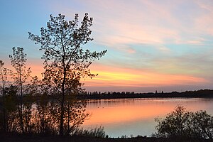
FortWhyte Alive
Nature preserve in Manitoba, Canada
Distance: Approx. 1720 meters
Latitude and longitude: 49.8202,-97.2252
FortWhyte Alive is a reclaimed wildlife preserve, recreation area, and environmental education centre in southwest Winnipeg, Manitoba, Canada. This 660-acre park is located along the migratory path of Canadian geese, and is named after the surrounding community of Fort Whyte. As of 2022, it represents 20% of Winnipeg’s urban green space.
Whyte Ridge
Neighbourhood in Winnipeg, Manitoba, Canada
Distance: Approx. 2686 meters
Latitude and longitude: 49.813,-97.207
Whyte Ridge is a residential area in the Waverley West ward in the southwest corner of Winnipeg, Manitoba, Canada. The subdivision was built on former farmland, just south of a small townsite that was historically known as Fort Whyte. The first homes in the subdivision were constructed in 1986.

Linden Woods
Neighbourhood in Winnipeg, Manitoba, Canada
Distance: Approx. 2143 meters
Latitude and longitude: 49.83416667,-97.19111111
Linden Woods is a neighbourhood in the Fort Garry area of southwest Winnipeg, Manitoba, Canada. The first phase of the neighbourhood was designed by IDE (Interdisciplinary Engineering Company) in 1980 and the construction of houses began in 1982. The centrepiece of the neighbourhood is a lake that adjoins Van Walleghem and Muys Parks.
Redekop School of Business
Distance: Approx. 2831 meters
Latitude and longitude: 49.8598,-97.232
The Redekop School of Business is a business program at Canadian Mennonite University. It was launched on October 19, 2011. The school was made possible through a donation from the Redekop family of British Columbia.
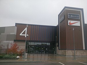
Outlet Collection Winnipeg
Outlet shopping centre in Manitoba, Canada
Distance: Approx. 1242 meters
Latitude and longitude: 49.845388,-97.213175
Outlet Collection Winnipeg is a fully-enclosed shopping centre development located on the intersection of Sterling Lyon Parkway and Kenaston Boulevard, in Winnipeg, Manitoba, Canada. It was developed by Ivanhoé Cambridge, a major Canadian real-estate company.
Naawi-Oodena
Reserve in Canada
Distance: Approx. 2238 meters
Latitude and longitude: 49.85416667,-97.20972222
Naawi-Oodena (Anishinaabemowin; English: "centre of the heart and community") is an urban reserve in Manitoba. Jointly controlled by the Brokenhead, Long Plain, Peguis, Roseau River, Sagkeeng, Sandy Bay and Swan Lake First Nations, the 64-acre parcel is located near the River Heights and Tuxedo neighbourhoods of southwest Winnipeg, and is the largest urban reserve in Canada. The land was formerly occupied by the Kapyong Barracks of Princess Patricia's Canadian Light Infantry.
Weather in this IP's area
light rain
18 Celsius
17 Celsius
17 Celsius
18 Celsius
1003 hPa
70 %
1003 hPa
976 hPa
10000 meters
3.6 m/s
140 degree
100 %
07:13:07
19:31:12