Country:
Region:
City:
Latitude and Longitude:
Time Zone:
Postal Code:
IP information under different IP Channel
ip-api
Country
Region
City
ASN
Time Zone
ISP
Blacklist
Proxy
Latitude
Longitude
Postal
Route
Luminati
Country
ASN
Time Zone
America/Toronto
ISP
ASN-WIBAND-1
Latitude
Longitude
Postal
IPinfo
Country
Region
City
ASN
Time Zone
ISP
Blacklist
Proxy
Latitude
Longitude
Postal
Route
db-ip
Country
Region
City
ASN
Time Zone
ISP
Blacklist
Proxy
Latitude
Longitude
Postal
Route
ipdata
Country
Region
City
ASN
Time Zone
ISP
Blacklist
Proxy
Latitude
Longitude
Postal
Route
Popular places and events near this IP address
Canada's Aviation Hall of Fame
Distance: Approx. 1471 meters
Latitude and longitude: 51.094167,-114.013056
Canada's Aviation Hall of Fame, based in The Hangar Flight Museum in Calgary, Alberta, Canada, commemorates and honours those whose accomplishments in aviation contributed so much to Canada's development as a nation. Founded in 1973, the Hall of Fame has honoured thus far more than 200 aviators, engineers, technicians and administrators. Due to its size and geographical location, Canada has had to rely upon aviation much more than other countries.

Calgary-Cross
Provincial electoral district in Alberta, Canada
Distance: Approx. 1461 meters
Latitude and longitude: 51.08,-113.98
Calgary-Cross is a current provincial electoral district in Calgary, Alberta, Canada. Created in 1993, the district is one of 87 districts mandated to return a single member (MLA) to the Legislative Assembly of Alberta using the first past the post method of voting. The district was created in the 1993 boundary redistribution from Calgary-McCall and Calgary-Montrose, and present boundaries covers the neighbourhoods of Pineridge, Rundle, Marlborough,Marlborough Park and Monterey Park in northeast Calgary.

Whitehorn station
Railway station in Alberta, Canada
Distance: Approx. 1321 meters
Latitude and longitude: 51.08666667,-113.98166667
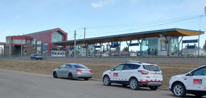
Whitehorn Station is a light rail station on the CTrain network of Calgary, Alberta, Canada. Located in the city's Northeast community of Whitehorn, the station serves the Northeast leg of the Blue Line. The station opened on April 27, 1985, as part of the original Route 202 (now called the Blue Line), and was the terminus of the line until a later extension to: McKnight-Westwinds, in December 2007.

Rundle station
Light rail station in Calgary, Alberta, Canada
Distance: Approx. 1614 meters
Latitude and longitude: 51.075,-113.98166667
Rundle Station is a Calgary C-Train light rail station in the Northeast community of Rundle. It is the sixth station northeast of City Hall on the Blue Line, with Marlborough Station sitting in the southbound direction, and Whitehorn Station sitting in the northbound direction. The station opened on April 27, 1985, as part of the original Northeast Route 202 Line.

Sunridge Mall
Shopping mall in Alberta, Canada
Distance: Approx. 1437 meters
Latitude and longitude: 51.07444444,-113.98583333
Sunridge Mall is a major enclosed shopping mall in Calgary, Alberta containing 830,599 square feet / 77,165 m² of retail space. It is in the city's northeast quadrant, located at the corner of 36 Street NE and 20 Avenue NE, adjacent to the Rundle LRT station, sunridge Spectrum Movie Theatre, and the Peter Lougheed Centre. Sunridge Mall is owned and operated by Primaris Management Inc, a division of H&R REIT. Originally opened in October 1981, Sunridge Mall completed a $50 million renovation and expansion program.

Peter Lougheed Centre
Hospital in Alberta, Canada
Distance: Approx. 1240 meters
Latitude and longitude: 51.079,-113.984
Peter Lougheed Centre (PLC) is a 506,000 square foot hospital in Calgary, Alberta, Canada. It is under the auspices of Alberta Health Services, formerly the Calgary Health Region, providing medical and surgical services to Calgary but also Southern Alberta. The PLC has a 24 hours emergency department, an intensive care unit (ICU), and offers ambulatory care.
Winston Heights-Mountview
Neighbourhood in Calgary, Alberta, Canada
Distance: Approx. 1693 meters
Latitude and longitude: 51.07111111,-114.01333333
Winston Heights/Mountview is a residential neighbourhood in the northeast quadrant of Calgary, Alberta. It is bounded by 32 Avenue to the north, the Nose Creek and Deerfoot Trail to the east, Trans-Canada Highway to the south and Edmonton Trail to the west. Fox Hollow Golf Course and The Winston Golf Club are developed at the eastern edge of the neighbourhood.
Vista Heights, Calgary
Neighbourhood in Calgary, Alberta, Canada
Distance: Approx. 1693 meters
Latitude and longitude: 51.07111111,-114.01333333
Vista Heights is a residential neighbourhood in the northeast quadrant of Calgary, Alberta. It is bounded to the south by the Trans-Canada Highway and to the west by Deerfoot Trail. To the north and east it borders the South Airways Industrial Area.
The Hangar Flight Museum
Aerospace museum in Calgary, Alberta
Distance: Approx. 1471 meters
Latitude and longitude: 51.094167,-114.013056
The Hangar Flight Museum, formerly known as the Aero Space Museum of Calgary, is a museum located south of Calgary International Airport in Calgary, Alberta, Canada.
Bay River College
College in Alberta, Canada
Distance: Approx. 282 meters
Latitude and longitude: 51.085545,-113.997081
Bay River College (formerly Evergreen College Calgary) is a Canadian private career college located in Calgary, Alberta, Canada. The college is a member of the Alberta Association of Career Colleges and the National Association of Career Colleges. Bay River College is a Designated Learning Institute (DLI) in Alberta, Canada: #O121321694207.
Heritage College (Calgary)
College in Alberta, Canada
Distance: Approx. 2087 meters
Latitude and longitude: 51.0790307,-114.0288598
Heritage College is a provincially accredited private career college located in Calgary, Alberta. Founded in 2014 as the Noor Pharmacy Training Centre, the institute subsequently rebranded as Heritage College in 2016.
Heritage Christian Academy (Calgary)
Christian K-12 school
Distance: Approx. 1171 meters
Latitude and longitude: 51.0921,-114.0103
Heritage Christian Academy (HCA) is non-denominational evangelical Christian K-12 school located in Calgary, Alberta. The school opened as a private school in 1979 as Heritage Christian School and moved to its current location in 1998, changing its name to Heritage Christian Academy. Since 2006, it is publicly funded and operates as an "alternative school program based on Christian values" within the Palliser School District.
Weather in this IP's area
light snow
-0 Celsius
-7 Celsius
-1 Celsius
1 Celsius
1015 hPa
90 %
1015 hPa
887 hPa
2414 meters
8.23 m/s
11.83 m/s
350 degree
100 %
07:36:25
17:02:48