64.47.50.74 - IP Lookup: Free IP Address Lookup, Postal Code Lookup, IP Location Lookup, IP ASN, Public IP
Country:
Region:
City:
Location:
Time Zone:
Postal Code:
IP information under different IP Channel
ip-api
Country
Region
City
ASN
Time Zone
ISP
Blacklist
Proxy
Latitude
Longitude
Postal
Route
Luminati
Country
Region
ca
ASN
Time Zone
America/Los_Angeles
ISP
MASERGY
Latitude
Longitude
Postal
IPinfo
Country
Region
City
ASN
Time Zone
ISP
Blacklist
Proxy
Latitude
Longitude
Postal
Route
IP2Location
64.47.50.74Country
Region
california
City
fresno
Time Zone
America/Los_Angeles
ISP
Language
User-Agent
Latitude
Longitude
Postal
db-ip
Country
Region
City
ASN
Time Zone
ISP
Blacklist
Proxy
Latitude
Longitude
Postal
Route
ipdata
Country
Region
City
ASN
Time Zone
ISP
Blacklist
Proxy
Latitude
Longitude
Postal
Route
Popular places and events near this IP address

Forestiere Underground Gardens
United States historic place
Distance: Approx. 1658 meters
Latitude and longitude: 36.80722222,-119.88083333
The Forestiere Underground Gardens in Fresno, California are a series of subterranean structures built by Baldassare Forestiere, an immigrant from Sicily, over a period of 40 years from 1906 to his death in 1946. The gardens are operated by members of the Forestiere family through the Forestiere Historical Center, and can be considered an unconventional example of vernacular architecture.
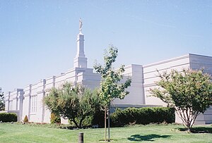
Fresno California Temple
Distance: Approx. 4892 meters
Latitude and longitude: 36.82819444,-119.85297222
The Fresno California Temple is the 78th operating temple of the Church of Jesus Christ of Latter-day Saints (LDS Church).

Sierra Sky Park Airport
Airport
Distance: Approx. 5475 meters
Latitude and longitude: 36.84027778,-119.86944444
Sierra Sky Park Airport (FAA LID: E79, formerly Q60) is a privately owned, public-use airport seven miles (11 km) northwest of the central business district of Fresno, a city in Fresno County, California, United States. Other area airports are Fresno Chandler Executive Airport and Fresno Yosemite International Airport.
Figarden, California
Unincorporated community in California, United States
Distance: Approx. 3916 meters
Latitude and longitude: 36.82277778,-119.8625
Figarden (formerly, Bullard and Fig Garden) was an unincorporated community in Fresno County, California. It is located 6 miles (9.7 km) northwest of downtown Fresno, at an elevation of 315 feet (96 m). A post office operated at Figarden from 1925 to 1944, moving in 1939, and from 1947 to 1951.
Herndon, California
Unincorporated community in California, United States
Distance: Approx. 5655 meters
Latitude and longitude: 36.83666667,-119.9175
Herndon (formerly, Sycamore) is an unincorporated community in Fresno County, California. It is located 9 miles (14 km) northwest of downtown Fresno, at an elevation of 299 feet (91 m).
Highway City, California
Unincorporated community in California, United States
Distance: Approx. 2008 meters
Latitude and longitude: 36.81083333,-119.885
Highway City is an unincorporated community in Fresno County, California. It is located 2.5 miles (4 km) southeast of Herndon, at an elevation of 299 feet (91 m). A post office opened in Highway City in 1951.
Sierra Sky Park, California
Unincorporated community in California, United States
Distance: Approx. 5774 meters
Latitude and longitude: 36.84222222,-119.86583333
Sierra Sky Park is a fly-in unincorporated community in Fresno County, California. It is located 7 miles (11 km) northwest of downtown Fresno, at an elevation of 328 feet (100 m).
Victor Maghakian
United States Marine Corps captain
Distance: Approx. 6958 meters
Latitude and longitude: 36.74559,-119.834365
Captain Victor "Transport" Maghakian (Armenian: Վիգդոր Մաղաքեան; December 30, 1915 – August 17, 1977) was an Armenian-American member of the United States Marine Corps during World War II. As a gunnery sergeant, he led his platoon through some of the bloodiest fighting in seven South Pacific campaigns, including the Naval Battle of Guadalcanal. Having received over two dozen medals and awards, he is considered one of the most decorated American soldiers of the war. Maghakian served with the 2nd and 4th Marine Divisions and the Raiders.
Ararat Cemetery
Armenian Cemetery in Fresno, California
Distance: Approx. 6956 meters
Latitude and longitude: 36.74555556,-119.83444444
The Ararat Massis Armenian Cemetery, commonly known as the Ararat Cemetery, is an Armenian cemetery in Fresno, California. Established in 1885, the cemetery is the burial place of many prominent figures of Armenian-American history, including Soghomon Tehlirian, Victor Maghakian, and William Saroyan. The Ararat Massis Cemetery was the only Armenian cemetery built outside Armenia and the Middle East for more than a century.

San Joaquin River Viaduct
Viaduct in Fresno County, California and Madera County, California
Distance: Approx. 7086 meters
Latitude and longitude: 36.844161,-119.932481
The San Joaquin River Viaduct is a bridge built to carry California High-Speed Rail over the San Joaquin River. Most of the bridge is in the city of Fresno, California, in Fresno County, although the portion north of the center line of the river is in Madera County. It is the second major river crossing built for the high-speed rail line, after the Fresno River Viaduct to the north.
Justin Garza High School
Public school in California, United States
Distance: Approx. 2546 meters
Latitude and longitude: 36.794946,-119.913936
Justin Garza High School is a public high school serving the rural area west of Fresno, California.

Mountain View Cemetery (Fresno)
Cemetery in Fresno County, California
Distance: Approx. 7108 meters
Latitude and longitude: 36.74972222,-119.82666667
Mountain View Cemetery is a cemetery in Fresno, California, opened in the 1880s.
Weather in this IP's area
mist
5 Celsius
5 Celsius
3 Celsius
5 Celsius
1021 hPa
87 %
1021 hPa
1010 hPa
8047 meters
