64.47.28.82 - IP Lookup: Free IP Address Lookup, Postal Code Lookup, IP Location Lookup, IP ASN, Public IP
Country:
Region:
City:
Location:
Time Zone:
Postal Code:
ISP:
ASN:
language:
User-Agent:
Proxy IP:
Blacklist:
IP information under different IP Channel
ip-api
Country
Region
City
ASN
Time Zone
ISP
Blacklist
Proxy
Latitude
Longitude
Postal
Route
db-ip
Country
Region
City
ASN
Time Zone
ISP
Blacklist
Proxy
Latitude
Longitude
Postal
Route
IPinfo
Country
Region
City
ASN
Time Zone
ISP
Blacklist
Proxy
Latitude
Longitude
Postal
Route
IP2Location
64.47.28.82Country
Region
wisconsin
City
milwaukee
Time Zone
America/Chicago
ISP
Language
User-Agent
Latitude
Longitude
Postal
ipdata
Country
Region
City
ASN
Time Zone
ISP
Blacklist
Proxy
Latitude
Longitude
Postal
Route
Popular places and events near this IP address

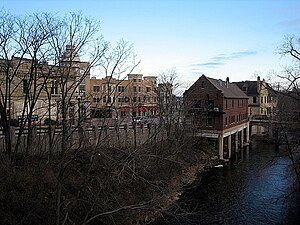
Wauwatosa, Wisconsin
City in Wisconsin, United States
Distance: Approx. 2244 meters
Latitude and longitude: 43.06666667,-88.03333333
Wauwatosa ( WAW-wə-TOH-sə; colloquially Tosa) is a city in Milwaukee County, Wisconsin, United States. The population was 48,387 at the 2020 census. Wauwatosa is a suburb located immediately west of Milwaukee and is part of the Milwaukee metropolitan area.
Medical College of Wisconsin
Private medical school in Milwaukee, Wisconsin, US
Distance: Approx. 1737 meters
Latitude and longitude: 43.04472222,-88.0225
The Medical College of Wisconsin (MCW) is a private medical school, pharmacy school, and graduate school of sciences in Milwaukee, Wisconsin, United States. The school was established in 1893 and is the largest research center in eastern Wisconsin. It is associated with Froedtert Hospital as well as Children's Hospital of Wisconsin and houses the Center for Infectious Disease Research.

Mayfair Mall
Shopping mall in Wauwatosa, Wisconsin
Distance: Approx. 1783 meters
Latitude and longitude: 43.06388889,-88.04472222
Mayfair Mall is a shopping mall located on Mayfair Road (Highway 100) between North Avenue and Center Street in Wauwatosa, Wisconsin, United States. It serves the Greater Milwaukee area, also Wisconsin's premier shopping Center and Largest Mall in Wisconsin with 161 stores. Mayfair Shopping Center was constructed from 1956 and completed in 1959 by the Hunzinger Construction Company.

Froedtert Hospital
Hospital in Wisconsin, United States
Distance: Approx. 1717 meters
Latitude and longitude: 43.04111111,-88.02444444
Froedtert Hospital , located in Wauwatosa, Wisconsin, is a teaching hospital and a Level I adult trauma center, one of two such facilities in Wisconsin. Froedtert is the primary teaching affiliate of the Medical College of Wisconsin (MCW), where MCW students and residents receive their clinical education. Froedtert has 735 inpatient hospital beds.

Wisconsin Lutheran College
Private college near Milwaukee, Wisconsin, US
Distance: Approx. 2076 meters
Latitude and longitude: 43.03694444,-88.02275
Wisconsin Lutheran College (WLC) is a private liberal arts college affiliated with the Wisconsin Evangelical Lutheran Synod and located on the border of Milwaukee and Wauwatosa, Wisconsin. It has an enrollment of about 1,200 students and is accredited by the Higher Learning Commission.

Muirdale Tuberculosis Sanatorium
United States historic place
Distance: Approx. 485 meters
Latitude and longitude: 43.04361111,-88.04444444
Muirdale Tuberculosis Sanatorium, also called Muirdale Tuberculosis Hospital, was built in 1914–15 by Milwaukee County, Wisconsin. It was located near the corner of Highway 100 and Watertown Plank Road in Wauwatosa and named after noted Wisconsin naturalist John Muir. Maximum capacity in 1923 was 350 patients, but in later years this figure rose to over 600, including a 100-bed Children's Cottage, or Preventorium, devoted to the treatment of young children.

Wauwatosa West High School
Public high school in Wauwatosa, Milwaukee, Wisconsin, United States
Distance: Approx. 2473 meters
Latitude and longitude: 43.0683,-88.05544
Wauwatosa West High School is a comprehensive four-year public high school located in the city of Wauwatosa, Wisconsin, United States. West opened in 1960/1961 as a sister-school to Wauwatosa East High School; together they are part of the Wauwatosa School District.

Dr. Fisk Holbrook Day House
Historic house in Wisconsin, United States
Distance: Approx. 2560 meters
Latitude and longitude: 43.05315278,-88.01276111
The Dr. Fisk Holbrook Day House, also known as Sunnyhill Home, is a historic house at 8000 West Milwaukee Avenue in Wauwatosa, Wisconsin. Built in 1874, it was the home of Doctor Fisk Holbrook Day (1826-1903), a prominent local physician and amateur geologist.
1933 PGA Championship
Golf tournament
Distance: Approx. 2246 meters
Latitude and longitude: 43.068,-88.041
The 1933 PGA Championship was the 16th PGA Championship, held August 8–13 at Blue Mound Country Club in Wauwatosa, Wisconsin, a suburb west of Milwaukee. Then a match play championship, Gene Sarazen won the third of his three PGA Championship titles, defeating Willie Goggin 5 and 4. It was the sixth of his seven major titles.
Blue Mound Golf & Country Club
Distance: Approx. 2191 meters
Latitude and longitude: 43.0675,-88.041
Blue Mound Golf & Country Club is a country club in the north central United States, located in Wauwatosa, Wisconsin, a suburb west of Milwaukee. The golf course was designed by Seth Raynor. The club hosted the PGA Championship in 1933, the Western Open in 1916, and the Women's Western Open in 1940, where Babe Zaharias defeated Mrs.
1940 Women's Western Open
Distance: Approx. 2192 meters
Latitude and longitude: 43.0675,-88.04083333
The 1940 Women's Western Open was a golf competition held at Blue Mound Golf & Country Club, the 11th edition of the event. Babe Zaharias won the championship in match play competition by defeating Mrs. Russell Mann in the final match, 5 and 4.
Children's Wisconsin
Hospital in Milwaukee, Wisconsin
Distance: Approx. 1793 meters
Latitude and longitude: 43.04222222,-88.02277778
Children's Wisconsin (formerly Children's Hospital of Wisconsin) is a nationally ranked, freestanding, 298-bed, pediatric acute care children's hospital located in Milwaukee, Wisconsin. It is affiliated with the Medical College of Wisconsin and is a member of the Children's Wisconsin health system, one of two of the children's hospitals in the system. The hospital provides comprehensive pediatric specialties and subspecialties to infants, children, teens, and young adults aged 0–21 throughout the Wisconsin region.
Weather in this IP's area
clear sky
-5 Celsius
-12 Celsius
-6 Celsius
-4 Celsius
1024 hPa
62 %
1024 hPa
992 hPa
10000 meters
7.2 m/s
9.77 m/s
270 degree
