64.47.191.120 - IP Lookup: Free IP Address Lookup, Postal Code Lookup, IP Location Lookup, IP ASN, Public IP
Country:
Region:
City:
Location:
Time Zone:
Postal Code:
ISP:
ASN:
language:
User-Agent:
Proxy IP:
Blacklist:
IP information under different IP Channel
ip-api
Country
Region
City
ASN
Time Zone
ISP
Blacklist
Proxy
Latitude
Longitude
Postal
Route
db-ip
Country
Region
City
ASN
Time Zone
ISP
Blacklist
Proxy
Latitude
Longitude
Postal
Route
IPinfo
Country
Region
City
ASN
Time Zone
ISP
Blacklist
Proxy
Latitude
Longitude
Postal
Route
IP2Location
64.47.191.120Country
Region
washington
City
clarkston
Time Zone
America/Los_Angeles
ISP
Language
User-Agent
Latitude
Longitude
Postal
ipdata
Country
Region
City
ASN
Time Zone
ISP
Blacklist
Proxy
Latitude
Longitude
Postal
Route
Popular places and events near this IP address

Lewis–Clark State College
Public college in Lewiston, Idaho, US
Distance: Approx. 3422 meters
Latitude and longitude: 46.411,-117.026
Lewis-Clark State College is a public college in Lewiston, Idaho, United States. It was founded 132 years ago in 1893 and has an approximate annual enrollment of 3,600. The college offers more than 130 degrees.

Clarkston, Washington
City in Washington, United States
Distance: Approx. 2334 meters
Latitude and longitude: 46.41611111,-117.05055556
Clarkston is a city in Asotin County, Washington, United States. It is part of the Lewiston, ID-WA metropolitan area, and is located west of Lewiston, Idaho, across the Snake River. The population of Clarkston was 7,161 at the 2020 census.

West Clarkston-Highland, Washington
CDP in Washington, United States
Distance: Approx. 1360 meters
Latitude and longitude: 46.3875,-117.05833333
West Clarkston-Highland is a census-designated place (CDP) in Asotin County, Washington, United States. It is part of the Lewiston, ID-WA Metropolitan Statistical Area. The population was 5,488 at the 2020 census.
KLCZ
Radio station in Lewiston, Idaho
Distance: Approx. 3544 meters
Latitude and longitude: 46.4125,-117.02527778
KLCZ (88.9 FM) is a public radio station broadcasting a news/talk format, simulcasting KBSX from Boise. Licensed to Lewiston, Idaho, United States, the radio station serves the Lewiston area. The station is currently owned by the Idaho State Board of Education.

Clarkston High School (Washington)
School in Clarkston, Washington, United States
Distance: Approx. 2263 meters
Latitude and longitude: 46.41027778,-117.04277778
Charles Francis Adams High School, locally referred to as Clarkston High School or CHS, is a four-year public high school located near downtown Clarkston, Washington. The school has a population of 800-850 students in grades 9–12, with over 100 staff members. CHS's mascot is the mighty Bantam, and the school colors are red, black, and white.

Clearwater River (Idaho)
River in Idaho, United States
Distance: Approx. 3731 meters
Latitude and longitude: 46.425,-117.03722222
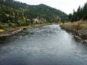
The Clearwater River is in the northwestern United States, in north central Idaho. Its length is 74.8 miles (120.4 km), it flows westward from the Bitterroot Mountains along the Idaho-Montana border, and joins the Snake River at Lewiston. In October 1805, the Lewis and Clark Expedition descended the Clearwater River in dugout canoes, putting in at "Canoe Camp," five miles (8 km) downstream from Orofino; they reached the Columbia Bar and the Pacific Ocean about six weeks later.
Harris Field
Distance: Approx. 3449 meters
Latitude and longitude: 46.41,-117.025
Harris Field is a college baseball park in the western United States, located in Lewiston, Idaho. An on-campus venue with a seating capacity of 5,000, it is the home field of the Warriors of Lewis–Clark State College, a top program in National Association of Intercollegiate Athletics (NAIA). Since 1984, LCSC has won nineteen national titles and had six runner-up finishes.

C. C. Van Arsdol House
United States historic place
Distance: Approx. 1360 meters
Latitude and longitude: 46.41044,-117.06862
The C. C. Van Arsdol House, at 1011 15th Street in Clarkston in Asotin County, Washington, was built in 1882. It was listed on the National Register of Historic Places in 1975. The house "is a complex assembly of additions built onto a small one-story, one room homesteader's cottage dating from the early 1880s." It was a home of civil engineer Cassius C. Van Arsdol.

Clarkston Public Library
United States historic place
Distance: Approx. 2141 meters
Latitude and longitude: 46.41066,-117.04523
The Clarkston Public Library, in Clarkston in Asotin County, Washington, was built in 1913 as a Carnegie library. Also known as the Asotin County Library, it was listed on the National Register of Historic Places in 1982. It is a square-plan two-story building of yellow-red brick.
U.S. Post Office – Clarkston Main
United States historic place
Distance: Approx. 2169 meters
Latitude and longitude: 46.41111,-117.04531
The Clarkston Main Post Office in Clarkston in Asotin County, Washington in southeast Washington is a historic post office building built in 1941. It was listed on the National Register of Historic Places as U.S. Post Office – Clarkston Main in 1991. Its design was credited to Supervising Architect Louis A. Simon.

Southway Bridge
Distance: Approx. 1999 meters
Latitude and longitude: 46.39569722,-117.04083056
The Southway Bridge is a highway bridge spanning the Snake River between Clarkston, Washington, and Lewiston, Idaho. It connects Fleshman Way in Clarkston with Bryden Canyon Road in Lewiston, and provides residents of the Lewiston Orchards with access to State Route 129, as well as providing Clarkston residents with access to the Lewiston–Nez Perce County Airport. The bridge was opened to traffic on August 3, 1982, at a cost of $21 million, after several delays due to repairs.

Interstate Highway Bridge
U.S. highway bridge between Clarkston, Washington and Lewiston, Idaho
Distance: Approx. 3371 meters
Latitude and longitude: 46.42027778,-117.03638889
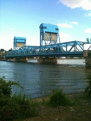
The Interstate Highway Bridge crosses the Snake River, between Clarkston, Washington and Lewiston, Idaho. The bridge carries U.S. Route 12 (US 12) across the state line between Washington and Idaho, and is maintained by the Washington State Department of Transportation. It was built in 1939 and is 1,424 feet (434 m) long.
Weather in this IP's area
clear sky
-1 Celsius
-4 Celsius
-2 Celsius
-1 Celsius
1033 hPa
64 %
1033 hPa
954 hPa
10000 meters
2.06 m/s
150 degree
