64.38.92.2 - IP Lookup: Free IP Address Lookup, Postal Code Lookup, IP Location Lookup, IP ASN, Public IP
Country:
Region:
City:
Location:
Time Zone:
Postal Code:
IP information under different IP Channel
ip-api
Country
Region
City
ASN
Time Zone
ISP
Blacklist
Proxy
Latitude
Longitude
Postal
Route
Luminati
Country
ASN
Time Zone
America/Chicago
ISP
APEIRON001
Latitude
Longitude
Postal
IPinfo
Country
Region
City
ASN
Time Zone
ISP
Blacklist
Proxy
Latitude
Longitude
Postal
Route
IP2Location
64.38.92.2Country
Region
california
City
hermosa beach
Time Zone
America/Los_Angeles
ISP
Language
User-Agent
Latitude
Longitude
Postal
db-ip
Country
Region
City
ASN
Time Zone
ISP
Blacklist
Proxy
Latitude
Longitude
Postal
Route
ipdata
Country
Region
City
ASN
Time Zone
ISP
Blacklist
Proxy
Latitude
Longitude
Postal
Route
Popular places and events near this IP address

Hermosa Beach, California
City in California, United States
Distance: Approx. 365 meters
Latitude and longitude: 33.86638889,-118.39972222
Hermosa Beach (Hermosa, Spanish for "Beautiful") is a beachfront city in Los Angeles County in the U.S. state of California, United States. Its population was 19,728 at the 2020 U.S. Census. The city is located in the South Bay region of the Greater Los Angeles area; it is one of the three Beach Cities.

Redondo Beach, California
City in California, United States
Distance: Approx. 1796 meters
Latitude and longitude: 33.85805556,-118.37888889
Redondo Beach (Spanish for 'round') is a coastal city in Los Angeles County, California, United States, located in the South Bay region of the Greater Los Angeles area. It is one of three adjacent beach cities along the southern portion of Santa Monica Bay. The population was 71,576 at the 2020 census, up from 66,748 in 2010.

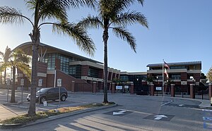
Mira Costa High School
Public high school in Manhattan Beach, California
Distance: Approx. 1021 meters
Latitude and longitude: 33.87368,-118.38976
Mira Costa High School (MCHS, "Costa") is a four-year public high school located in Manhattan Beach, California that first opened 1950. It is the only high school in the Manhattan Beach Unified School District. The school's athletic teams are known as the Mustangs and the school colors are green and gold.
Redondo Union High School
Public school
Distance: Approx. 2469 meters
Latitude and longitude: 33.8461,-118.384
Redondo Union High School (RUHS) is a public high school in Redondo Beach, California. Redondo Union High School is a part of the Redondo Beach Unified School District. All residents of Redondo Beach are zoned to Redondo Union.
Creators Syndicate
American media distributor
Distance: Approx. 1046 meters
Latitude and longitude: 33.85733,-118.39143
Creators Syndicate (also known as Creators) is an American independent distributor of comic strips and syndicated columns to daily newspapers, websites, and other digital outlets. When founded in 1987, Creators Syndicate became one of the few successful independent syndicates founded since the 1930s and was the first syndicate to allow cartoonists ownership rights to their work. Creators Syndicate is based in Hermosa Beach, California.

Manhattan Beach Pier
Historic site in Manhattan Beach, California, United States
Distance: Approx. 2571 meters
Latitude and longitude: 33.88374,-118.41361
The Manhattan Beach Pier is a pier located in Manhattan Beach, California on the coast of the Pacific Ocean. The pier is 928 feet (283 m) long and located at the end of Manhattan Beach Boulevard. An octagonal Mediterranean-style building sits at the end of the pier and houses the Roundhouse Aquarium.

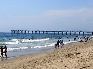
Hermosa Beach Pier
Pier in Southern California, United States
Distance: Approx. 893 meters
Latitude and longitude: 33.8615,-118.4038
The Hermosa Beach Pier is located in the Southern California community of Hermosa Beach. It extends into the Pacific Ocean. In 1904 the first pier was built.
Total Access Recording
Recording studio in Redondo Beach, California, United States
Distance: Approx. 2543 meters
Latitude and longitude: 33.85944444,-118.36944444
Total Access Recording is a recording studio located in Redondo Beach, California, owned and operated by founder Wyn Davis and Steve Ornest. Total Access opened for business in December 1980. The first clients of the studio were bands signed with SST Records, whose owner Greg Ginn had made a "bulk recording deal" with Davis.

Diamond Apartments
United States historic place
Distance: Approx. 2541 meters
Latitude and longitude: 33.84416667,-118.38777778
The Diamond Apartments are an apartment building located at 321 Diamond St. in Redondo Beach, California. Built in 1913 by Harry Meacham, the apartment complex was the first commercial building in the surrounding neighborhood.
Valor Christian Academy
Religious school in Redondo Beach, California, United States
Distance: Approx. 2248 meters
Latitude and longitude: 33.860615,-118.372364
Valor Christian Academy is a private transitional kindergarten through middle grades Christian school in Redondo Beach, California, in the Los Angeles metropolitan area. It was previously known as Coast Christian School but received its current name in September 2012. It was affiliated with the Assemblies of God.

Manhattan Beach Botanical Garden
Botanical garden at Polliwog Park in Manhattan Beach, California
Distance: Approx. 2631 meters
Latitude and longitude: 33.8885,-118.3871
The Manhattan Beach Botanical Garden (.66 acres (0.27 ha)) is a botanical garden located within Polliwog Park in Manhattan Beach, California. It is open daily with free admission. The garden was first envisioned in 1992, with garden construction starting in 1994.

Old Salt Lake
Historic saltwater marsh in Redondo Beach, California
Distance: Approx. 1571 meters
Latitude and longitude: 33.85192222,-118.39691944
The Old Salt Lake, also called Lake Salinas, was a historic site in coastal Southern California where sea salt was harvested for barter or sale. Old Salt Lake was a large pond that was 600 by 1,800 feet (180 by 550 m), fed by a natural spring. The lake was 600 feet (180 m) from what is now the Redondo Beach seashore at an elevation of about 10 feet (3.0 m).
Weather in this IP's area
smoke
16 Celsius
15 Celsius
15 Celsius
18 Celsius
1019 hPa
55 %
1019 hPa
1017 hPa
10000 meters
3.09 m/s
260 degree