64.33.226.5 - IP Lookup: Free IP Address Lookup, Postal Code Lookup, IP Location Lookup, IP ASN, Public IP
Country:
Region:
City:
Location:
Time Zone:
Postal Code:
IP information under different IP Channel
ip-api
Country
Region
City
ASN
Time Zone
ISP
Blacklist
Proxy
Latitude
Longitude
Postal
Route
Luminati
Country
Region
sd
City
watertown
ASN
Time Zone
America/Chicago
ISP
SDNW-13576
Latitude
Longitude
Postal
IPinfo
Country
Region
City
ASN
Time Zone
ISP
Blacklist
Proxy
Latitude
Longitude
Postal
Route
IP2Location
64.33.226.5Country
Region
south dakota
City
brookings
Time Zone
America/Chicago
ISP
Language
User-Agent
Latitude
Longitude
Postal
db-ip
Country
Region
City
ASN
Time Zone
ISP
Blacklist
Proxy
Latitude
Longitude
Postal
Route
ipdata
Country
Region
City
ASN
Time Zone
ISP
Blacklist
Proxy
Latitude
Longitude
Postal
Route
Popular places and events near this IP address
South Dakota State University
Public university in Brookings, South Dakota, US
Distance: Approx. 1410 meters
Latitude and longitude: 44.31805556,-96.78333333
South Dakota State University (SDSU or SD State) is a public land-grant research university in Brookings, South Dakota, United States. Founded in 1881, it is the state's largest university and is the second oldest continually operating university in the state, trailing the University of South Dakota which was founded in 1862. The university is governed by the South Dakota Board of Regents, which governs the state's six public universities and two special schools.

Brookings, South Dakota
City in South Dakota, United States
Distance: Approx. 1415 meters
Latitude and longitude: 44.30222222,-96.78611111
Brookings is a city in and the county seat of Brookings County, South Dakota, United States. Brookings is South Dakota's fourth most populous city, with a population of 23,377 at the 2020 census. It is home to South Dakota State University, the state's largest institution of higher education.

Coughlin Campanile
United States historic place
Distance: Approx. 979 meters
Latitude and longitude: 44.31583333,-96.78777778
The Coughlin Campanile was completed on the campus of South Dakota State University (SDSU) in 1929. It was designed by architects Perkins & McWayne. It was listed on the National Register of Historic Places in 1987.
KSDJ
Radio station in Brookings, South Dakota
Distance: Approx. 1310 meters
Latitude and longitude: 44.31694444,-96.78388889
KSDJ (90.7 FM, "New Rock 90.7") is a radio station licensed to serve Brookings, South Dakota. The station is owned by South Dakota State University. It airs an Alternative rock music format.
E. E. Haugen House
Historic house in South Dakota, United States
Distance: Approx. 302 meters
Latitude and longitude: 44.31032222,-96.80188333
The E. E. Haugen House, also known as Charles R. Berry Residence or E. E. Haugen Residence, in Brookings, South Dakota, United States, was built in 1904. According to the National Park Service: The Haugen, E.E., Residence is an excellent local example of the Colonial Revival style of architecture used for homes built in the U.S. during the late-nineteenth and early-twentieth centuries. The residence is a local interpretation of a nationally advertised architect’s design that appeared in The Woman’s Home Companion between 1898 and 1904.
Wenona Hall and Wecota Hall
United States historic place
Distance: Approx. 1038 meters
Latitude and longitude: 44.31777778,-96.78888889
Wenona Hall and Wecota Hall at South Dakota State University in Brookings, South Dakota are women's dormitories that were built in 1909 and 1915. John J. Schwartz was architect. The combination was listed on the U.S. National Register of Historic Places in 1980.

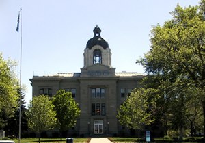
Brookings County Courthouse
United States historic place
Distance: Approx. 374 meters
Latitude and longitude: 44.30888889,-96.79527778
Brookings County Courthouse, located at the intersection of 4th St. and 6th Ave. in Brookings, is Brookings County, South Dakota's county courthouse.

Brookings Commercial Historic District
Historic district in South Dakota, United States
Distance: Approx. 281 meters
Latitude and longitude: 44.30888889,-96.79805556
The Brookings Commercial Historic District, in Brookings, South Dakota, is a 13 acres (5.3 ha) historic district which was listed on the National Register of Historic Places in 1988. The listing included 39 contributing buildings in an area roughly along Main Ave. between the former C&NW railroad and the alley north of Fifth St.
Brookings University Residential Historic District
Historic district in South Dakota, United States
Distance: Approx. 562 meters
Latitude and longitude: 44.31444444,-96.79277778
The Brookings University Residential Historic District is a 60 acres (24 ha) historic district in Brookings, South Dakota which was listed on the National Register of Historic Places in 1999. The district included 303 contributing buildings. It is roughly bounded by Harvey Dunn St., Medary Ave., Sixth St., and Main Ave.

Nick's Hamburger Shop
United States historic place
Distance: Approx. 161 meters
Latitude and longitude: 44.31,-96.79888889
Nick's Hamburger Shop is a building at 427 Main Ave. in Brookings, South Dakota, United States, which is listed on the National Register of Historic Places. It is also included in the Brookings Commercial Historic District, which is also National Register-listed.

Institute of Lutheran Theology
Seminary in Brookings, South Dakota, US
Distance: Approx. 763 meters
Latitude and longitude: 44.30886111,-96.7895
The Institute of Lutheran Theology is a private Lutheran seminary in Brookings, South Dakota. It provides distance education online and at its campus in Brookings.

Brookings station
Distance: Approx. 500 meters
Latitude and longitude: 44.30694444,-96.79916667
The Chicago and North Western Railway Depot was built by the Chicago and North Western Railway (C&NW) in the early 1900s. It is located at the south end of the business district in Brookings, South Dakota. The building is a rectangular single-story brick patternbook style building with some classical features.
Weather in this IP's area
clear sky
-17 Celsius
-24 Celsius
-18 Celsius
-16 Celsius
1026 hPa
79 %
1026 hPa
961 hPa
10000 meters
3.6 m/s
310 degree
