64.254.6.141 - IP Lookup: Free IP Address Lookup, Postal Code Lookup, IP Location Lookup, IP ASN, Public IP
Country:
 Canada
Region:
City:
Location:
Time Zone:
Postal Code:
ISP:
ASN:
language:
User-Agent:
Proxy IP:
Blacklist:
IP information under different IP Channel
ip-api
Country
Region
City
ASN
Time Zone
ISP
Blacklist
Proxy
Latitude
Longitude
Postal
Route
db-ip
Country
Region
City
ASN
Time Zone
ISP
Blacklist
Proxy
Latitude
Longitude
Postal
Route
IPinfo
Country
Region
City
ASN
Time Zone
ISP
Blacklist
Proxy
Latitude
Longitude
Postal
Route
IP2Location
64.254.6.141Country
caRegion
ontario
City
mississauga
Time Zone
America/Toronto
ISP
Language
User-Agent
Latitude
Longitude
Postal
ipdata
Country
Region
City
ASN
Time Zone
ISP
Blacklist
Proxy
Latitude
Longitude
Postal
Route
Popular places and events near this IP address

Golden Horseshoe
Secondary region in Ontario, Canada
Distance: Approx. 2965 meters
Latitude and longitude: 43.6,-79.73
The Golden Horseshoe (French: Fer à cheval doré) is a secondary region of Southern Ontario, Canada, which lies at the western end of Lake Ontario, with outer boundaries stretching south to Lake Erie and north to Lake Scugog, Lake Simcoe and Georgian Bay of Lake Huron. The region is the most densely populated and industrialized in Canada. Based on the 2021 census, with a population of 7,759,635 people in its core and 9,765,188 in its greater area, the Golden Horseshoe accounts for over 20 percent of the population of Canada and more than 54 percent of Ontario's population.

Meadowvale GO Station
Railway station in Mississauga, Ontario, Canada
Distance: Approx. 1192 meters
Latitude and longitude: 43.5975,-79.75444444
Meadowvale GO Station is a GO Transit railway station on the Milton line in the Greater Toronto Area, Ontario, Canada. It is located at 6845 Millcreek Drive near Derry Road West and Winston Churchill Blvd., in the City of Mississauga in the community of Meadowvale. As with most GO stations, Meadowvale offers parking for commuters, and ticket sales with an attendant during the morning rush hour.

Lisgar GO Station
Railway station in Mississauga, Ontario, Canada
Distance: Approx. 2300 meters
Latitude and longitude: 43.59083333,-79.78861111
Lisgar GO Station is a railway station on GO Transit's Milton line in Mississauga, Ontario, Canada. It opened for service on September 4, 2007. The station is located at Argentia Road and Tenth Line, near the interchange of Highway 401, and Highway 407.

Meadowvale Secondary School
High school in Mississauga, Ontario, Canada
Distance: Approx. 2912 meters
Latitude and longitude: 43.5779,-79.7613
Located at the intersection of Battleford and Edenwood Dr, Meadowvale Secondary School is a part of the Peel District School Board in Mississauga, Ontario, Canada. Nearby commonly associated school with Meadowvale Secondary School is Our Lady of Mount Carmel and Stephen Lewis Secondary The two feeder schools for Meadowvale Secondary School are Edenwood Middle School and Lisgar Middle School.

West Credit Secondary School
High school in Mississauga, Ontario, Canada
Distance: Approx. 2552 meters
Latitude and longitude: 43.5858,-79.7468
West Credit Secondary School is a high school in Mississauga, Ontario, Canada. It is a workplace or college destination for the Peel District School Board. Its cousin school, Judith Nyman Secondary School is a high school in Brampton, Ontario, Canada that offers similar trades courses.
Al Rahman Islamic Center
Mosque in Toronto, Canada
Distance: Approx. 3038 meters
Latitude and longitude: 43.5823,-79.7432
The Al Rahman Islamic Center, officially the Al-Rahman Islamic Centre for Islamic Education, is a mosque in Mississauga, Ontario, Canada, a city of 734,000 west of Toronto. It serves the Muslim community in the Mississauga area. The mosque gained notoriety in 2006 due to its links with alleged terrorists.

Mississauga—Streetsville (provincial electoral district)
Provincial electoral district in Ontario, Canada
Distance: Approx. 1984 meters
Latitude and longitude: 43.595,-79.745
Mississauga—Streetsville is a provincial electoral district in Ontario, Canada, that has been represented in the Legislative Assembly of Ontario since 2007. This riding is centred on the villages of Streetsville and Meadowvale. Mississauga—Streetsville is one of the most affluent ridings in Ontario, along with Mississauga—Erindale and Mississauga South.

Meadowvale Town Centre Bus Terminal
Canadian Bus Terminal
Distance: Approx. 2363 meters
Latitude and longitude: 43.58333333,-79.75861111
The Meadowvale Town Centre Bus Terminal is the main, inter-regional transit hub for the community of Meadowvale located in northwestern Mississauga, Ontario, Canada. It is the third-largest terminal served by MiWay, the second-largest in Mississauga after City Centre Transit Terminal. It is situated on the eastern side of Meadowvale Town Centre, which is a community mall.
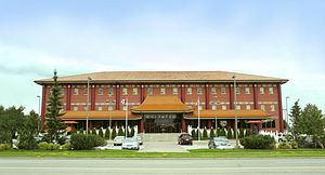
Fo Guang Shan Temple, Toronto
Distance: Approx. 2338 meters
Latitude and longitude: 43.5914,-79.743
Fo Guang Shan Temple of Toronto (Chinese: 多倫多佛光山; pinyin: duō lún duō fó guāng shān) was built to serve as a cultural, educational, community and spiritual centre for Chinese Buddhism and those interested in Buddhist teachings and practice. Founded by Venerable Master Hsing Yun in 1991 and completed in 1997, Fo Guang Shan Temple of Toronto (FGS Toronto) is one of the over 400 Fo Guang Shan Temples worldwide. It was founded with the intention to propagate Humanistic Buddhism to the local community in the Greater Toronto Area, which emphasizes bringing Buddhist teaching into our daily lives and maintaining harmony with the environment, society, each other and within ourselves.

Syro-Malabar Catholic Eparchy of Mississauga
Eastern Catholic eparchy in Canada
Distance: Approx. 2062 meters
Latitude and longitude: 43.5975406,-79.7423258
The Syro-Malabar Catholic Eparchy of Mississauga is an ecclesiastical territory or eparchy of the Catholic Church for all Syro-Malabar Catholics in Canada. Its episcopal seat is the St. Alphonsa Cathedral in the episcopal see of Mississauga.

Meadowvale Community Centre and Library
Library in Mississauga, Canada
Distance: Approx. 2220 meters
Latitude and longitude: 43.58526667,-79.75624444
Meadowvale Community Centre and Library is a library branch under the Mississauga Library System and a community centre located in the Meadowvale neighbourhood of Mississauga, Ontario. The Meadowvale Community Centre was officially opened in January 1982. The original building was 43,500 square feet, including a pool, fitness centre with racquetball and squash courts, meetings rooms (including a large auditorium) and lobby space.

Lisgar, Mississauga
Neighbourhood in Peel, Ontario, Canada
Distance: Approx. 1544 meters
Latitude and longitude: 43.59861111,-79.78416667
Lisgar is a residential neighbourhood in the city of Mississauga, Ontario, Canada. It is located in the extreme northwestern corner of the city, bordering the larger Meadowvale district to the east and the Churchill Meadows neighbourhood to the south. It is named after the former hamlet located at the corner of Winston Churchill Boulevard and Derry Road, which is actually outside the present neighbourhood in Meadowvale.
Weather in this IP's area
overcast clouds
-11 Celsius
-16 Celsius
-12 Celsius
-10 Celsius
1028 hPa
85 %
1028 hPa
1002 hPa
10000 meters
2.99 m/s
9 m/s
262 degree
100 %