64.251.242.63 - IP Lookup: Free IP Address Lookup, Postal Code Lookup, IP Location Lookup, IP ASN, Public IP
Country:
Region:
City:
Location:
Time Zone:
Postal Code:
ISP:
ASN:
language:
User-Agent:
Proxy IP:
Blacklist:
IP information under different IP Channel
ip-api
Country
Region
City
ASN
Time Zone
ISP
Blacklist
Proxy
Latitude
Longitude
Postal
Route
db-ip
Country
Region
City
ASN
Time Zone
ISP
Blacklist
Proxy
Latitude
Longitude
Postal
Route
IPinfo
Country
Region
City
ASN
Time Zone
ISP
Blacklist
Proxy
Latitude
Longitude
Postal
Route
IP2Location
64.251.242.63Country
Region
oregon
City
portland
Time Zone
America/Los_Angeles
ISP
Language
User-Agent
Latitude
Longitude
Postal
ipdata
Country
Region
City
ASN
Time Zone
ISP
Blacklist
Proxy
Latitude
Longitude
Postal
Route
Popular places and events near this IP address
University Park, Portland, Oregon
Neighborhood in Portland, Oregon, United States
Distance: Approx. 1223 meters
Latitude and longitude: 45.579,-122.737
University Park is a neighborhood in the north section of Portland, Oregon, United States, on the east shore of the Willamette River. University Park is bounded by North Lombard Street and the Portsmouth neighborhood to the north, North Chautauqua Boulevard and the Arbor Lodge neighborhood to the east, The Willamette River and Mock's Bottom industrial area to the south, and the North Portland railroad cut with Cathedral Park and St. Johns neighborhoods to the west.

Roosevelt High School (Oregon)
Public school in Portland, Oregon, United States
Distance: Approx. 86 meters
Latitude and longitude: 45.589407,-122.738147
Roosevelt High School (RHS) is a public high school in Portland, Oregon, United States. It is located in the St. Johns neighborhood.

St. Johns Signal Tower Gas Station
Historic building in Portland, Oregon, U.S.
Distance: Approx. 1037 meters
Latitude and longitude: 45.5892,-122.752275
The St. Johns Signal Tower Gas Station, located in the St. Johns neighborhood of north Portland, Oregon, is listed on the National Register of Historic Places.

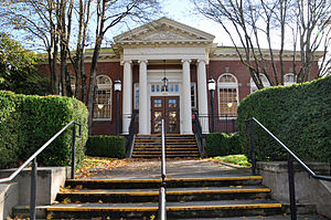
St. Johns Library
Library building in Portland, Oregon, U. S.
Distance: Approx. 944 meters
Latitude and longitude: 45.59,-122.75111111
The St. Johns Library is a branch of the Multnomah County Library, in St. Johns, Portland, Oregon.

St. Johns Twin Cinema
Movie theater in Portland, Oregon, U.S.
Distance: Approx. 1292 meters
Latitude and longitude: 45.59055556,-122.75555556
The St. Johns Twin Cinema, formerly known as the Northgate Theater and the St. Johns Theater, is a movie theater located in the St.
St. Johns Racquet Center
Indoor tennis facility in Portland, Oregon, U.S.
Distance: Approx. 1236 meters
Latitude and longitude: 45.59138889,-122.75472222
Portland Tennis & Education (formally St. Johns Racquet Center) offers a variety of classes, drills, mixers, & private lessons for tennis & pickleball players of all levels. As a public facility, we welcome everyone.
James John Elementary School
School in Portland, Oregon, United States
Distance: Approx. 1006 meters
Latitude and longitude: 45.5903,-122.7519
James John Elementary is a K–5 school within the Portland Public Schools district located in the St. Johns neighborhood of north Portland, Oregon, United States. Built in 1929, it feeds graduates to George Middle School which then feeds Roosevelt High School.
George Park (Portland, Oregon)
Public park in Portland, Oregon, U.S.
Distance: Approx. 421 meters
Latitude and longitude: 45.593684,-122.739152
George Park is a 2.03-acre (0.82 ha) public park in Portland, Oregon's St. Johns neighborhood, in the United States. Acquired in 1971, the park is named after Melvin Clark George.
McKenna Park
Public park in Portland, Oregon, U.S.
Distance: Approx. 999 meters
Latitude and longitude: 45.58194444,-122.73305556
McKenna Park is a 4.52-acre (1.83 ha) public park in the University Park neighborhood of Portland, Oregon, in the United States. The park was acquired in 1940.
St. Johns Park (Portland, Oregon)
Public park in Portland, Oregon, U.S.
Distance: Approx. 1077 meters
Latitude and longitude: 45.592779,-122.752206
St. Johns Park is a public park in north Portland, Oregon's St. Johns neighborhood, in the United States.
Wayfinding College
Nonprofit alternative college in Portland, Oregon
Distance: Approx. 913 meters
Latitude and longitude: 45.59069444,-122.75066667
Wayfinding College (formerly Wayfinding Academy) was a two-year, nonprofit alternative college located in Portland, Oregon, United States. Students graduate from the program with an Associates of Arts degree in Self and Society. As of January 2020, 19 students have completed the two-year program.

Gracie's Apizza
Pizzeria in Portland, Oregon, U.S.
Distance: Approx. 1170 meters
Latitude and longitude: 45.5893,-122.754
Gracie's Apizza is a pizzeria in Portland, Oregon's St. Johns neighborhood, in the United States.
Weather in this IP's area
clear sky
1 Celsius
1 Celsius
-2 Celsius
3 Celsius
1028 hPa
62 %
1028 hPa
1019 hPa
10000 meters
0.89 m/s
1.34 m/s
61 degree


