Country:
 USA
USARegion:
City:
Latitude and Longitude:
Time Zone:
Postal Code:
IP information under different IP Channel
ip-api
Country
Region
City
ASN
Time Zone
ISP
Blacklist
Proxy
Latitude
Longitude
Postal
Route
IPinfo
Country
Region
City
ASN
Time Zone
ISP
Blacklist
Proxy
Latitude
Longitude
Postal
Route
MaxMind
Country
Region
City
ASN
Time Zone
ISP
Blacklist
Proxy
Latitude
Longitude
Postal
Route
Luminati
Country
USRegion
vt
City
southburlington
ASN
Time Zone
America/New_York
ISP
TVC-AS1
Latitude
Longitude
Postal
db-ip
Country
Region
City
ASN
Time Zone
ISP
Blacklist
Proxy
Latitude
Longitude
Postal
Route
ipdata
Country
Region
City
ASN
Time Zone
ISP
Blacklist
Proxy
Latitude
Longitude
Postal
Route
Popular places and events near this IP address

Colchester, Vermont
Town in Vermont, United States
Distance: Approx. 3875 meters
Latitude and longitude: 44.54194444,-73.19666667
Colchester is a town in Chittenden County, Vermont, United States. As of the 2020 census, the population of Colchester was 17,524. It is the third-most populous municipality and most populous town in the state of Vermont.
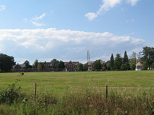
Saint Michael's College
Private Catholic college in Colchester, Vermont, U.S.
Distance: Approx. 5648 meters
Latitude and longitude: 44.4947,-73.1653
Saint Michael's College (St. Mikes) is a private Catholic college in Colchester, Vermont, founded in 1904 by the Society of Saint Edmund. It grants Bachelor of Arts and Bachelor of Science degrees in more than 40 majors to about 1,200 undergraduate students.
Fort Ethan Allen
United States historic place
Distance: Approx. 4273 meters
Latitude and longitude: 44.50555556,-73.15027778
Fort Ethan Allen was a United States Army installation in Vermont, named for American Revolutionary War figure Ethan Allen. Established as a cavalry post in 1894 and closed in 1944, today it is the center of a designated national historic district straddling the town line between Colchester and Essex. Locally, it is known simply as "The Fort", and now houses a Vermont National Guard installation a variety of businesses, academic institutions, and residential areas.
Chittenden-7-1 Vermont Representative District, 2002–2012
Distance: Approx. 1636 meters
Latitude and longitude: 44.55,-73.16666667
The Chittenden-7-1 Representative District is a two-member state Representative district in the U.S. state of Vermont. It is one of the 108 one or two member districts into which the state was divided by the redistricting and reapportionment plan developed by the Vermont General Assembly following the 2000 U.S. census. The plan applies to legislatures elected in 2002, 2004, 2006, 2008, and 2010.
WXXX
Radio station in Vermont, United States
Distance: Approx. 4720 meters
Latitude and longitude: 44.509472,-73.182611
WXXX (95.5 FM, "95 Triple X") is a radio station that is licensed to South Burlington, Vermont, and serving the Champlain Valley of Vermont and New York. On air and in advertisements the station is known as "95 Triple X". The station is owned by Sison Broadcasting, and it airs a contemporary hit radio/Top 40 format.
WVTX (FM)
Vermont Public Radio station in Colchester, Vermont
Distance: Approx. 4016 meters
Latitude and longitude: 44.50788889,-73.15088889
WVTX (88.7 FM) was a radio station formerly licensed to Colchester, Vermont and owned by Vermont Public. The station, established in 1973 by Saint Michael's College as the original FM home of its campus radio station WWPV-FM, last aired programming from the Vermont Public Classical network. Vermont Public turned in the station's license in 2024.
Colchester High School (Vermont)
School in Colchester, Vermont, United States
Distance: Approx. 5219 meters
Latitude and longitude: 44.5396,-73.2134
Colchester High School is a public senior high school in Colchester, Vermont, and is part of the Colchester School District in Chittenden County, Vermont. The high school serves 9th through 12th grades. Enrollment is approximately 650 to 825 students with an annual graduating class of around 170 to 230 seniors.
Colchester School District (Vermont)
School district in Vermont, United States
Distance: Approx. 1842 meters
Latitude and longitude: 44.537,-73.169
Colchester School District is a school district in Colchester, Vermont, United States.
Ross Sports Center
Distance: Approx. 5768 meters
Latitude and longitude: 44.494202,-73.168473
Ross Sports Center is a 2,500-seat indoor arena in Colchester, Vermont. It is used primarily for basketball, and is home to the Saint Michael's College Knights basketball and volleyball teams. It was built in 1973.

St. Francis Xavier Church (Winooski, Vermont)
Church in Vermont, United States
Distance: Approx. 5162 meters
Latitude and longitude: 44.506968,-73.187235
St. Francis Xavier Church is a Catholic church within the City of Winooski, Vermont in the United States. Built in 1870 within what was then known as a village within the township of Colchester, the parish church became one of the most visible landmarks in Chittenden County due to its unique double-spired design and proportional size comparative to its surrounding structures.

Indian Brook Reservoir
Reservoir in Essex, Vermont
Distance: Approx. 4039 meters
Latitude and longitude: 44.53499,-73.09855
Indian Brook Reservoir is a 58 acre reservoir located in the town of Essex, Vermont. It is the focal point of the Indian Brook Town Conservation Area.
WWPV-LP
Radio station at Saint Michael's College in Colchester, Vermont
Distance: Approx. 5704 meters
Latitude and longitude: 44.49391667,-73.16372222
WWPV-LP (92.5 FM) is a radio station licensed to serve the community of Colchester, Vermont. The station is owned by Saint Michael's College. It airs a variety radio format.
Weather in this IP's area
clear sky
17 Celsius
15 Celsius
15 Celsius
18 Celsius
1031 hPa
44 %
1031 hPa
1021 hPa
10000 meters
1.54 m/s
90 degree
07:12:01
18:02:56