Country:
 USA
USARegion:
City:
Latitude and Longitude:
Time Zone:
Postal Code:
IP information under different IP Channel
ip-api
Country
Region
City
ASN
Time Zone
ISP
Blacklist
Proxy
Latitude
Longitude
Postal
Route
IPinfo
Country
Region
City
ASN
Time Zone
ISP
Blacklist
Proxy
Latitude
Longitude
Postal
Route
MaxMind
Country
Region
City
ASN
Time Zone
ISP
Blacklist
Proxy
Latitude
Longitude
Postal
Route
Luminati
Country
USRegion
vt
City
southburlington
ASN
Time Zone
America/New_York
ISP
TVC-AS1
Latitude
Longitude
Postal
db-ip
Country
Region
City
ASN
Time Zone
ISP
Blacklist
Proxy
Latitude
Longitude
Postal
Route
ipdata
Country
Region
City
ASN
Time Zone
ISP
Blacklist
Proxy
Latitude
Longitude
Postal
Route
Popular places and events near this IP address

Winooski, Vermont
City in Vermont, United States
Distance: Approx. 1419 meters
Latitude and longitude: 44.495,-73.1825
Winooski is a city in Chittenden County, Vermont, United States. Located on the Winooski River, as of the 2020 U.S. census the municipal population was 7,997. The city is the most densely populated municipality in northern New England, an area comprising the states of Maine, New Hampshire, and Vermont.
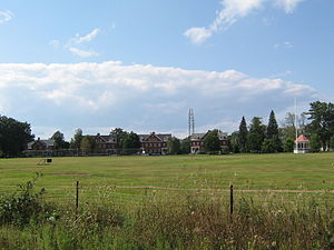
Saint Michael's College
Private Catholic college in Colchester, Vermont, U.S.
Distance: Approx. 357 meters
Latitude and longitude: 44.4947,-73.1653
Saint Michael's College (St. Mikes) is a private Catholic college in Colchester, Vermont, founded in 1904 by the Society of Saint Edmund. It grants Bachelor of Arts and Bachelor of Science degrees in more than 40 majors to about 1,200 undergraduate students.
Fort Frederick (Vermont)
Distance: Approx. 1920 meters
Latitude and longitude: 44.4896,-73.1863
Fort Frederick was a formidable blockhouse that was built at the Winooski (then “Onion”) River in 1773 by Ira Allen, one of the first English occupants to settle in the locality. He named it after the ten-year-old Frederick, Duke of York and Albany, second son of George III of the United Kingdom. Allen also established a shipyard nearby at the Winooski River bridge in 1772.
Fort Ethan Allen
United States historic place
Distance: Approx. 1453 meters
Latitude and longitude: 44.50555556,-73.15027778
Fort Ethan Allen was a United States Army installation in Vermont, named for American Revolutionary War figure Ethan Allen. Established as a cavalry post in 1894 and closed in 1944, today it is the center of a designated national historic district straddling the town line between Colchester and Essex. Locally, it is known simply as "The Fort", and now houses a Vermont National Guard installation a variety of businesses, academic institutions, and residential areas.
Chittenden-3-6 Vermont Representative District, 2002–2012
Distance: Approx. 1807 meters
Latitude and longitude: 44.49166667,-73.18611111
The Chittenden-3-6 Representative District is a two-member state Representative district in the U.S. state of Vermont. It is one of the 108 one or two member districts into which the state was divided by the redistricting and reapportionment plan developed by the Vermont General Assembly following the 2000 U.S. Census. The plan applies to legislatures elected in 2002, 2004, 2006, 2008, and 2010.
WXXX
Radio station in Vermont, United States
Distance: Approx. 1895 meters
Latitude and longitude: 44.509472,-73.182611
WXXX (95.5 FM, "95 Triple X") is a radio station that is licensed to South Burlington, Vermont, and serving the Champlain Valley of Vermont and New York. On air and in advertisements the station is known as "95 Triple X". The station is owned by Sison Broadcasting, and it airs a contemporary hit radio/Top 40 format.
WVTX (FM)
Vermont Public Radio station in Colchester, Vermont
Distance: Approx. 1584 meters
Latitude and longitude: 44.50788889,-73.15088889
WVTX (88.7 FM) was a radio station formerly licensed to Colchester, Vermont and owned by Vermont Public. The station, established in 1973 by Saint Michael's College as the original FM home of its campus radio station WWPV-FM, last aired programming from the Vermont Public Classical network. Vermont Public turned in the station's license in 2024.
Ross Sports Center
Distance: Approx. 491 meters
Latitude and longitude: 44.494202,-73.168473
Ross Sports Center is a 2,500-seat indoor arena in Colchester, Vermont. It is used primarily for basketball, and is home to the Saint Michael's College Knights basketball and volleyball teams. It was built in 1973.

Old Stone House (Winooski, Vermont)
Historic house in Vermont, United States
Distance: Approx. 1653 meters
Latitude and longitude: 44.49111111,-73.18361111
The Old Stone House is a historic house at 73 East Allen Street in central Winooski, Vermont. Built around 1790, it is the city's oldest building. It has served as a tavern, as a residence, and now supports professional offices.

Porter Screen Company
United States historic place
Distance: Approx. 1399 meters
Latitude and longitude: 44.49361111,-73.18166667
The Porter Screen Company is a historic former industrial facility at 110 East Spring Street in Winooski, Vermont. Developed beginning 1910–11, this mill complex was an important secondary industrial employer in the city, shipping window screens and other housing parts nationwide. The facility, now converted to senior housing, was listed on the National Register of Historic Places in 1979.

Winooski Block
United States historic place
Distance: Approx. 1827 meters
Latitude and longitude: 44.49166667,-73.18638889
The Winooski Block is a historic commercial building at 1 through 17 East Allen Street (corner of Main Street) in downtown Winooski, Vermont. Built in 1867, it is the only major building to survive the city's urban renewal activities of the 1970s, and is a fine example of post-Civil War commercial architecture. It was listed on the National Register of Historic Places in 1974.
WWPV-LP
Radio station at Saint Michael's College in Colchester, Vermont
Distance: Approx. 457 meters
Latitude and longitude: 44.49391667,-73.16372222
WWPV-LP (92.5 FM) is a radio station licensed to serve the community of Colchester, Vermont. The station is owned by Saint Michael's College. It airs a variety radio format.
Weather in this IP's area
overcast clouds
13 Celsius
12 Celsius
12 Celsius
14 Celsius
1009 hPa
96 %
1009 hPa
998 hPa
10000 meters
0.45 m/s
1.79 m/s
120 degree
86 %
06:24:07
19:16:35