Country:
 USA
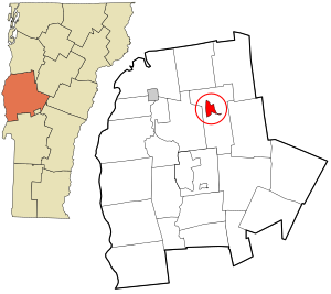
USARegion:
City:
Latitude and Longitude:
Time Zone:
Postal Code:
IP information under different IP Channel
ip-api
Country
Region
City
ASN
Time Zone
ISP
Blacklist
Proxy
Latitude
Longitude
Postal
Route
IPinfo
Country
Region
City
ASN
Time Zone
ISP
Blacklist
Proxy
Latitude
Longitude
Postal
Route
MaxMind
Country
Region
City
ASN
Time Zone
ISP
Blacklist
Proxy
Latitude
Longitude
Postal
Route
Luminati
Country
USRegion
vt
City
southburlington
ASN
Time Zone
America/New_York
ISP
CLEARBEARING-00
Latitude
Longitude
Postal
db-ip
Country
Region
City
ASN
Time Zone
ISP
Blacklist
Proxy
Latitude
Longitude
Postal
Route
ipdata
Country
Region
City
ASN
Time Zone
ISP
Blacklist
Proxy
Latitude
Longitude
Postal
Route
Popular places and events near this IP address

Bristol, Vermont
Town in Vermont, United States
Distance: Approx. 33 meters
Latitude and longitude: 44.13333333,-73.07944444
Bristol is a town in Addison County, Vermont, United States. The town was chartered on June 26, 1762, by the colonial governor of New Hampshire, Benning Wentworth. The charter was granted to Samuel Averill and sixty-three associates in the name of Pocock—in honor of a distinguished English admiral of that name.
Addison-4 Vermont Representative District, 2002–2012
Distance: Approx. 33 meters
Latitude and longitude: 44.13333333,-73.07944444
The Addison-4 Representative District is a two-member state Representative district in the U.S. state of Vermont. It is one of the 108 one or two member districts into which the state was divided by the redistricting and reapportionment plan developed by the Vermont General Assembly following the 2000 U.S. Census. The plan applies to legislatures elected in 2002, 2004, 2006, 2008, and 2010.
Bristol (CDP), Vermont
Census-designated place in Vermont, United States
Distance: Approx. 70 meters
Latitude and longitude: 44.13333333,-73.07888889
Bristol is the main settlement in the town of Bristol in Addison County, Vermont, United States, and a census-designated place (CDP). The population was 1,936 at the 2020 census, out of a total population of 3,782 in the town of Bristol.

Union Church (New Haven, Vermont)
Historic church in Vermont, United States
Distance: Approx. 5107 meters
Latitude and longitude: 44.0925,-73.10944444
Union Church, also known as the Union Church of New Haven Mills is a historic church at the junction of River Rd. and East Street in New Haven, Vermont. Built in 1851, it is a fine local example of Greek Revival architecture with added Queen Anne Victorian features, and one of the oldest surviving buildings in a once-thriving mill village.
Lawrence Memorial Library
Distance: Approx. 314 meters
Latitude and longitude: 44.13577778,-73.07847222
. The Lawrence Memorial Library is a public library located in Bristol, Vermont.

New Haven Junction station
Distance: Approx. 5971 meters
Latitude and longitude: 44.12666667,-73.15388889
New Haven Junction station is a former railway station at the junction of United States Route 7 and Vermont Route 17 in New Haven, Vermont. Probably built in the 1850s, it is a well-preserved example of a first-generation railroad depot. It was listed on the National Register of Historic Places in 1978 as New Haven Junction Depot, and now houses offices.

Lampson School
United States historic place
Distance: Approx. 5178 meters
Latitude and longitude: 44.0918,-73.1095
The Lampson School is a historic school building at 44 Summer Road in New Haven, Vermont. Built in 1868, it is a prominent example of Italianate architecture, donated to the town by one of its native sons, Curtis Lampson. It served as a public school until 1940, and was afterward converted to residential use.

Bristol Downtown Historic District
Historic district in Vermont, United States
Distance: Approx. 167 meters
Latitude and longitude: 44.1325,-73.07777778
The Bristol Downtown Historic District encompasses the historic late 19th-century commercial heart of Bristol, Vermont. At first a rural agricultural market town, it developed in the second half of the 19th century as a small industrial center, producing finished wood products. Its downtown occupies an area of one block on both sides of Main Street, and features a diversity of architectural styles.
Bristol Cliffs Wilderness
Protected area in Vermont, United States
Distance: Approx. 4383 meters
Latitude and longitude: 44.1,-73.05
The Bristol Cliffs Wilderness is one of eight wilderness areas in the Green Mountain National Forest in the U.S. state of Vermont. The area, near Lincoln, Vermont, is managed by the U.S. Forest Service. With a total of 3,750 acres (1,520 ha), the wilderness is the smallest in Vermont.
Mount Abraham Union High School
Public middle school and high school in Bristol, Vermont, United States
Distance: Approx. 1166 meters
Latitude and longitude: 44.1355,-73.0939
Mount Abraham Union High School is a public high school in Bristol, Vermont (U.S.).
New Haven (CDP), Vermont
Census-designated place in Vermont, United States
Distance: Approx. 5967 meters
Latitude and longitude: 44.12416667,-73.15333333
New Haven is the central settlement and a census-designated place (CDP) in the town of New Haven, Addison County, Vermont, United States. It was first listed as a CDP prior to the 2020 census. It is in north-central Addison County, in the north-central part of the town of New Haven.
The Tillerman
Restaurant in Bristol, Vermont, U.S.
Distance: Approx. 3633 meters
Latitude and longitude: 44.154793,-73.045714
The Tillerman is a restaurant in Bristol, Vermont.
Weather in this IP's area
clear sky
4 Celsius
4 Celsius
0 Celsius
6 Celsius
1031 hPa
85 %
1031 hPa
1009 hPa
10000 meters
0.44 m/s
0.83 m/s
109 degree
07:11:13
18:03:11