Country:
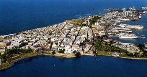
 Puerto Rico
Region:
City:
Latitude and Longitude:
Time Zone:
Postal Code:
IP information under different IP Channel
ip-api
Country
Region
City
ASN
Time Zone
ISP
Blacklist
Proxy
Latitude
Longitude
Postal
Route
IPinfo
Country
Region
City
ASN
Time Zone
ISP
Blacklist
Proxy
Latitude
Longitude
Postal
Route
MaxMind
Country
Region
City
ASN
Time Zone
ISP
Blacklist
Proxy
Latitude
Longitude
Postal
Route
Luminati
Country
PRCity
sanjuan
ASN
Time Zone
America/Puerto_Rico
ISP
COQUI-NET
Latitude
Longitude
Postal
db-ip
Country
Region
City
ASN
Time Zone
ISP
Blacklist
Proxy
Latitude
Longitude
Postal
Route
ipdata
Country
Region
City
ASN
Time Zone
ISP
Blacklist
Proxy
Latitude
Longitude
Postal
Route
Popular places and events near this IP address

Senate of Puerto Rico
Subnational legislature
Distance: Approx. 302 meters
Latitude and longitude: 18.46888889,-66.10611111
The Senate of Puerto Rico (Spanish: Senado de Puerto Rico) is the upper house of the Legislative Assembly of Puerto Rico, the territorial legislature of Puerto Rico. The Senate, together with the House of Representatives of Puerto Rico, control the legislative branch of the government of Puerto Rico. The structure and responsibilities of the Senate are defined in Article III of the Constitution of Puerto Rico which vests all legislative power in the Legislative Assembly.

Ateneo Puertorriqueño
Cultural institution in Puerto Rico founded in 1876
Distance: Approx. 382 meters
Latitude and longitude: 18.46416667,-66.10861111
The Ateneo Puertorriqueño (Puerto Rican Athenaeum) is a cultural institution in Puerto Rico. Founded on April 30, 1876, it has been called Puerto Rico's oldest cultural institution, however, it is actually its third oldest overall and second culturally, after the Bar Association of Puerto Rico and the Casino of Mayagüez. One of its founders was the playwright, Alejandro Tapia y Rivera.
San Juan Islet
Island with Old San Juan in Puerto Rico
Distance: Approx. 186 meters
Latitude and longitude: 18.46678611,-66.10735278
San Juan Islet (Spanish: Isleta de San Juan) is a 3-square-mile (7.8 km2) islet or small island on San Juan Bay in the Atlantic coast of northern Puerto Rico. Home to Old San Juan, it is the site of the oldest permanent European settlement in Puerto Rico (1521), and the second oldest European settlement in the West Indies after Santo Domingo (1496). Due to its strategic location in the Caribbean during the Spanish colonization of the Americas, it is home to a city wall and a number of militaristic buildings such as El Morro Castle.

Capitol of Puerto Rico
Seat of Legislative Assembly of Puerto Rico
Distance: Approx. 84 meters
Latitude and longitude: 18.46694444,-66.10583333
The Capitol of Puerto Rico (Spanish: Capitolio de Puerto Rico), also known as Casa de las Leyes (House of Laws), and most commonly referred to as El Capitolio (The Capitol), is the seat of the Legislative Assembly, or the bicameral legislature, composed of the Senate and House of Representatives, responsible for the legislative branch of the government of Puerto Rico. Located on San Juan Islet immediately outside the Walls of Old San Juan, the oceanfront, neoclassical Beaux-Arts-style, entirely white marble-covered edifice was constructed between 1921 and 1929 to resemble the ancient Roman Pantheon in Rome, using as inspiration the Low Memorial Library in New York City. It was added to the National Register of Historic Places in 1977.

Casa Rosa
Historic house in Old San Juan, Puerto Rico
Distance: Approx. 347 meters
Latitude and longitude: 18.46805556,-66.10305556
Casa Rosa or Casa Rosada, also known as the Pink House, is a historic house located in Old San Juan, Puerto Rico. The house was built in 1812 as a barrack for the troops assigned to the San Agustin Bastion. It was converted to an officers quarters in 1881 by the Spanish Army.

Casa de España
Historic building in San Juan, Puerto Rico
Distance: Approx. 246 meters
Latitude and longitude: 18.466432,-66.108019
Casa de España is the headquarters of a private social organization whose members are those of Spanish descent in San Juan, Puerto Rico on Avenida de La Constitución in Old San Juan.

School of Tropical Medicine (Puerto Rico)
Historic place in San Juan, Puerto Rico
Distance: Approx. 200 meters
Latitude and longitude: 18.467003,-66.104005
The School of Tropical Medicine (Spanish: Escuela de Medicina Tropical), was an educational institution created in 1926 by an act of the Puerto Rican Legislature, to further the research initiated by the Anemia Commissions and the Institute of Tropical Medicine on anemia and its causes. The institution existed as an independent entity until 1949, when it was integrated into the School of Medicine of the University of Puerto Rico.

San Juan Antiguo
Barrio of San Juan, Puerto Rico
Distance: Approx. 332 meters
Latitude and longitude: 18.46611,-66.10884
San Juan Antiguo (English: Ancient San Juan)(not to be confused with the historic district of Old San Juan which is located within this district), is a barrio located in the municipality of San Juan in the Commonwealth of Puerto Rico. San Juan Antiguo has 7 subbarrios. In 2020, San Juan Antiguo had a population of 6,383 inhabitants and a population density of 2,400 people per km2.

El Monumento de la Recordación
Memorial monument and monolith erected in San Juan, Puerto Rico
Distance: Approx. 22 meters
Latitude and longitude: 18.46611111,-66.10588889
El Monumento de la Recordación (English: The Monument of Remembrance) is a memorial monument and monolith erected in San Juan, Puerto Rico that honors Puerto Ricans who have fallen in combat in service of the United States Armed Forces. The monument was unveiled on May 19, 1996 as a granite wall engraved with the names of Puerto Rican soldiers who died during combat. As of 2009, the monument was etched with the names of more than 2,000 service members.

Biblioteca Carnegie
United States historic place
Distance: Approx. 461 meters
Latitude and longitude: 18.46833333,-66.10944444
The Biblioteca Carnegie (or Carnegie Library) on Avenida Juan Ponce de León in Puerta de Tierra, San Juan, Puerto Rico is a NRHP-listed Carnegie library funded through a $100,000 donation from the Carnegie Foundation, becoming Puerto Rico's first purpose-built library when it was completed in 1915.

José Celso Barbosa Graded School
United States historic place
Distance: Approx. 467 meters
Latitude and longitude: 18.4659954,-66.101282
The José Celso Barbosa Graded School (Spanish: Escuela Graduada José Celso Barbosa) is a historic school building located in the Puerta de Tierra historic district in the city of San Juan, Puerto Rico. The school is named after Puerto Rico statehood movement founder Dr. José Celso Barbosa and has been listed in the National Register of Historic Places since 1989, and on the Puerto Rico Register of Historic Sites and Zones since 2000.

Arsenal de San Juan
Historic site in San Juan, Puerto Rico
Distance: Approx. 426 meters
Latitude and longitude: 18.46611111,-66.10166667
The former Spanish Navy Arsenal of San Juan (Spanish: Arsenal de la Marina Española), historically known as the San Juan Naval Station and also known as the Navy Arsenal of La Puntilla (Arsenal de la Marina de la Puntilla), the Arsenal of San Juan (Arsenal de San Juan) or simply El Arsenal, is a historic building complex and former Spanish Navy armory located in La Puntilla, a former neighborhood of the Old San Juan historic district in San Juan, Puerto Rico. It was built in 1800 at the site of the old main port of San Juan, today the Old San Juan marine and cruise piers area between the former United States Custom House and the Coast Guard Station.
Weather in this IP's area
broken clouds
29 Celsius
36 Celsius
28 Celsius
31 Celsius
1015 hPa
81 %
1015 hPa
1015 hPa
10000 meters
1.54 m/s
350 degree
75 %
06:19:02
17:59:35