Country:
 Japan
JapanRegion:
City:
Latitude and Longitude:
Time Zone:
Postal Code:
IP information under different IP Channel
ip-api
Country
Region
City
ASN
Time Zone
ISP
Blacklist
Proxy
Latitude
Longitude
Postal
Route
IPinfo
Country
Region
City
ASN
Time Zone
ISP
Blacklist
Proxy
Latitude
Longitude
Postal
Route
MaxMind
Country
Region
City
ASN
Time Zone
ISP
Blacklist
Proxy
Latitude
Longitude
Postal
Route
Luminati
Country
JPASN
Time Zone
Asia/Tokyo
ISP
GTT Communications Netherlands B.V.
Latitude
Longitude
Postal
db-ip
Country
Region
City
ASN
Time Zone
ISP
Blacklist
Proxy
Latitude
Longitude
Postal
Route
ipdata
Country
Region
City
ASN
Time Zone
ISP
Blacklist
Proxy
Latitude
Longitude
Postal
Route
Popular places and events near this IP address
Okayama Prefecture
Prefecture of Japan
Distance: Approx. 1513 meters
Latitude and longitude: 34.66166667,133.93472222
Okayama Prefecture (岡山県, Okayama-ken) is a prefecture of Japan located in the Chūgoku region of Honshu. Okayama Prefecture has a population of 1,906,464 (1 February 2018) and has a geographic area of 7,114 km2 (2,746 sq mi). Okayama Prefecture borders Tottori Prefecture to the north, Hyōgo Prefecture to the east, and Hiroshima Prefecture to the west.

RSK Sanyo Broadcasting
Television station in Okayama and Kagawa, Japan
Distance: Approx. 1537 meters
Latitude and longitude: 34.66458333,133.93263889
RSK Sanyo Broadcasting Co., Ltd. (RSK山陽放送株式会社, Āruesukē San'yō Hōsō Kabushikigaisha) is a Japanese television and radio broadcaster in Okayama and Kagawa. The abbreviation, RSK originates in the former name in Japanese (Radio San'yō Kabushikigaisha, ラジオ山陽株式会社).

TV Setouchi
TV station in Okayama Prefecture, Japan
Distance: Approx. 288 meters
Latitude and longitude: 34.65808333,133.92019444
TV Setouchi Broadcasting Co., Ltd. (テレビせとうち株式会社, Terebi Setouchi Kabushikigaisha) (TSC), callsign JOPH-DTV (channel 7) is a Japanese television station based in Okayama, serving as the affiliate of the TX Network for the Okayama and Kagawa prefectures.
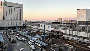
Okayama Station
Major railway station in Okayama, Japan
Distance: Approx. 1219 meters
Latitude and longitude: 34.66638889,133.91861111
Okayama Station (岡山駅, Okayama-eki) is a major railway station in Kita-ku, Okayama, Okayama Prefecture, Japan. The station is operated by West Japan Railway Company (JR West).

Okayama
Designated city in Chūgoku, Japan
Distance: Approx. 684 meters
Latitude and longitude: 34.65,133.91666667
Okayama (岡山市, Okayama-shi, Japanese: [okaꜜjama]) is the capital city of Okayama Prefecture in the Chūgoku region of Japan. The Okayama metropolitan area, centered around the city, has the largest urban employment zone in the Chugoku region of western Japan. The city was founded on June 1, 1889.

Ōmoto Station
Railway station in Okayama, Japan
Distance: Approx. 1235 meters
Latitude and longitude: 34.64742222,133.91075
Ōmoto Station (大元駅, Ōmoto-eki) is a passenger railway station located in Kita-ku of the city of Okayama, Okayama Prefecture, Japan. It is operated by the West Japan Railway Company (JR West).

Kita-ku, Okayama
Ward of Okayama in Chūgoku, Japan
Distance: Approx. 75 meters
Latitude and longitude: 34.655,133.91944444
Kita-ku (北区) is one of four wards of Okayama, Okayama Prefecture, Japan. The ward has an area of 451.03 km2 and a population of 295,312. The population density is 655 per square kilometer.

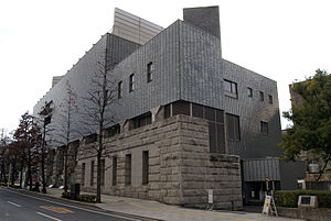
Hayashibara Museum of Art
Art museum in Japan
Distance: Approx. 1518 meters
Latitude and longitude: 34.66361111,133.93333333
The Hayashibara Museum of Art (林原美術館, Hayashibara Bijutsukan) is an art museum owned by the Hayashibara Group, and located at 2-7-15 Marunouchi, Kita-ku, Okayama, Japan. It is on the site of a former guesthouse beside the inner moat of Okayama Castle. Its 6,832 square meter interior was designed by Kunio Maekawa.

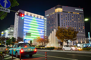
Okayama Symphony Hall
Concert hall in Okayama, Japan
Distance: Approx. 1406 meters
Latitude and longitude: 34.66527778,133.92972222
Okayama Symphony Hall (岡山シンフォニーホール, Okayama Shinfonī Hōlu) is a concert hall in Okayama, Okayama, Japan. It opened in 1991 and seats 2,001. Yoshinobu Ashihara was the architect, with acoustical design by Nagata Acoustics.

Okayama Orient Museum
Distance: Approx. 1519 meters
Latitude and longitude: 34.66638889,133.93
Okayama Orient Museum (岡山市立オリエント美術館, Okayama Shiritsu Oriento Bijutsukan) is a museum of Ancient Near Eastern, Roman provincial, Byzantine, Sassanian, and Islamic Art in Kita-ku, Okayama, Okayama Prefecture, Japan. As of 2007 there were some 4,852 items, including a winged Assyrian relief from the palace of Ashurnasirpal II in Nimrud, Mesopotamia, acquired to mark the institution's 25th anniversary. The museum was founded to house the collection of Shinjiro Yasuhiro, who acquired thousands of objects with the advice of academics from the University of Tokyo.
Okayama Prefectural Museum of Art
Distance: Approx. 1645 meters
Latitude and longitude: 34.66777778,133.93
The Okayama Prefectural Museum of Art (岡山県立美術館, Okayama Kenritsu Bijutsukan) is located in Okayama, Okayama Prefecture, Japan. It is one of Japan's many museums which are supported by a prefecture. The museum, by architects Okada & Associates, opened in 1988 and has a collection of around two thousand works.

Inryō-ji
Buddhist temple in Okayama, Japan
Distance: Approx. 347 meters
Latitude and longitude: 34.65680556,133.92344444
Inryō-ji (Japanese: 蔭凉寺) is a Buddhist temple in Okayama City, Okayama Prefecture, Japan. It is also known as Inryo-ji, Inryou-ji, or Inryoji. It is a temple of the Myōshin-ji school of the Rinzai sect in Japanese Zen.
Weather in this IP's area
broken clouds
18 Celsius
17 Celsius
17 Celsius
19 Celsius
1022 hPa
73 %
1022 hPa
1021 hPa
10000 meters
6.97 m/s
11.46 m/s
4 degree
82 %
06:13:00
17:25:15