64.222.159.29 - IP Lookup: Free IP Address Lookup, Postal Code Lookup, IP Location Lookup, IP ASN, Public IP
Country:
Region:
City:
Location:
Time Zone:
Postal Code:
ISP:
ASN:
language:
User-Agent:
Proxy IP:
Blacklist:
IP information under different IP Channel
ip-api
Country
Region
City
ASN
Time Zone
ISP
Blacklist
Proxy
Latitude
Longitude
Postal
Route
db-ip
Country
Region
City
ASN
Time Zone
ISP
Blacklist
Proxy
Latitude
Longitude
Postal
Route
IPinfo
Country
Region
City
ASN
Time Zone
ISP
Blacklist
Proxy
Latitude
Longitude
Postal
Route
IP2Location
64.222.159.29Country
Region
vermont
City
williamstown
Time Zone
America/New_York
ISP
Language
User-Agent
Latitude
Longitude
Postal
ipdata
Country
Region
City
ASN
Time Zone
ISP
Blacklist
Proxy
Latitude
Longitude
Postal
Route
Popular places and events near this IP address

Williamstown, Vermont
Town in Vermont, United States
Distance: Approx. 624 meters
Latitude and longitude: 44.11611111,-72.54083333
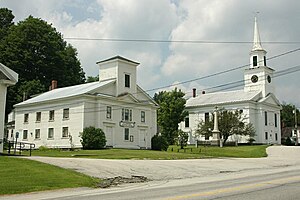
Williamstown is a town in Orange County, Vermont, United States. The population was 3,515 at the 2020 census, making it the second largest municipality in the county.

Graniteville-East Barre, Vermont
Former CDP in Vermont, United States
Distance: Approx. 7181 meters
Latitude and longitude: 44.15888889,-72.46805556
Graniteville-East Barre is a former census-designated place (CDP) defined for the 2000 census in the town of Barre, Washington County, Vermont, United States. The population of the CDP was 2,136 at the 2000 census. The CDP consisted of three unincorporated villages in the town: Graniteville, East Barre, and Websterville.

South Barre, Vermont
Census-designated place in Vermont, United States
Distance: Approx. 6787 meters
Latitude and longitude: 44.17694444,-72.50555556
South Barre is a census-designated place (CDP) in the town of Barre in Washington County, Vermont, United States. The population was 1,242 at the 2000 census.
Graniteville, Vermont
Census-designated place in Vermont, United States
Distance: Approx. 5101 meters
Latitude and longitude: 44.15083333,-72.49222222
Graniteville is a census-designated place (CDP) in the town of Barre, Washington County, Vermont, United States. The population of the CDP was 784 at the 2010 census. Prior to 2010, it was part of the Graniteville-East Barre CDP, which consisted of three unincorporated villages in the town: Graniteville, East Barre, and Websterville.
Thunder Road International SpeedBowl
Automobile racetrack in Vermont, USA
Distance: Approx. 7753 meters
Latitude and longitude: 44.17979444,-72.48795278
Thunder Road International Speedbowl, more commonly known as just Thunder Road, is a .25-mile (0.40 km) high-banked, paved short track speedway located in the town of Barre, Vermont. The track was founded by Ken Squier in 1960 and sold by Squier and co-owner Tom Curley in the spring of 2017 to former Thunder Road track champion Cris Michaud and local businessman Pat Malone. Currently, Thunder Road hosts three weekly championship divisions: Late Models, Flying Tigers, and Street Stocks along with the non-point Road Warrior class.

WRFK (FM)
Radio station in Vermont, United States
Distance: Approx. 6452 meters
Latitude and longitude: 44.15838889,-72.47897222
WRFK (107.1 MHz, "Frank FM") is an FM radio station licensed to Barre and serving central Vermont. Established in 1974, the station is owned by Jeffrey Shapiro's Great Eastern Radio. WRFK airs a classic rock format, and is simulcast in the Champlain Valley on WWFK (also on 107.1 FM) in Plattsburgh West, New York.

Barre granite
Distance: Approx. 5721 meters
Latitude and longitude: 44.15222222,-72.48388889
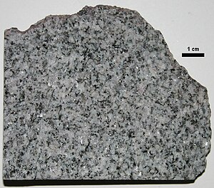
Barre granite /ˈbæri/ is a Devonian granite pluton near the town of Barre in Washington County, Vermont. Richardson described it as a "fine granite, composed of quartz, feldspar, and mica. The mica is both muscovite and biotite." It intrudes into the Waits River Formation.

Websterville, Vermont
Census-designated place in Vermont, United States
Distance: Approx. 7201 meters
Latitude and longitude: 44.16083333,-72.46972222
Websterville is a census-designated place (CDP) in the town of Barre, Washington County, Vermont, United States. The population of the CDP was 550 at the 2010 census. Prior to 2010, it was part of the Graniteville-East Barre CDP, which consisted of three unincorporated villages in the town: Graniteville, East Barre, and Websterville.
Knight's Spider Web Farm
Distance: Approx. 566 meters
Latitude and longitude: 44.11676,-72.54317
Knight's Spider Web Farm is an art studio, retail outlet and residence located in Williamstown, Vermont. The farm was started by Will Knight in 1978 when he decided to use spider webs to produce art. The finished artwork uses whole spider webs as a form of textile art over painted or stained wood.
Williamstown (CDP), Vermont
Census-designated place in Vermont, United States
Distance: Approx. 31 meters
Latitude and longitude: 44.12166667,-72.54111111
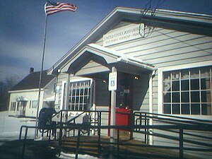
Williamstown is the primary village and a census-designated place (CDP) in the town of Williamstown, Orange County, Vermont, United States. As of the 2020 census, it had a population of 1,264, out of 3,515 in the entire town of Williamstown. The CDP is in northwestern Orange County, in the north-central part of the town of Williamstown.
Vermont Creamery
Creamery and butter maker in Websterville Vermont.
Distance: Approx. 7001 meters
Latitude and longitude: 44.17138889,-72.48777778
Vermont Creamery is a creamery and artisanal cheese and butter-maker in Websterville, Vermont, USA. It was founded in 1984 by business partners Allison Hooper and Bob Reese. Previously known as the Vermont Butter and Cheese Company, the company adopted its current name in 2013.

Nichols House (East Barre, Vermont)
Historic house in Vermont, United States
Distance: Approx. 7320 meters
Latitude and longitude: 44.14972222,-72.45861111
The Nichols House is a historic house at the junction of Little John and Waterman Roads, south of the East Barre village of the town of Barre, Vermont. Built in 1799, it is one of the Barre area's oldest surviving buildings, built by one of the town's first settlers. It was listed on the National Register of Historic Places in 1978.
Weather in this IP's area
broken clouds
-5 Celsius
-10 Celsius
-5 Celsius
-5 Celsius
1013 hPa
63 %
1013 hPa
960 hPa
10000 meters
2.66 m/s
3.49 m/s
346 degree
84 %
