64.150.199.237 - IP Lookup: Free IP Address Lookup, Postal Code Lookup, IP Location Lookup, IP ASN, Public IP
Country:
Region:
City:
Location:
Time Zone:
Postal Code:
ISP:
ASN:
language:
User-Agent:
Proxy IP:
Blacklist:
IP information under different IP Channel
ip-api
Country
Region
City
ASN
Time Zone
ISP
Blacklist
Proxy
Latitude
Longitude
Postal
Route
db-ip
Country
Region
City
ASN
Time Zone
ISP
Blacklist
Proxy
Latitude
Longitude
Postal
Route
IPinfo
Country
Region
City
ASN
Time Zone
ISP
Blacklist
Proxy
Latitude
Longitude
Postal
Route
IP2Location
64.150.199.237Country
Region
black point
City
black point
Time Zone
America/Nassau
ISP
Language
User-Agent
Latitude
Longitude
Postal
ipdata
Country
Region
City
ASN
Time Zone
ISP
Blacklist
Proxy
Latitude
Longitude
Postal
Route
Popular places and events near this IP address

Black Point, Bahamas
District in The Bahamas
Distance: Approx. 5885 meters
Latitude and longitude: 24.08333333,-76.4
Black Point is one of the districts of the Bahamas. As of 2010, it has a population of 414 and an area of 12.1 km2.

Staniel Cay Airport
Airport in Staniel Cay
Distance: Approx. 4583 meters
Latitude and longitude: 24.16916667,-76.43916667
Staniel Cay Airport (IATA: TYM, ICAO: MYES) is an airport serving Staniel Cay, one of the Exuma Islands in The Bahamas.

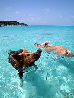
Pig Beach
Uninhabited island in Exuma, the Bahamas
Distance: Approx. 6905 meters
Latitude and longitude: 24.18361111,-76.45638889
Pig Beach located on Big Major Cay (also known as Major Cay) is a beach on an uninhabited island (or cay) located in Exuma, the Bahamas. The island takes its unofficial name from the fact that it is populated by a colony of feral pigs which live on the island. It has become a tourist attraction in modern times.
Black Point Airport
Airport in Bahamas
Distance: Approx. 5314 meters
Latitude and longitude: 24.08927778,-76.39791667
Black Point Airport (ICAO: MYEB) is a public use airport located near Black Point, the Bahamas.
Leaf Cay Airport
Airport in Bahamas
Distance: Approx. 6116 meters
Latitude and longitude: 24.14941667,-76.47291667
Leaf Cay Airport (ICAO: MYXD) is a private use airport located near Leaf Cay, the Bahamas.
Staniel Cay
Island in the Bahamas
Distance: Approx. 4670 meters
Latitude and longitude: 24.16944444,-76.44027778
Staniel Cay is an island located in The Exuma Cays, a district of The Bahamas. Staniel Cay is located roughly 120 km (75 mi) south of Nassau and 400 km (250 mi) southeast of Florida. The island has a population of less than 118 full-time residents and has an area of less than 5 km2 (2 sq mi).
Weather in this IP's area
broken clouds
24 Celsius
25 Celsius
24 Celsius
24 Celsius
1018 hPa
88 %
1018 hPa
1018 hPa
10000 meters
6.03 m/s
8.05 m/s
190 degree
54 %