Country:
 USA
USARegion:
City:
Latitude and Longitude:
Time Zone:
Postal Code:
IP information under different IP Channel
ip-api
Country
Region
City
ASN
Time Zone
ISP
Blacklist
Proxy
Latitude
Longitude
Postal
Route
IPinfo
Country
Region
City
ASN
Time Zone
ISP
Blacklist
Proxy
Latitude
Longitude
Postal
Route
MaxMind
Country
Region
City
ASN
Time Zone
ISP
Blacklist
Proxy
Latitude
Longitude
Postal
Route
Luminati
Country
USRegion
vt
City
bondville
ASN
Time Zone
America/New_York
ISP
TVC-AS1
Latitude
Longitude
Postal
db-ip
Country
Region
City
ASN
Time Zone
ISP
Blacklist
Proxy
Latitude
Longitude
Postal
Route
ipdata
Country
Region
City
ASN
Time Zone
ISP
Blacklist
Proxy
Latitude
Longitude
Postal
Route
Popular places and events near this IP address
Winhall, Vermont
Town in Vermont, United States
Distance: Approx. 635 meters
Latitude and longitude: 43.15611111,-72.91333333
Winhall is a town in Bennington County, Vermont, United States. The population was 1,182 at the 2020 census. In the southeastern corner of the town is the unincorporated village of Bondville.
Windham–Bennington–Windsor-1 Vermont Representative District, 2002–2012
Distance: Approx. 7834 meters
Latitude and longitude: 43.1,-72.86666667
The Windham–Bennington–Windsor-1 Representative District is a one-member state Representative district in the U.S. state of Vermont. It is one of the 108 one- or two-member districts into which the state was divided by the redistricting and reapportionment plan developed by the Vermont General Assembly following the 2000 U.S. Census. The plan applies to legislatures elected in 2002, 2004, 2006, 2008, and 2010.
South Londonderry, Vermont
Census-designated place in Vermont, United States
Distance: Approx. 8656 meters
Latitude and longitude: 43.19277778,-72.815
South Londonderry is an unincorporated village and census-designated place (CDP) in the town of Londonderry, Windham County, Vermont, United States. As of the 2020 census, it had a population of 147. The center of the village comprises the South Londonderry Village Historic District.

Stratton Mountain (Vermont)
Mountain in United States of America
Distance: Approx. 8479 meters
Latitude and longitude: 43.08616667,-72.92516667
Stratton Mountain is a mountain located in Windham County, Vermont, in the Green Mountain National Forest. The mountain is the highest point of Windham County, and of the southern Green Mountains generally. A fire tower located on the summit is generally open for climbing by the public.
Bromley Brook School
All girls single-sex school in Manchester Center, Vermont, USA
Distance: Approx. 8280 meters
Latitude and longitude: 43.180951,-73.011349
Bromley Brook School was a therapeutic boarding school in Manchester Center, Vermont, for teenage girls who were not functioning at traditional schools. The school was owned and operated by the Aspen Education Group. Bromley Brook was mentioned in The New York Times.
Stratton Mountain, Vermont
Census-designated place in Vermont, United States
Distance: Approx. 5262 meters
Latitude and longitude: 43.11472222,-72.90694444
Stratton Mountain is a resort community and census-designated place (CDP) in Bennington and Windham counties, Vermont, United States. Sitting at the northern foot of Stratton Mountain and its ski resort, it was first listed as a CDP prior to the 2020 census. The southern half of the community, including the base of the ski area, is in the town of Stratton in Windham County, while the northern half, including the Stratton Golf Course, is in the town of Winhall in Bennington County.
Stratton Mountain School
School in Stratton, Vermont, United States
Distance: Approx. 6612 meters
Latitude and longitude: 43.10527778,-72.88777778
The Stratton Mountain School is a college preparatory high school located at Stratton Mountain in Stratton, Vermont. The school was founded in 1972 by Warren Hellman and Donald Tarinelli. The current headmaster is Carson Thurber.
Stratton Mountain Resort
Ski area in Vermont, United States
Distance: Approx. 5326 meters
Latitude and longitude: 43.11416667,-72.90666667
Stratton Mountain Resort is a ski area in the northeastern United States, located on Stratton Mountain in Stratton, Vermont, east of Manchester.

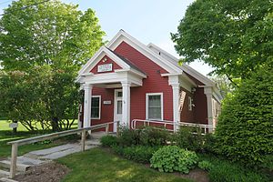
Londonderry Town House
United States historic place
Distance: Approx. 8744 meters
Latitude and longitude: 43.19472222,-72.815
The Londonderry Town House, or the Londonderry Town Hall is the town hall of Londonderry, Vermont. It is located on Middletown Road in the village of South Londonderry. Built in 1860, its architecture encapsulates the changing functions of this type of public venue through more than 100 years of history.
South Londonderry Village Historic District
Historic district in Vermont, United States
Distance: Approx. 8704 meters
Latitude and longitude: 43.18833333,-72.81194444
The South Londonderry Village Historic District encompasses a significant portion of the historic developed area of the village of South Londonderry, Vermont. The village has a well-preserved mid-19th century core, with most of its major development history taking place between about 1806 and 1860. The district was listed on the National Register of Historic Places in 1986.

Johnny Seesaw's
United States historic place
Distance: Approx. 6115 meters
Latitude and longitude: 43.21583333,-72.92638889
Johnny Seesaw's is a historic country lodge on Vermont Route 11, near the Bromley Mountain Ski Area in Peru, Vermont. Established in 1924, the lodge was an influential component of the early success of downhill skiing in southwestern Vermont, and is the place where events leading to the founding of both the National Ski Patrol and the United States Army's 10th Mountain Division took place. It was listed on the National Register of Historic Places in 2008, and was delisted in 2023.

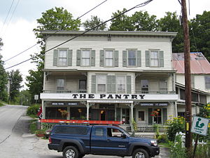
Bondville, Vermont
Village in Vermont, United States
Distance: Approx. 3572 meters
Latitude and longitude: 43.14472222,-72.87555556
Bondville is an unincorporated village in the town of Winhall, Bennington County, Vermont, United States. The community is located along Vermont Route 30, 10 miles (16 km) east of the village of Manchester. Bondville has a post office with ZIP code 05340, which opened on May 23, 1850.
Weather in this IP's area
broken clouds
9 Celsius
9 Celsius
8 Celsius
10 Celsius
1011 hPa
92 %
1011 hPa
953 hPa
10000 meters
0.45 m/s
2.24 m/s
274 degree
65 %
06:24:12
19:14:29