Country:
Region:
City:
Latitude and Longitude:
Time Zone:
Postal Code:
IP information under different IP Channel
ip-api
Country
Region
City
ASN
Time Zone
ISP
Blacklist
Proxy
Latitude
Longitude
Postal
Route
Luminati
Country
Region
mi
City
kalamazoo
ASN
Time Zone
America/Detroit
ISP
CTSTELECOM
Latitude
Longitude
Postal
IPinfo
Country
Region
City
ASN
Time Zone
ISP
Blacklist
Proxy
Latitude
Longitude
Postal
Route
db-ip
Country
Region
City
ASN
Time Zone
ISP
Blacklist
Proxy
Latitude
Longitude
Postal
Route
ipdata
Country
Region
City
ASN
Time Zone
ISP
Blacklist
Proxy
Latitude
Longitude
Postal
Route
Popular places and events near this IP address

Westwood, Michigan
Census-designated place & unincorporated community in Michigan, United States
Distance: Approx. 1312 meters
Latitude and longitude: 42.30277778,-85.63361111
Westwood is an unincorporated community in Kalamazoo Charter Township, Kalamazoo County in the U.S. state of Michigan. It is a census-designated place (CDP) for statistical purposes and does not have any legal status as an incorporated municipality. The population was 8,653 at the 2010 census, down from 9,122 at the 2000 census.
Western Michigan University
Public university in Kalamazoo, Michigan, U.S.
Distance: Approx. 1870 meters
Latitude and longitude: 42.28333333,-85.61388889
Western Michigan University (Western Michigan, Western or WMU) is a public research university in Kalamazoo, Michigan, United States. It was initially established as Western State Normal School in 1903 by Governor Aaron T. Bliss for the training of teachers. It was renamed Western Michigan University in 1957.

Lawson Arena
Distance: Approx. 2150 meters
Latitude and longitude: 42.275937,-85.617765
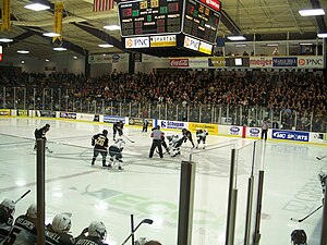
Harry W. Lawson Ice Arena and Gabel Natatorium is a 3,667-seat multi-purpose arena, and adjacent natatorium in Kalamazoo, Michigan, located on the far Southwest corner of Western Michigan University's main campus. The arena is a single-level, horseshoe-style arena with a concourse at the top. It is home to the Western Michigan Broncos men's ice hockey team, the WMU men's ice hockey club team, and the WMU synchronized skating club team.
University Arena (Western Michigan University)
Distance: Approx. 2277 meters
Latitude and longitude: 42.283372,-85.60845
University Arena is a multi-purpose arena on the campus of Western Michigan University in Kalamazoo, Michigan, United States. Located in Read Fieldhouse, the arena opened in 1957 and is home to multiple Western Michigan Broncos athletic teams, including men's and women's basketball, women's gymnastics, women's indoor track and field, and women's volleyball. The facility seats 5,421 people.
Miller Auditorium
Theater in Kalamazoo, Michigan
Distance: Approx. 2001 meters
Latitude and longitude: 42.279422,-85.615519
James W. Miller Auditorium is a performance venue at Western Michigan University in Kalamazoo, Michigan, United States. It opened on January 12, 1968, with a ceremony that included WMU's third president, James W. Miller, for whom the auditorium was later renamed. With a seating capacity of 3,497, Miller Auditorium is the fifth-largest auditorium in Michigan, after the Fox Theatre, Masonic Temple, Hill Auditorium and MSU Concert Auditorium.
Maple Hill Pavilion
Shopping mall in Michigan, United States
Distance: Approx. 1667 meters
Latitude and longitude: 42.298,-85.652
Maple Hill Pavilion (formerly Maple Hill Mall) is a strip mall serving the city of Kalamazoo, Michigan, United States. Maple Hill Mall became a "dead mall" after several years of decline and the loss of several major tenants. The center has since been redeveloped as a strip mall called Maple Hill Pavilion, which features DSW Shoe Warehouse, Hobby Lobby, Marshalls, PetSmart, Pier One Imports, Office Max, Rooms Today and Target as its anchor stores.
WIDR
Radio station in Kalamazoo, Michigan
Distance: Approx. 1655 meters
Latitude and longitude: 42.282,-85.6181
WIDR (89.1 FM) is a freeform FM radio station that broadcasts from Western Michigan University in Kalamazoo, Michigan. WIDR, a student-run radio station licensed to Western Michigan University, broadcasts with 100 watts of power. The station is entirely student-run, employing six to eight part-time staff members.

John E. Fetzer Center
Conference center
Distance: Approx. 1492 meters
Latitude and longitude: 42.285,-85.6179
The John E. Fetzer Center is a conference center and special events facility at Western Michigan University in Kalamazoo, Michigan, USA. It was opened in 1983 and named for the radio pioneer and Detroit Tigers owner John Fetzer. The facility’s lounge and exhibition area features a display of Fetzer’s life and accomplishments. The Fetzer Center is a multi usage full service center with on-site catering and videoconferencing capabilities.

Richmond Center for Visual Arts
Visual arts center at Western Michigan University
Distance: Approx. 1898 meters
Latitude and longitude: 42.279935,-85.61657
James and Lois Richmond Center for Visual Arts is a visual arts center at Western Michigan University in Kalamazoo, Michigan, United States. It was opened on March 9, 2007 and was dedicated on Thursday, April 12, 2007. Along with Kohrman Hall, the Richmond Center for Visual Arts houses the Frostic School of Art.

The Oaklands
United States historic place
Distance: Approx. 2043 meters
Latitude and longitude: 42.28361111,-85.61138889
The Oaklands is a bed and breakfast owned by Western Michigan University, located at 1815 West Michigan Avenue in Kalamazoo, Michigan. It was listed on the National Register of Historic Places in 1983.

Henderson Park-West Main Hill Historic District
United States historic place
Distance: Approx. 2328 meters
Latitude and longitude: 42.29138889,-85.60583333
The Henderson Park-West Main Hill Historic District is a primarily residential historic district roughly bounded by West Main, Thompson, Academy, Monroe, West Lovell and Valley Streets and Prairie Avenue in Kalamazoo, Michigan. The district was listed on the National Register of Historic Places in 1995.

Drake Farmstead
United States historic place
Distance: Approx. 1925 meters
Latitude and longitude: 42.30083333,-85.65333333
The Benjamin and Maria (Ogden) Drake Farm, also known as the Drake Farmstead, is a farmstead located at 927 North Drake Road in Kalamazoo, Michigan. It was listed on the National Register of Historic Places in 2012, and as of 2021 is open to the public as the Drake Farmstead Park.
Weather in this IP's area
overcast clouds
11 Celsius
10 Celsius
10 Celsius
12 Celsius
1024 hPa
62 %
1024 hPa
991 hPa
10000 meters
6.28 m/s
12.07 m/s
128 degree
100 %
07:18:47
17:33:21