Country:
 USA
USARegion:
City:
Latitude and Longitude:
Time Zone:
Postal Code:
IP information under different IP Channel
ip-api
Country
Region
City
ASN
Time Zone
ISP
Blacklist
Proxy
Latitude
Longitude
Postal
Route
IPinfo
Country
Region
City
ASN
Time Zone
ISP
Blacklist
Proxy
Latitude
Longitude
Postal
Route
MaxMind
Country
Region
City
ASN
Time Zone
ISP
Blacklist
Proxy
Latitude
Longitude
Postal
Route
Luminati
Country
USASN
Time Zone
America/Chicago
ISP
MARK-TWAIN
Latitude
Longitude
Postal
db-ip
Country
Region
City
ASN
Time Zone
ISP
Blacklist
Proxy
Latitude
Longitude
Postal
Route
ipdata
Country
Region
City
ASN
Time Zone
ISP
Blacklist
Proxy
Latitude
Longitude
Postal
Route
Popular places and events near this IP address

Brashear, Missouri
Town in Missouri, United States
Distance: Approx. 6419 meters
Latitude and longitude: 40.14833333,-92.3775
Brashear is a city in Salt River Township, Adair County, Missouri, United States. The population was 273 at the 2010 census.
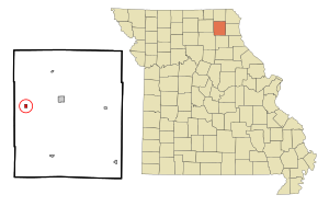
Hurdland, Missouri
City in Missouri, United States
Distance: Approx. 318 meters
Latitude and longitude: 40.14944444,-92.3025
Hurdland is a city in Knox County, Missouri, United States. As of the 2020 census, its population was 155.
Paultown, Missouri
Unincorporated community in the American state of Missouri
Distance: Approx. 5573 meters
Latitude and longitude: 40.16055556,-92.365
Paultown (also known as Paulville) is an unincorporated community in eastern Adair County, in the U.S. state of Missouri. The community was approximately one mile northeast of Brashear and the Paultown Cemetery is about one-half mile to the east above Big Deer Branch.
Democrat Creek
Stream in Missouri, U.S.
Distance: Approx. 9835 meters
Latitude and longitude: 40.1439275,-92.1865714
Democrat Creek is a stream in Knox County in the U.S. state of Missouri. It is a tributary to Rock Creek. The confluence is approximately one mile south-southeast of Edina.
Kenwood, Missouri
Unincorporated community in Missouri, United States
Distance: Approx. 5601 meters
Latitude and longitude: 40.195593,-92.287131
Kenwood is an unincorporated community in Knox County, in the U.S. state of Missouri.
Lyon Township, Knox County, Missouri
Township in the American state of Missouri
Distance: Approx. 4568 meters
Latitude and longitude: 40.1731,-92.2611
Lyon Township is an inactive township in Knox County, in the U.S. state of Missouri. Lyon Township was established in 1860, taking its name from Hezekiah Lyon, a local judge. As of 2020, it had a population of 464.
Shelton Township, Knox County, Missouri
Township in Knox County, Missouri, U.S.
Distance: Approx. 8255 meters
Latitude and longitude: 40.0794,-92.2611
Shelton Township is an inactive township in Knox County, in the U.S. state of Missouri. Shelton Township was established in 1845, taking its name from Medley Shelton, a pioneer judge.
Weather in this IP's area
clear sky
7 Celsius
6 Celsius
7 Celsius
7 Celsius
1023 hPa
57 %
1023 hPa
991 hPa
10000 meters
1.43 m/s
1.45 m/s
96 degree
06:44:06
19:29:40