63.93.193.196 - IP Lookup: Free IP Address Lookup, Postal Code Lookup, IP Location Lookup, IP ASN, Public IP
Country:
 USA
USARegion:
City:
Location:
Time Zone:
Postal Code:
ISP:
ASN:
language:
User-Agent:
Proxy IP:
Blacklist:
IP information under different IP Channel
ip-api
Country
Region
City
ASN
Time Zone
ISP
Blacklist
Proxy
Latitude
Longitude
Postal
Route
db-ip
Country
Region
City
ASN
Time Zone
ISP
Blacklist
Proxy
Latitude
Longitude
Postal
Route
IPinfo
Country
Region
City
ASN
Time Zone
ISP
Blacklist
Proxy
Latitude
Longitude
Postal
Route
IP2Location
63.93.193.196Country
usRegion
new jersey
City
plainsboro
Time Zone
America/New_York
ISP
Language
User-Agent
Latitude
Longitude
Postal
ipdata
Country
Region
City
ASN
Time Zone
ISP
Blacklist
Proxy
Latitude
Longitude
Postal
Route
Popular places and events near this IP address

Princeton Plasma Physics Laboratory
National laboratory for plasma physics and nuclear fusion science at Princeton, New Jersey
Distance: Approx. 2499 meters
Latitude and longitude: 40.348825,-74.602183
Princeton Plasma Physics Laboratory (PPPL) is a United States Department of Energy national laboratory for plasma physics and nuclear fusion science. Its primary mission is research into and development of fusion as an energy source. It is known for the development of the stellarator and tokamak designs, along with numerous fundamental advances in plasma physics and the exploration of many other plasma confinement concepts.

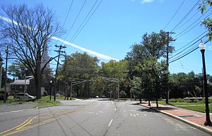
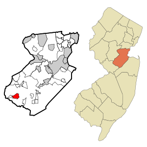
Plainsboro Township, New Jersey
Township in Middlesex County, New Jersey, US
Distance: Approx. 459 meters
Latitude and longitude: 40.338255,-74.581898
Plainsboro Township is a township situated in southern Middlesex County, in the U.S. state of New Jersey. Centrally located in the Raritan Valley region, the township is an outer-ring suburb of New York City in the New York metropolitan area, even though it is slightly geographically closer to Center City, Philadelphia than to Midtown Manhattan. As of the 2020 United States census, the township's population was 24,084, its highest decennial count ever and an increase of 1,085 (+4.7%) from the 22,999 recorded at the 2010 census, which in turn reflected an increase of 2,784 (+13.8%) from the 20,215 counted in the 2000 census.
Plainsboro Center, New Jersey
Populated place in Middlesex County, New Jersey, US
Distance: Approx. 937 meters
Latitude and longitude: 40.332213,-74.589986
Plainsboro Center is an unincorporated community and census-designated place (CDP) in Plainsboro Township, Middlesex County, New Jersey, United States. As of the 2020 census, the CDP's population was 2,760, its highest decennial count ever and an increase of 48 (+1.8%) from the 2,712 recorded at the 2010 census.
Princeton Meadows, New Jersey
Populated place in Middlesex County, New Jersey, US
Distance: Approx. 1128 meters
Latitude and longitude: 40.333922,-74.566133
Princeton Meadows is an unincorporated community and census-designated place (CDP) in Plainsboro Township, Middlesex County, New Jersey, United States. As of the 2020 census, the population was 14,776.

Grovers Mill, New Jersey
Populated place in Mercer County, New Jersey, US
Distance: Approx. 3238 meters
Latitude and longitude: 40.31666667,-74.60944444
Grovers Mill is an unincorporated community located within West Windsor in Mercer County, in the U.S. state of New Jersey. It is centered around the intersection of Clarksville Road and Cranbury Road, adjacent to the community's mill-pond. It is 4 miles (6 km) southeast of Princeton, 6 miles (10 km) northwest of Hightstown, and 12 miles (19 km) northeast of Trenton, the state capital.

West Windsor-Plainsboro High School North
High school in Middlesex County, New Jersey, US
Distance: Approx. 2247 meters
Latitude and longitude: 40.3225,-74.6006
West Windsor-Plainsboro High School North, also known as WW-P North or North, is a four-year public comprehensive high school located in Plainsboro Township in Middlesex County, in the U.S. state of New Jersey. The school serves students in ninth through twelfth grades. The school joins West Windsor-Plainsboro High School South as the two secondary schools of the West Windsor-Plainsboro Regional School District, a school district serving students from West Windsor (in Mercer County) and Plainsboro Township (in Middlesex County).
Shallow Brook
River in the United States
Distance: Approx. 1439 meters
Latitude and longitude: 40.34722222,-74.58305556
Shallow Brook is a tributary of Devils Brook in central New Jersey in the United States. Shallow Brook flows generally parallel to the Devils Brook, draining a similar area in Middlesex and Mercer counties.
Cedar Brook
River in the United States
Distance: Approx. 2353 meters
Latitude and longitude: 40.32111111,-74.55805556
Cedar Brook is a tributary of Cranbury Brook in Cranbury, New Jersey, United States.

Cranbury Brook
River in the United States
Distance: Approx. 3095 meters
Latitude and longitude: 40.32388889,-74.61305556
Cranbury Brook, also known as Cranberry Brook, is a tributary of the Millstone River in Middlesex and Monmouth Counties, New Jersey in the United States.
Rowland Park (New Jersey)
Distance: Approx. 3196 meters
Latitude and longitude: 40.34721,-74.54556
Rowland Park is a park and sports complex featuring soccer, baseball, and softball facilities. It is located in South Brunswick, New Jersey with a Cranbury, NJ address and is the home of the New Jersey Blaze of the Women's Premier Soccer League (WPSL).

Schalks, New Jersey
Populated place in Middlesex County, New Jersey, US
Distance: Approx. 1381 meters
Latitude and longitude: 40.3425,-74.59194444
Schalks or Schalks Station is an unincorporated community located within Plainsboro Township in Middlesex County, in the U.S. state of New Jersey. Located along Schalks Crossing Road (County Route 683) at its junction with the Northeast Corridor railroad tracks, the area contains single-family homes, forested areas, a former research nuclear reactor built by Industrial Reactor Laboratories, and the rear yards to offices within the Princeton Forrestal Center.

John Van Buren Wicoff House
United States historic place
Distance: Approx. 505 meters
Latitude and longitude: 40.33305556,-74.585
The John Van Buren Wicoff House is a historic building located at 641 Plainsboro Road in the township of Plainsboro in Middlesex County, New Jersey. It was added to the National Register of Historic Places on September 12, 1979, for its significance in politics/government from 1907 to 1947. It is currently a historic house museum, known as the Historic Wicoff House Museum.
Weather in this IP's area
overcast clouds
2 Celsius
2 Celsius
2 Celsius
3 Celsius
1011 hPa
94 %
1011 hPa
1007 hPa
70 meters
0.45 m/s
2.24 m/s
244 degree
100 %