63.250.108.195 - IP Lookup: Free IP Address Lookup, Postal Code Lookup, IP Location Lookup, IP ASN, Public IP
Country:
Region:
City:
Location:
Time Zone:
Postal Code:
ISP:
ASN:
language:
User-Agent:
Proxy IP:
Blacklist:
IP information under different IP Channel
ip-api
Country
Region
City
ASN
Time Zone
ISP
Blacklist
Proxy
Latitude
Longitude
Postal
Route
db-ip
Country
Region
City
ASN
Time Zone
ISP
Blacklist
Proxy
Latitude
Longitude
Postal
Route
IPinfo
Country
Region
City
ASN
Time Zone
ISP
Blacklist
Proxy
Latitude
Longitude
Postal
Route
IP2Location
63.250.108.195Country
Region
ontario
City
etobicoke
Time Zone
America/Toronto
ISP
Language
User-Agent
Latitude
Longitude
Postal
ipdata
Country
Region
City
ASN
Time Zone
ISP
Blacklist
Proxy
Latitude
Longitude
Postal
Route
Popular places and events near this IP address

Richview Collegiate Institute
High school in Richview, Etobicoke, Ontario, Canada
Distance: Approx. 526 meters
Latitude and longitude: 43.67871944,-79.53996389
Richview Collegiate Institute (Richview CI, RCI or Richview) is a secondary school in Etobicoke, in the west end of Toronto, Ontario. It is in the Etobicoke Board of Education which in turn became the part of the Toronto District School Board in 1998. The motto is Monumentum Aere Perennius ("A monument more lasting than bronze").
Richview, Toronto
Neighbourhood in Toronto, Ontario, Canada
Distance: Approx. 555 meters
Latitude and longitude: 43.67722222,-79.55083333
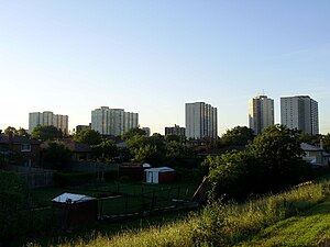
Richview, formally known as Willowridge-Martingrove-Richview, is a neighbourhood in the city of Toronto, Ontario, Canada. It is bounded on the west by Highway 401 and on the north by the highway and by Dixon Road, Royal York Road on the east, and Eglinton Avenue West along the south. Richview was originally established as a postal village within the then-agricultural Etobicoke Township.
Martingrove Collegiate Institute
High school in Toronto, Canada
Distance: Approx. 1449 meters
Latitude and longitude: 43.673406,-79.56081
Martingrove Collegiate Institute is a semestered public secondary school in the Etobicoke district of Toronto, Ontario, Canada. It opened in 1966 and is currently overseen by the Toronto District School Board.

Kingsview Village
Neighbourhood in Toronto, Ontario, Canada
Distance: Approx. 1841 meters
Latitude and longitude: 43.69444444,-79.55861111
Kingsview Village is a neighbourhood in the city of Toronto, Ontario, Canada. It is located in the north end of the former suburb of Etobicoke, and is bounded on the north by Highway 401, on the east by the Humber River and St. Phillips Road, on the south by Dixon Road.
Scarlett Heights Entrepreneurial Academy
Public high school in Toronto, Ontario, Canada
Distance: Approx. 1527 meters
Latitude and longitude: 43.68953,-79.531381
Scarlett Heights Entrepreneurial Academy, formerly known as Scarlett Heights Collegiate Institute is a Toronto District School Board facility that was originally operated as a secondary school, opened in 1963, and whose curriculum was broadened through a Student Leadership Development Program. This program extends the base curriculum. Although the TDSB closed the school in June 2018 due to low enrolment, the school facility was used to temporarily accommodate students from York Memorial Collegiate Institute.

Princess Gardens
Neighbourhood in Toronto, Ontario, Canada
Distance: Approx. 1223 meters
Latitude and longitude: 43.67027778,-79.54111111
Princess Gardens is a neighbourhood in Toronto, Ontario, Canada. It is located in the western area of Toronto that was formerly the City of Etobicoke. Its boundaries are Eglinton Avenue to the north, Martin Grove to the west, Islington to the east, and Rathburn Road to the south.
St. George's Golf and Country Club
Distance: Approx. 1357 meters
Latitude and longitude: 43.675,-79.531
St. George's Golf and Country Club (originally The Royal York Golf Club) is a golf course and country club located in Etobicoke, Toronto, Ontario, Canada in the west end neighbourhood of Islington.
Kipling Collegiate Institute
Public high school in Toronto, Ontario, Canada
Distance: Approx. 1409 meters
Latitude and longitude: 43.6853,-79.5622
Kipling Collegiate Institute (Kipling CI, KCI, or Kipling) is a public high school in Toronto, Ontario, Canada. It is located in the former suburb of Etobicoke under the management of the Toronto District School Board, operating since 1960.
Central Etobicoke High School
Public high school in Toronto, Ontario, Canada
Distance: Approx. 781 meters
Latitude and longitude: 43.67888889,-79.55527778
Central Etobicoke High School (or Central Etobicoke, CEHS, formerly Westway High School) is a secondary school in Toronto, Ontario, Canada. It is located at 10 Denfield Street, bordered by Widdicombe Hill Blvd to the South and Clement Rd to the North, in the Richview neighbourhood of the former suburb of Etobicoke. It is operated by the Toronto District School Board since being transferred from the Etobicoke Board of Education in 1997.
1980 Peter Jackson Classic
Distance: Approx. 1357 meters
Latitude and longitude: 43.675,-79.531
The 1980 Peter Jackson Classic was contested from August 7–10 at St. George's Golf and Country Club. It was the 8th edition of the Peter Jackson Classic, and the second edition as a major championship on the LPGA Tour.
1982 Peter Jackson Classic
Distance: Approx. 1357 meters
Latitude and longitude: 43.675,-79.531
The 1982 Peter Jackson Classic was contested from July 1–4 at St. George's Golf and Country Club. It was the 10th edition of the Peter Jackson Classic, and the fourth edition as a major championship on the LPGA Tour.
1984 du Maurier Classic
Distance: Approx. 1357 meters
Latitude and longitude: 43.675,-79.531
The 1984 du Maurier Classic was contested from July 26–29 at St. George's Golf and Country Club. It was the 12th edition of the du Maurier Classic, and the sixth edition as a major championship on the LPGA Tour.
Weather in this IP's area
few clouds
-10 Celsius
-17 Celsius
-12 Celsius
-9 Celsius
1036 hPa
62 %
1036 hPa
1017 hPa
10000 meters
4.12 m/s
10 degree
20 %


