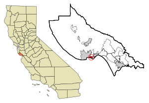
63.249.80.71 - IP Lookup: Free IP Address Lookup, Postal Code Lookup, IP Location Lookup, IP ASN, Public IP
Country:
Region:
City:
Location:
Time Zone:
Postal Code:
IP information under different IP Channel
ip-api
Country
Region
City
ASN
Time Zone
ISP
Blacklist
Proxy
Latitude
Longitude
Postal
Route
Luminati
Country
Region
ca
City
santacruz
ASN
Time Zone
America/Los_Angeles
ISP
CZIO-ASN
Latitude
Longitude
Postal
IPinfo
Country
Region
City
ASN
Time Zone
ISP
Blacklist
Proxy
Latitude
Longitude
Postal
Route
IP2Location
63.249.80.71Country
Region
california
City
santa cruz
Time Zone
America/Los_Angeles
ISP
Language
User-Agent
Latitude
Longitude
Postal
db-ip
Country
Region
City
ASN
Time Zone
ISP
Blacklist
Proxy
Latitude
Longitude
Postal
Route
ipdata
Country
Region
City
ASN
Time Zone
ISP
Blacklist
Proxy
Latitude
Longitude
Postal
Route
Popular places and events near this IP address

Live Oak, Santa Cruz County, California
Census-designated place in California, United States
Distance: Approx. 1732 meters
Latitude and longitude: 36.98611111,-121.98055556
Live Oak is a census-designated place (CDP) in Santa Cruz County, California between the cities of Santa Cruz and Capitola and north of the former Union Pacific railroad. Live Oak sits at an elevation of 102 feet (31 m). The population was 17,038 at the 2020 census.

Opal Cliffs, California
Unincorporated community in California, United States
Distance: Approx. 1812 meters
Latitude and longitude: 36.96138889,-121.97083333
Opal Cliffs is an unincorporated community in Santa Cruz County, California, United States. The population was 6,458 at the 2000 census. For statistical purposes, the United States Census Bureau defined Opal Cliffs as a census-designated place (CDP).

Twin Lakes, California
Census-designated place in California, United States
Distance: Approx. 1078 meters
Latitude and longitude: 36.96333333,-121.99361111
Twin Lakes is a census-designated place (CDP) in Santa Cruz County, California, United States. The population is at an estimated 5,378 as of 2016 which is up by 461 in 2010.
KSCO
Talk radio station in Santa Cruz, California
Distance: Approx. 1181 meters
Latitude and longitude: 36.96152778,-121.98202778
KSCO (1080 AM) is a commercial radio station broadcasting a talk radio format. The station is owned by Zwerling Broadcasting System, Ltd and is licensed to Santa Cruz, California. The radio studios and offices are on Portola Drive in Santa Cruz.

Santa Cruz Breakwater Light
Lighthouse in California, United States
Distance: Approx. 1810 meters
Latitude and longitude: 36.96069444,-122.00222222
Santa Cruz Breakwater Lighthouse, is a lighthouse in California, United States, in the Santa Cruz Small Craft Harbor in Santa Cruz, California. The lighthouse is known as Walton Lighthouse because Charles Walton, a local businessman, contributed a significant part of the construction cost in memory of his late brother Derek Walton, who was a merchant seaman. The Walton lighthouse was built in 2001 with donations including $60,000 from Charles Walton.
Harbor High School (California)
School in Santa Cruz, California, United States of America
Distance: Approx. 1784 meters
Latitude and longitude: 36.9863,-121.9943
Harbor High School is a high school located in Santa Cruz, California, with roughly 950 members of its student body. The mascot, Petey the Pirate, sports the school colors of green and gold.
Capitola Mall
Shopping mall in Capitola, California
Distance: Approx. 1817 meters
Latitude and longitude: 36.97594,-121.96728
Capitola Mall is a shopping mall located in Capitola, California. It was managed and owned by Macerich before being sold to Merlone Geier Partners in April 2016. The mall sits on the northern edge of the Monterey Bay in Santa Cruz County.
UEI College
American for-profit technical career college
Distance: Approx. 1884 meters
Latitude and longitude: 36.988279,-121.985295
UEI College is a private for-profit career college with locations in the U.S. states of California, Washington, Arizona, and Georgia. It specializes in short-term technical and vocational education to prepare students for entry-level positions in industries such as healthcare, business, and skilled trades. UEI College is owned by International Education Corporation.

Five Branches University
Private university in California, United States
Distance: Approx. 1272 meters
Latitude and longitude: 36.9643,-121.9981
The Five Branches University is a private university in California. It has two campuses, one in Santa Cruz and one in San Jose.

Twin Lakes State Beach
State beach in Santa Cruz County, California, United States
Distance: Approx. 1531 meters
Latitude and longitude: 36.96222222,-121.99972222
Twin Lakes State Beach is a beach located on Monterey Bay directly south of the Santa Cruz Yacht Harbor Santa Cruz, in coastal Santa Cruz County, northern California. This mile-long shoreline is a popular place for swimming and picnicking, along with birdwatching in the adjacent Schwan's Lake. It has a small craft harbor parallel to East Cliff and Portola Drives.

Santa Cruz harbor
Harbor and marina in Santa Cruz, California
Distance: Approx. 1519 meters
Latitude and longitude: 36.9657838,-122.0024618
The Santa Cruz Small Craft Harbor (also "Santa Cruz Harbor", but see below) is situated in Santa Cruz, California, on the site of the former Woods Lagoon. Built in 1962–1963, its public use specializes in boating and extracurricular marine activities for the local community and visitors. The harbor straddles the city limits which runs down the center of Arana Gulch; the west side of the harbor is in Santa Cruz's Seabright neighborhood while the east is in unincorporated Santa Cruz County.

Santa Cruz Yacht Club
Californian yacht club
Distance: Approx. 1577 meters
Latitude and longitude: 36.96608333,-122.00333333
The Santa Cruz Yacht Club (SCYC) is a yacht club founded in 1928 and is the oldest, and currently the only, yacht club in Santa Cruz, California.
Weather in this IP's area
clear sky
7 Celsius
5 Celsius
5 Celsius
8 Celsius
1021 hPa
57 %
1021 hPa
1003 hPa
10000 meters
1.79 m/s
2.24 m/s
9 degree