Country:
Region:
City:
Latitude and Longitude:
Time Zone:
Postal Code:
IP information under different IP Channel
ip-api
Country
Region
City
ASN
Time Zone
ISP
Blacklist
Proxy
Latitude
Longitude
Postal
Route
Luminati
Country
ASN
Time Zone
America/Chicago
ISP
USC-UNIVERSITY-HOSPITAL
Latitude
Longitude
Postal
IPinfo
Country
Region
City
ASN
Time Zone
ISP
Blacklist
Proxy
Latitude
Longitude
Postal
Route
db-ip
Country
Region
City
ASN
Time Zone
ISP
Blacklist
Proxy
Latitude
Longitude
Postal
Route
ipdata
Country
Region
City
ASN
Time Zone
ISP
Blacklist
Proxy
Latitude
Longitude
Postal
Route
Popular places and events near this IP address
Browning, Wisconsin
Town in Wisconsin, United States
Distance: Approx. 8996 meters
Latitude and longitude: 45.16638889,-90.2325
Browning is a town in Taylor County, Wisconsin, United States. The population was 850 at the 2000 census. The unincorporated community of Gad is located in the town.

Little Black, Wisconsin
Town in Wisconsin, United States
Distance: Approx. 3707 meters
Latitude and longitude: 45.10611111,-90.32972222
Little Black is a town (six-mile square municipality) located in Taylor County, Wisconsin. The village of Stetsonville lies partly in the town, and the hamlet of Little Black. As of the 2000 census, the town had a total population of 1,148.

Stetsonville, Wisconsin
Village in Wisconsin, United States
Distance: Approx. 7225 meters
Latitude and longitude: 45.07638889,-90.31388889
Stetsonville is a village in Taylor County, Wisconsin, United States. The population was 541 at the 2010 census.

Medford (town), Wisconsin
Town in Wisconsin, United States
Distance: Approx. 3188 meters
Latitude and longitude: 45.15611111,-90.37222222
Medford is a town (seven by six mile rural municipality) in Taylor County, Wisconsin, United States. The population was 2,216 at the 2000 census. The City of Medford lies mostly within the town boundaries.

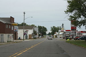
Medford, Wisconsin
City in Wisconsin, United States
Distance: Approx. 411 meters
Latitude and longitude: 45.13805556,-90.34527778
Medford is a city and county seat of Taylor County, in north-central Wisconsin, United States. The population was 4,349 at the 2020 census. The city is located mostly within the boundaries of the Town of Medford.
Aspirus Medford Hospital
Hospital in Wisconsin, United States
Distance: Approx. 1249 meters
Latitude and longitude: 45.13587,-90.35553
Aspirus Medford Hospital, formerly Memorial Health Center, is a Critical Access Hospital with a Level IV Trauma Center and a birthing center located in Medford, Wisconsin. The facility is owned by Wisconsin-based non-profit Aspirus Health. It also has a satellite campus of the Aspirus Heart & Vascular Institute.

Medford Area Senior High School
Public secondary school in Medford, WI
Distance: Approx. 1985 meters
Latitude and longitude: 45.14169444,-90.365
Medford Area Senior High School (known as MASH) is a public secondary school located in Medford, Wisconsin. MASH is the only high school in the Medford Area Public School District.

Whittlesey, Wisconsin
Census-designated place in Wisconsin, United States
Distance: Approx. 9443 meters
Latitude and longitude: 45.22305556,-90.32888889
Whittlesey is a census-designated place in the town of Chelsea, Taylor County, Wisconsin, United States. Its population was 105 as of the 2010 census. The community of Whittlesey was started in the 1870s when the Wisconsin Central Railroad Company built its line up through the forests, heading for Ashland.
J. W. Benn Building
United States historic place
Distance: Approx. 357 meters
Latitude and longitude: 45.13721,-90.3442
The J. W. Benn Building is a Beaux-Arts-Classic-styled commercial building located in downtown Medford, Wisconsin. John W. Benn had it built in 1912 as a private post office. It was added to the National Register of Historic Places in 1983.

Medford Free Public Library
United States historic place
Distance: Approx. 539 meters
Latitude and longitude: 45.13388889,-90.34166667
The Medford Free Public Library is a Carnegie library in Medford, Wisconsin, built in 1916. It was added to the National Register of Historic Places in 1993. The first library in Medford was a reading room in Temperance Hall, opened in 1903 and operated by the local chapter of the Woman's Christian Temperance Union and the Medford Women's Club.

Medford Post Office
United States historic place
Distance: Approx. 367 meters
Latitude and longitude: 45.13629,-90.34344
The 1937 Medford Post Office is located in downtown Medford, Wisconsin. It was added to the National Register of Historic Places in 2000. Until 1937, Medford's post office was housed in the J. W. Benn Building, just up the street.

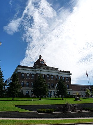
Taylor County Courthouse (Wisconsin)
United States historic place
Distance: Approx. 211 meters
Latitude and longitude: 45.13729,-90.34205
The current Taylor County Courthouse, built in 1914, is a Neoclassical-styled three-story building with a metal-clad dome, located in Medford, Wisconsin. It was added to the National Register of Historic Places in 1980. It was preceded by a courthouse built in 1876 on the same site.
Weather in this IP's area
clear sky
10 Celsius
9 Celsius
9 Celsius
11 Celsius
1019 hPa
68 %
1019 hPa
966 hPa
10000 meters
2.06 m/s
170 degree
07:00:14
16:32:07

