63.247.202.92 - IP Lookup: Free IP Address Lookup, Postal Code Lookup, IP Location Lookup, IP ASN, Public IP
Country:
Region:
City:
Location:
Time Zone:
Postal Code:
IP information under different IP Channel
ip-api
Country
Region
City
ASN
Time Zone
ISP
Blacklist
Proxy
Latitude
Longitude
Postal
Route
Luminati
Country
ASN
Time Zone
Europe/Paris
ISP
Expereo International BV
Latitude
Longitude
Postal
IPinfo
Country
Region
City
ASN
Time Zone
ISP
Blacklist
Proxy
Latitude
Longitude
Postal
Route
IP2Location
63.247.202.92Country
Region
ile-de-france
City
gentilly
Time Zone
Europe/Paris
ISP
Language
User-Agent
Latitude
Longitude
Postal
db-ip
Country
Region
City
ASN
Time Zone
ISP
Blacklist
Proxy
Latitude
Longitude
Postal
Route
ipdata
Country
Region
City
ASN
Time Zone
ISP
Blacklist
Proxy
Latitude
Longitude
Postal
Route
Popular places and events near this IP address

Arcueil
Commune in Île-de-France, France
Distance: Approx. 728 meters
Latitude and longitude: 48.8075,2.3361
Arcueil (French pronunciation: [aʁkœj] ) is a commune in the Val-de-Marne department in the southern suburbs of Paris, France. It is located 5.3 km (3.3 mi) from the center of Paris.

Cité Universitaire station
Railway station in Paris, France
Distance: Approx. 923 meters
Latitude and longitude: 48.821,2.339
Cité Universitaire station (French pronunciation: [site ynivɛʁsitɛʁ]) is a station on RER B of Île-de-France's express suburban rail system, the Réseau Express Régional. It is situated in the 14th arrondissement of Paris.

Pavillon Suisse
Building
Distance: Approx. 702 meters
Latitude and longitude: 48.81915278,2.34296111
The Fondation Suisse or Pavillon Le Corbusier is a building designed by Le Corbusier between 1930–31 and is located at the Cité Internationale Universitaire, in Paris.

Gentilly, Val-de-Marne
Commune in Île-de-France, France
Distance: Approx. 203 meters
Latitude and longitude: 48.8133,2.3444
Gentilly (French pronunciation: [ʒɑ̃tiji] ) is a commune in the southern suburbs of Paris, France. It is the closest commune to Paris, located 4.1 km (2.5 mi) from the city center.

Stade Sébastien Charléty
Multi-purpose stadium in Paris, France
Distance: Approx. 733 meters
Latitude and longitude: 48.81861111,2.34666667
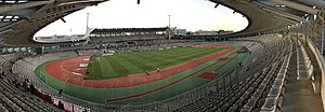
Stade Sébastien-Charléty (French pronunciation: [stad sebastjɛ̃ ʃaʁleti]; lit. 'Stadium of Sébastien Charléty'), also known as Stade Charléty or Charléty, is a multi-purpose stadium located in the 13th arrondissement of Paris, France. Comprising a running track and a football field, the stadium is a 20,000-seat state-owned venue used for numerous sports and events. It is also the current home ground of the rugby union team of Paris Université Club, who operate the venue, and the association football clubs Paris FC and Paris 13 Atletico.

Maison de la photographie Robert Doisneau
Photographic art museum in Gentilly, France
Distance: Approx. 449 meters
Latitude and longitude: 48.81409,2.34755
The Maison de la photographie Robert Doisneau (Robert Doisneau house of photography) is a photography gallery in the Paris suburb of Gentilly, created to commemorate the Parisian photographer Robert Doisneau and dedicated to exhibiting humanist photography.

Maison du Brésil
Building in France
Distance: Approx. 561 meters
Latitude and longitude: 48.81777778,2.34361111
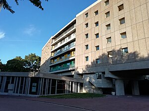
Maison du Brésil is a student hostel building located in the Cité Universitaire complex in Paris, France, designed by noted architects Le Corbusier and Lúcio Costa for Brazilian students and scientists. It was built in 1957 and refurbished in 2000. The first sketch for the building was made by Costa, but soon afterwards Le Corbusier became a collaborator, working out the final design.

Gentilly station
Railway station in Gentilly, France
Distance: Approx. 367 meters
Latitude and longitude: 48.81611111,2.34055556
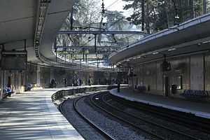
Gentilly station is a station on the line B of the Réseau Express Régional, a hybrid suburban commuter and rapid transit line. It is named after the city of Gentilly where the station is located.

Laplace station
Railway station in Arcueil, France
Distance: Approx. 873 meters
Latitude and longitude: 48.8075,2.33305556
Laplace station is a station on the line B of the Réseau Express Régional, a hybrid suburban commuter and rapid transit line. It is located in the city of Arcueil.

Hôpital Bicêtre station
Paris Métro station in Le Kremlin-Bicêtre
Distance: Approx. 686 meters
Latitude and longitude: 48.8097222,2.3497222
Hôpital Bicêtre station (French pronunciation: [opital bisɛtʁ]) is a station on Line 14 of the Paris Métro. It is located in the commune of Le Kremlin-Bicêtre in the department of Val-de-Marne, near the commune of Gentilly. It is 800 metres away from Bicêtre Hospital.

Maison Heinrich Heine
Building in France
Distance: Approx. 687 meters
Latitude and longitude: 48.81764722,2.33570278
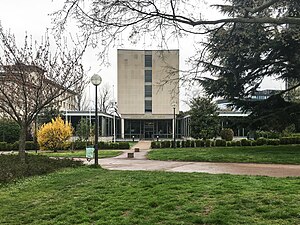
Fondation de l'Allemagne — Maison Heinrich Heine is a cultural center and student hostel building located in the Cité Universitaire complex in Paris, France. It was designed by Johannes Krahn and opened in 1956.

Fondation Biermans-Lapôtre
Distance: Approx. 738 meters
Latitude and longitude: 48.8195,2.3408
The Fondation Biermans-Lapôtre is a university residence that is part of the Cité international universitaire de Paris, located in the 14th arrondissement of Paris, near Parc Montsouris. It is the first foreign house decided on the site of the Cité Internationale universitaire de Paris. The residence primarily accommodates graduate students from Belgium and Luxembourg who are pursuing their studies in Paris, but students of other nationalities also live there as a part of the Cité's commitment to international exchange.
Weather in this IP's area
clear sky
-4 Celsius
-7 Celsius
-5 Celsius
-3 Celsius
1037 hPa
91 %
1037 hPa
1026 hPa
10000 meters
2.06 m/s
320 degree