63.245.151.152 - IP Lookup: Free IP Address Lookup, Postal Code Lookup, IP Location Lookup, IP ASN, Public IP
Country:
 USA
USARegion:
City:
Location:
Time Zone:
Postal Code:
ISP:
ASN:
language:
User-Agent:
Proxy IP:
Blacklist:
IP information under different IP Channel
ip-api
Country
Region
City
ASN
Time Zone
ISP
Blacklist
Proxy
Latitude
Longitude
Postal
Route
db-ip
Country
Region
City
ASN
Time Zone
ISP
Blacklist
Proxy
Latitude
Longitude
Postal
Route
IPinfo
Country
Region
City
ASN
Time Zone
ISP
Blacklist
Proxy
Latitude
Longitude
Postal
Route
IP2Location
63.245.151.152Country
usRegion
kansas
City
hays
Time Zone
America/Chicago
ISP
Language
User-Agent
Latitude
Longitude
Postal
ipdata
Country
Region
City
ASN
Time Zone
ISP
Blacklist
Proxy
Latitude
Longitude
Postal
Route
Popular places and events near this IP address

Hays, Kansas
City in Ellis County, Kansas
Distance: Approx. 398 meters
Latitude and longitude: 38.87944444,-99.32222222
Hays is a city in and the county seat of Ellis County, Kansas, United States. The largest city in northwestern Kansas, it is the economic and cultural center of the region. As of the 2020 census, the population of the city was 21,116.

Fort Hays State University
Public university in Hays, Kansas, US
Distance: Approx. 1575 meters
Latitude and longitude: 38.87333333,-99.34333333
Fort Hays State University (FHSU) is a public university in Hays, Kansas, United States. It is the largest university in western Kansas, and the fourth largest of the six state universities governed by the Kansas Board of Regents, with a total enrollment of approximately 15,100 students.
Thomas More Prep-Marian
Private school in Hays, Kansas, United States
Distance: Approx. 1005 meters
Latitude and longitude: 38.88138889,-99.33805556
Thomas More Prep-Marian (TMP-M), TMP, is a co-educational Catholic college preparatory high school located in Hays, Kansas in the United States. The original school was founded by the Capuchin Franciscan order. Although now governed by the Roman Catholic Diocese of Salina, the order still maintains a presence in the school.

Big Creek Township, Ellis County, Kansas
Township in Kansas, United States
Distance: Approx. 1603 meters
Latitude and longitude: 38.87833333,-99.30833333
Big Creek Township is a township in Ellis County, Kansas, United States, named for Big Creek, which flows diagonally through the township from the northwest to the southeast. As of the 2010 census, its population was 1,883.
Kansas Academy of Mathematics and Science
School in Hays, Kansas, United States
Distance: Approx. 1532 meters
Latitude and longitude: 38.87083333,-99.34083333
The Kansas Academy of Mathematics and Science (KAMS) is a two-year, residential, early-entrance-to-college program for U.S. high school juniors and seniors who are academically talented in the areas of mathematics and science. Located on the Fort Hays State University campus in Hays, Kansas, students concurrently complete their last two years of high school, while earning over 60 college credits.

Lewis Field Stadium
Distance: Approx. 1784 meters
Latitude and longitude: 38.86638889,-99.33916667
Lewis Field is a sport stadium in Hays, Kansas. The facility is primarily used by Fort Hays State University for college football team. The stadium is also the primary home field for Hays High School and Thomas More Prep-Marian.
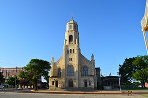
First Presbyterian Church (Hays, Kansas)
Historic church in Kansas, United States
Distance: Approx. 987 meters
Latitude and longitude: 38.87083333,-99.33055556
The First Presbyterian Church in Hays, Kansas is a historic stone Presbyterian church building at 100 W. 7th Street. It was built in 1879 and added to the National Register in 1973. The congregation was organized in 1873, and may have been the first in western Kansas.
St. Joseph's Church and Parochial School
Historic church in Kansas, United States
Distance: Approx. 669 meters
Latitude and longitude: 38.87472222,-99.33194444
The St. Joseph's Church and Parochial School in Hays, Kansas is a historic church and school at 210 W. 13th and 217 W. 13th. They were added to the National Register in 2008.
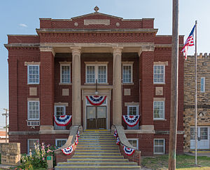
Hays USD 489
Public school district in Hays, Kansas
Distance: Approx. 780 meters
Latitude and longitude: 38.87416667,-99.33305556
Hays USD 489 is a public unified school district headquartered in Hays, Kansas, United States. The district includes the communities of Hays, Schoenchen, Antonino, Catharine, Munjor, and nearby rural areas.

Rome, Ellis County, Kansas
Ghost town in Ellis County, Kansas
Distance: Approx. 1523 meters
Latitude and longitude: 38.878775,-99.34436389
Rome was a short-lived postbellum frontier settlement in Big Creek Township, Ellis County, Kansas, United States. It is notable for its association with the early plains career of its co-founder, William Frederick "Buffalo Bill" Cody. Rome was the first town established within the future Ellis County, followed very shortly by rival Hays City.

Ellis County Courthouse (Kansas)
Building in Hays, Kansas
Distance: Approx. 714 meters
Latitude and longitude: 38.87361111,-99.33083333
The Ellis County Courthouse, located at 1204 Fort Street in Hays City, is the seat of government of Ellis County, Kansas. Hays has been the county seat since 1867. The courthouse was built from 1940 to 1942 by Ralph Hunter Construction as a Works Progress Administration (WPA) project.

Justus Bissing Jr. Historic District
Historic district in Kansas, United States
Distance: Approx. 977 meters
Latitude and longitude: 38.8753,-99.3369
The Justus Bissing Jr. Historic District, in Hays, Kansas in Ellis County, Kansas, was listed on the National Register of Historic Places in 2004. The district includes two contributing buildings: the 1920 Justus Bissing Jr.
Weather in this IP's area
clear sky
-2 Celsius
-5 Celsius
-2 Celsius
-2 Celsius
1013 hPa
100 %
1013 hPa
937 hPa
10000 meters
2.06 m/s
90 degree