Country:
Region:
City:
Latitude and Longitude:
Time Zone:
Postal Code:
IP information under different IP Channel
ip-api
Country
Region
City
ASN
Time Zone
ISP
Blacklist
Proxy
Latitude
Longitude
Postal
Route
IPinfo
Country
Region
City
ASN
Time Zone
ISP
Blacklist
Proxy
Latitude
Longitude
Postal
Route
MaxMind
Country
Region
City
ASN
Time Zone
ISP
Blacklist
Proxy
Latitude
Longitude
Postal
Route
Luminati
Country
Region
wa
City
omak
ASN
Time Zone
America/Los_Angeles
ISP
OKPUD-WA
Latitude
Longitude
Postal
db-ip
Country
Region
City
ASN
Time Zone
ISP
Blacklist
Proxy
Latitude
Longitude
Postal
Route
ipdata
Country
Region
City
ASN
Time Zone
ISP
Blacklist
Proxy
Latitude
Longitude
Postal
Route
Popular places and events near this IP address

North Omak, Washington
CDP in Washington, United States
Distance: Approx. 5688 meters
Latitude and longitude: 48.43222222,-119.45416667
North Omak is a census-designated place (CDP) in Okanogan County, Washington, United States, north of Omak, Washington. The community is considered to be part of Greater Omak, and had a population of 651 at the 2020 census.

Okanogan, Washington
City in Washington, United States
Distance: Approx. 6550 meters
Latitude and longitude: 48.36666667,-119.58111111
Okanogan ( OH-kə-NOG-ən; derived from Syilx'tsn: "rendezvous" or "meeting place") is a city in Okanogan County, Washington, United States. The population was 2,379 at the 2020 census, down from 2,552 at the 2010 census, within the Greater Omak Area. It is the seat of Okanogan County.

Omak, Washington
City in Washington, United States
Distance: Approx. 924 meters
Latitude and longitude: 48.4125,-119.5375
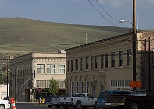
Omak ( o-MAK) is a city located in the foothills of the Okanogan Highlands in north-central Washington, United States. With a population of 4,860 residents as of 2020, distributed over a land area of 3.43 square miles (8.9 km2), Omak is the largest municipality of Okanogan County and the largest municipality in Central Washington north of Wenatchee. The Greater Omak Area of around 8,229 inhabitants as of the 2010 census is the largest urban cluster in the Okanogan Country region, encompassing most of its twin city of Okanogan.
Suicide Race
Horse race in Omak, Washington
Distance: Approx. 647 meters
Latitude and longitude: 48.4136,-119.5165
The Suicide Race, also promoted as the World Famous Suicide Race, is a horse race in the northwest United States in Omak, Washington. It is part of the Omak Stampede, an annual rodeo in early to mid-August. First held in 1935, the race is known for the portion of the race where horses and riders run down Suicide Hill, a 62-percent slope that runs for 225 feet (70 m) to the Okanogan River, opposite Eastside Park.
KOMW
Radio station in Omak, Washington
Distance: Approx. 2070 meters
Latitude and longitude: 48.39444444,-119.53333333
KOMW (680 AM, "Radio Okanogan 680") is a radio station broadcasting an adult standards music format. Licensed to Omak, Washington, United States, the station is currently owned by North Cascades Broadcasting, Inc. and features programming from Salem Radio Network.

Omak Airport
Airport based in Omak, Washington
Distance: Approx. 5808 meters
Latitude and longitude: 48.46416667,-119.51805556
Omak Airport (IATA: OMK, ICAO: KOMK, FAA LID: OMK), also known as Omak Municipal Airport or Omak City Airport, is a regional airport located 3 miles (4.8 km) north of Omak, Washington, a city in the Okanogan region of United States. It is owned and operated by the Omak City Council and serves Omak, although it is situated in nearby town Riverside's city limits rather. The airport was built by the United States Army Air Forces around 1942 and was approved for public use the following year.
Mid-Valley Hospital
Hospital in Washington, United States
Distance: Approx. 2343 meters
Latitude and longitude: 48.39666667,-119.54638889
Mid-Valley Hospital is a 44-bed community hospital in Omak, Washington. The District, alongside Mid-Valley Clinic, (RHC) provides acute care and clinical services to patients in Omak and surrounding areas. The services include hospital inpatient and outpatient general surgery, emergency room, obstetrics, rehabilitation, primary care, orthopedic surgery, and the related ancillary procedures (lab, anesthesia, x-ray, therapy, etc.) associated with those services.
Omak School District
School district in Washington, United States
Distance: Approx. 1675 meters
Latitude and longitude: 48.40195,-119.5416
Omak School District, officially known as Omak School District 19, is a school district that serves Omak, Washington, a city in the Okanogan region of United States. It consists of three elementary schools, two middle schools and three high schools. The district was established in 1912.
Omak High School
Public school in Omak, Okanogan County, Washington, United States
Distance: Approx. 740 meters
Latitude and longitude: 48.41,-119.53444444
Omak High School is a public high school situated in Omak, Washington, a city in the Okanogan Country region of North America. It provides educational service for children in grades 9 to 12, and is part of the Omak School District.
Okanogan Legion Airport
Airport
Distance: Approx. 6416 meters
Latitude and longitude: 48.36194444,-119.5675
Okanogan Legion Airport (FAA LID: S35) is a city-owned, public-use airport located one nautical mile (2 km) east of the central business district of Okanogan, a city in Okanogan County, Washington, United States.
Weather in this IP's area
clear sky
9 Celsius
7 Celsius
6 Celsius
10 Celsius
1018 hPa
61 %
1018 hPa
987 hPa
10000 meters
4.12 m/s
310 degree
07:27:42
17:57:14