Country:
 USA
USARegion:
City:
Latitude and Longitude:
Time Zone:
Postal Code:
IP information under different IP Channel
ip-api
Country
Region
City
ASN
Time Zone
ISP
Blacklist
Proxy
Latitude
Longitude
Postal
Route
IPinfo
Country
Region
City
ASN
Time Zone
ISP
Blacklist
Proxy
Latitude
Longitude
Postal
Route
MaxMind
Country
Region
City
ASN
Time Zone
ISP
Blacklist
Proxy
Latitude
Longitude
Postal
Route
Luminati
Country
USRegion
wa
City
omak
ASN
Time Zone
America/Los_Angeles
ISP
OKPUD-WA
Latitude
Longitude
Postal
db-ip
Country
Region
City
ASN
Time Zone
ISP
Blacklist
Proxy
Latitude
Longitude
Postal
Route
ipdata
Country
Region
City
ASN
Time Zone
ISP
Blacklist
Proxy
Latitude
Longitude
Postal
Route
Popular places and events near this IP address

Pateros, Washington
City in Washington, United States
Distance: Approx. 6052 meters
Latitude and longitude: 48.05333333,-119.9025
Pateros pə-TARR-əs is a city in Okanogan County, Washington, United States. The population at the 2020 census was 593.

Alta Lake State Park
Park in the U.S. state of Washington
Distance: Approx. 2787 meters
Latitude and longitude: 48.02861111,-119.94194444
Alta Lake State Park is a public recreation area located two miles (3.2 km) southwest of Pateros, Washington, at the northern end of 220-acre (89 ha) Alta Lake, in the mountainous northwest interior of the state. The 181-acre (73 ha) state park and adjacent lake lie beneath towering stone cliffs, formed by glaciation, that rise 1000 feet (304 m) above the valley floor, and carry on up to the top of Old Goat Mountain which sits 4200 ft (1280 m) above the park. A two-mile-long (3 km) road leading to the park, Alta Lake Road, intersects State Route 153, which runs along the Methow River.
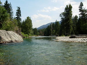
Methow River
River in Washington, United States
Distance: Approx. 6462 meters
Latitude and longitude: 48.05055556,-119.89527778
The Methow River ( MET-how) is a tributary of the Columbia River in northern Washington in the United States. The river's 1,890-square-mile (4,900 km2) watershed drains the eastern North Cascades, with a population of about 5,000 people. The Methow's watershed is characterized by relatively pristine habitats, as much of the river basin is located in national forests and wildernesses.
Pateros High School
Public school in Pateros, Washington, United States
Distance: Approx. 5727 meters
Latitude and longitude: 48.05194444,-119.90638889
Pateros High School (grades 9–12) is the only secondary school in the small town of Pateros, Washington. Pateros High School is part of the Pateros School District, one of only three K-12 schools in the United States to have been selected as a National Blue Ribbon Award Winning School.
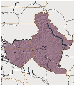
Washington's 12th legislative district
Distance: Approx. 4110 meters
Latitude and longitude: 48,-120
Washington's 12th legislative district is one of forty-nine districts in Washington state for representation in the state legislature. The rural district in north central Washington contains all of Chelan County and parts of Douglas, King, and Snohomish counties. The district's legislators are state senator Brad Hawkins and state representatives Keith Goehner (position 1) and Mike Steel (position 2), all Republicans.
Swaram Creek
Stream in Washington, U.S.
Distance: Approx. 6904 meters
Latitude and longitude: 48.09027778,-120.0175
Swaram Creek is a stream in the U.S. state of Washington. It is a tributary to the Methow River. The creek was formerly called Squaw Creek.
Weather in this IP's area
broken clouds
4 Celsius
2 Celsius
4 Celsius
5 Celsius
1015 hPa
54 %
1015 hPa
876 hPa
10000 meters
2.75 m/s
2.9 m/s
265 degree
81 %
07:28:52
17:59:41