Country:
Region:
City:
Latitude and Longitude:
Time Zone:
Postal Code:
IP information under different IP Channel
ip-api
Country
Region
City
ASN
Time Zone
ISP
Blacklist
Proxy
Latitude
Longitude
Postal
Route
Luminati
Country
Region
in
City
terrehaute
ASN
Time Zone
America/Indiana/Indianapolis
ISP
1-JOINK
Latitude
Longitude
Postal
IPinfo
Country
Region
City
ASN
Time Zone
ISP
Blacklist
Proxy
Latitude
Longitude
Postal
Route
db-ip
Country
Region
City
ASN
Time Zone
ISP
Blacklist
Proxy
Latitude
Longitude
Postal
Route
ipdata
Country
Region
City
ASN
Time Zone
ISP
Blacklist
Proxy
Latitude
Longitude
Postal
Route
Popular places and events near this IP address

Terre Haute, Indiana
City in Indiana, United States
Distance: Approx. 3207 meters
Latitude and longitude: 39.46972222,-87.38972222
Terre Haute ( TERR-ə HOHT) is a city in, and the county seat of, Vigo County, Indiana, United States, about 5 miles (8 km) east of the state's western border with Illinois. As of the 2020 census, the city had a population of 58,389 and its metropolitan area had a population of 168,716. Located along the Wabash River, Terre Haute is one of the largest cities in the Wabash Valley and is known as the Queen City of the Wabash.
Max Ehrmann
American writer, poet, and attorney (1872–1945)
Distance: Approx. 1432 meters
Latitude and longitude: 39.476398,-87.347801
Max Ehrmann (September 26, 1872 – September 9, 1945) was an American writer, poet, and attorney from Terre Haute, Indiana, widely known for his 1927 prose poem "Desiderata" (Latin: "things desired"). He often wrote on spiritual themes.

Tony Hulman
American businessman (1901–1977)
Distance: Approx. 687 meters
Latitude and longitude: 39.4702988,-87.3518982
Anton "Tony" Hulman Jr.
Mary Fendrich Hulman
American businesswoman
Distance: Approx. 687 meters
Latitude and longitude: 39.4702988,-87.3518982
Mary Fendrich Hulman (March 13, 1905 – April 10, 1998) was the wife of the late Indiana industrialist Anton "Tony" Hulman, Jr. and matriarch of the Hulman-George family that controls Hulman & Company.

Woodrow Wilson Middle School (Terre Haute, Indiana)
United States historic place
Distance: Approx. 2312 meters
Latitude and longitude: 39.46388889,-87.38
Woodrow Wilson Middle School, formerly Woodrow Wilson Junior High School, is a historic school building located at Terre Haute, Vigo County, Indiana. It was built in 1927 for approximately $750,000. Designed by the firm of Miller & Yeager Architects.

Highland Lawn Cemetery
Distance: Approx. 1432 meters
Latitude and longitude: 39.47638889,-87.34777778
Highland Lawn Cemetery is a city-owned cemetery in Terre Haute, Indiana. Opened in 1884, the cemetery includes 139 acres (0.56 km2). The cemetery features a Richardsonian Romanesque chapel built by architect Jesse A. Vrydaugh in 1893 for a cost of $10,000.

Ohio Boulevard–Deming Park Historic District
Historic district in Indiana, United States
Distance: Approx. 689 meters
Latitude and longitude: 39.46583333,-87.36083333
Ohio Boulevard–Deming Park Historic District is a boulevard in Terre Haute, Vigo County, Indiana. Designed by architect and city planner George E. Kessler, the boulevard is 1.5 miles (2.4 km) long. At its start at the intersection with 19th Street is an entrance including a stone structure on either side of the road.

Memorial Stadium (Terre Haute, Indiana)
Stadium in Terre Haute
Distance: Approx. 1670 meters
Latitude and longitude: 39.47472222,-87.36694444
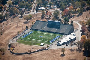
Memorial Stadium is the current home of the Indiana State Sycamores football and soccer section in Terre Haute, Indiana, United States. The stadium was renovated between 1967 and 1969; it was built to host professional minor league baseball; the Indiana State football team began playing there in 1949.
WMKI-LP
Radio station in Terre Haute, Indiana
Distance: Approx. 3029 meters
Latitude and longitude: 39.468,-87.388
WMKI-LP is a broadcast radio station licensed to and serving Terre Haute, Indiana. WMKI-LP is owned and operated by Wabash Valley Educational Media.

Butternut Hill
Historic house in Indiana, United States
Distance: Approx. 1299 meters
Latitude and longitude: 39.47583333,-87.35194444
Butternut Hill, also known as Prospect Hill, Blake House, and Ross House, is a historic home located at Terre Haute, Vigo County, Indiana. It was built about 1835, and enlarged in 1869 and 1902. It is a two-story, central passage plan, vernacular Greek Revival style brick dwelling.: 5 It was listed on the National Register of Historic Places in 1993.

Terre Haute Fire Station No. 8
United States historic place
Distance: Approx. 3096 meters
Latitude and longitude: 39.46888889,-87.38861111
Terre Haute Fire Station No. 8 is a historic fire station located at Terre Haute, Vigo County, Indiana. It was built in 1906, and is a two-story, Romanesque Revival style brick building on a dressed limestone base.
Meadows Shopping Center
Shopping mall in Indiana, United States
Distance: Approx. 1973 meters
Latitude and longitude: 39.46423238,-87.3760584
Meadows Shopping Center (often called "The Meadows") is an enclosed shopping center in Terre Haute, Indiana, United States. It opened in 1956 as an open-air shopping center and was enclosed in a 1982–1983 renovation.
Weather in this IP's area
overcast clouds
9 Celsius
8 Celsius
8 Celsius
9 Celsius
1020 hPa
83 %
1020 hPa
1000 hPa
10000 meters
2.57 m/s
30 degree
100 %
07:34:03
17:34:24