62.93.73.20 - IP Lookup: Free IP Address Lookup, Postal Code Lookup, IP Location Lookup, IP ASN, Public IP
Country:
Region:
City:
Location:
Time Zone:
Postal Code:
IP information under different IP Channel
ip-api
Country
Region
City
ASN
Time Zone
ISP
Blacklist
Proxy
Latitude
Longitude
Postal
Route
Luminati
Country
ASN
Time Zone
Europe/Vienna
ISP
JM-DATA GmbH
Latitude
Longitude
Postal
IPinfo
Country
Region
City
ASN
Time Zone
ISP
Blacklist
Proxy
Latitude
Longitude
Postal
Route
IP2Location
62.93.73.20Country
Region
tirol
City
kundl
Time Zone
Europe/Vienna
ISP
Language
User-Agent
Latitude
Longitude
Postal
db-ip
Country
Region
City
ASN
Time Zone
ISP
Blacklist
Proxy
Latitude
Longitude
Postal
Route
ipdata
Country
Region
City
ASN
Time Zone
ISP
Blacklist
Proxy
Latitude
Longitude
Postal
Route
Popular places and events near this IP address
Wörgl
Municipality in Tyrol, Austria
Distance: Approx. 6540 meters
Latitude and longitude: 47.48333333,12.06666667
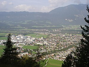
Wörgl (German pronunciation: [ˈvœrɡəl]) is a city in the Austrian state of Tyrol, in the Kufstein district. It is 20 km (12 mi) from the international border with Bavaria, Germany.

Wildschönau
Municipality in Tyrol, Austria
Distance: Approx. 5353 meters
Latitude and longitude: 47.45,12.05
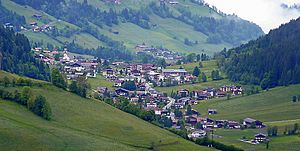
Wildschönau is a municipality within the district of Kufstein in the state of Tyrol 6 km south of Wörgl. The 24 km long high valley near Wörgl is one of the district's tourist centers. Besides a few hamlets, the municipality consists of the four church villages Niederau, Oberau, Auffach and Thierbach and is situated in the Kitzbühel Alps.

Angerberg
Municipality in Tyrol, Austria
Distance: Approx. 4477 meters
Latitude and longitude: 47.5,12.01666667
Angerberg is a municipality in the Kufstein district of Austria. It is located 2.7 kilometres (1.7 mi) north of Wörgl and 14 kilometres (9 mi) southwest of Kufstein. The village was mentioned for the first time in documents in 1190.

Breitenbach am Inn
Municipality in Tyrol, Austria
Distance: Approx. 1550 meters
Latitude and longitude: 47.47888889,11.97333333
Breitenbach am Inn (Central Bavarian: Broadnbåch am Inn) is a municipality in the Kufstein district in the Austrian state of Tyrol located 5.5 km west of Wörgl and 19 km southwest of Kufstein. The village has five parts and received new parts and house numbers in 2006. It was founded in the middle of the 19th century.
Kundl
Municipality in Tyrol, Austria
Distance: Approx. 4 meters
Latitude and longitude: 47.46666667,11.98333333
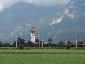
Kundl is a market town in the Kufstein district in the Austrian state of Tyrol.

Radfeld
Municipality in Tyrol, Austria
Distance: Approx. 5878 meters
Latitude and longitude: 47.44611111,11.91138889
Radfeld is a municipality in the Kufstein district in the Austrian state of Tyrol located 1 km east of the town of Rattenberg, 13 km west of Wörgl, and 24 km southwest of Kufstein.
Wörgl Hauptbahnhof
Railway station in Tyrol, Austria
Distance: Approx. 6537 meters
Latitude and longitude: 47.49166667,12.06194444
Wörgl Hauptbahnhof is the main railway station of Wörgl, a city in the Kufstein district of the Austrian federal state of Tyrol, about 20 km from the state border with Bavaria. It is a major hub for regional and international rail travel, both passenger and freight.

Berglsteiner See
Lake in Tyrol, Austria
Distance: Approx. 5361 meters
Latitude and longitude: 47.4726,11.9126
Berglsteiner See is a lake of Tyrol, Austria. The lake is located on 713 m height in Breitenbach am Inn in a depression of the south slope of the Voldöppberg (1,509 m), which is part of the Brandenberg Alps.

Gratlspitze
Distance: Approx. 6356 meters
Latitude and longitude: 47.4149389,11.9476611
The Gratlspitze or Gratlspitz, is a mountain in the Austrian state of Tyrol in the Kitzbühel Alps. It is linked to the Schatzberg to the north. In addition to its 1,899 m (AA) high main summit it has two subpeaks, that give it a striking appearance.

Salzburg-Tyrol Railway
Railway line in Austria
Distance: Approx. 6480 meters
Latitude and longitude: 47.49166667,12.06111111
The Salzburg-Tyrol Railway (German: Salzburg-Tiroler-Bahn) is a main line railway in Austria. It runs through the states of Salzburg and Tyrol (North Tyrol) from the city of Salzburg to Wörgl and belongs to the core network (Kernnetz) of the Austrian Federal Railways (ÖBB). The section between Salzburg and Schwarzach-Sankt Veit is part of the Salzburg S-Bahn urban railway network.
Museum of Tyrolean Farms
Open-air museum in Kramsach, Austria
Distance: Approx. 4881 meters
Latitude and longitude: 47.4636,11.9186
The Museum of Tyrolean Farms (German: Museum Tiroler Bauernhöfe) is an open-air museum in Kramsach, Austria. As at 2009 the museum had around 30 historic farmsteads and other historic rural buildings as well as their associated barns, sheds, alms and storehouses.
Lower Inn Valley
Distance: Approx. 3009 meters
Latitude and longitude: 47.45777778,11.94555556
The Lower Inn Valley (German: Unterinntal) is that part of the Inntal valley through which the Inn river flows from a point a few kilometres west of Innsbruck near its confluence with the Melach downstream to a few kilometres before Rosenheim. A further distinction can be made between the Tyrolean Lower Inn Valley (Tiroler Unterinntal) (as far as Kufstein) and the Bavarian Lower Inn Valley (from Kiefersfelden). The Lower Inn Valley should not be confused with the Tyrolean Unterland, of which it forms only a part.
Weather in this IP's area
overcast clouds
-1 Celsius
-1 Celsius
-1 Celsius
-1 Celsius
1036 hPa
79 %
1036 hPa
902 hPa
10000 meters
0.66 m/s
0.79 m/s
39 degree
98 %


