62.93.114.77 - IP Lookup: Free IP Address Lookup, Postal Code Lookup, IP Location Lookup, IP ASN, Public IP
Country:
Region:
City:
Location:
Time Zone:
Postal Code:
ISP:
ASN:
language:
User-Agent:
Proxy IP:
Blacklist:
IP information under different IP Channel
ip-api
Country
Region
City
ASN
Time Zone
ISP
Blacklist
Proxy
Latitude
Longitude
Postal
Route
db-ip
Country
Region
City
ASN
Time Zone
ISP
Blacklist
Proxy
Latitude
Longitude
Postal
Route
IPinfo
Country
Region
City
ASN
Time Zone
ISP
Blacklist
Proxy
Latitude
Longitude
Postal
Route
IP2Location
62.93.114.77Country
Region
niederosterreich
City
waldhausen
Time Zone
Europe/Vienna
ISP
Language
User-Agent
Latitude
Longitude
Postal
ipdata
Country
Region
City
ASN
Time Zone
ISP
Blacklist
Proxy
Latitude
Longitude
Postal
Route
Popular places and events near this IP address

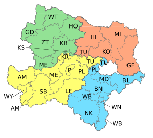
Waldviertel
Subdivision of the region of Lower Austria
Distance: Approx. 4 meters
Latitude and longitude: 48.51666667,15.25
The Waldviertel (German: [ˈvaltˌfɪʁtl̩] ; lit. 'Forest Quarter'; Central Bavarian: Woidviadl; Czech: Lesní čtrvť) is the northwestern region of the Austrian state of Lower Austria. It is bounded to the south by the river Danube, to the southwest by Upper Austria, to the northwest and to the north by the Czech Republic and to the east by the Manhartsberg (537 m, 1,762 ft), which is the survey point dividing the Waldviertel from the Weinviertel region. Geologically it is part of the Bohemian Massif.

Großdietmanns
Municipality in Lower Austria, Austria
Distance: Approx. 9244 meters
Latitude and longitude: 48.46666667,15.15
Großdietmanns is a town in the district of Gmünd in the Austrian state of Lower Austria.

Lichtenau im Waldviertel
Municipality in Lower Austria, Austria
Distance: Approx. 10008 meters
Latitude and longitude: 48.5,15.38333333
Lichtenau im Waldviertel is a town in the district of Krems-Land in the Austrian state of Lower Austria.

Rastenfeld
Municipality in Lower Austria, Austria
Distance: Approx. 7422 meters
Latitude and longitude: 48.56666667,15.31666667
Rastenfeld is a town in the district of Krems-Land in the Austrian state of Lower Austria.

Grafenschlag
Municipality in Lower Austria, Austria
Distance: Approx. 6421 meters
Latitude and longitude: 48.5,15.16666667
Grafenschlag is a municipality in the district of Zwettl in the Austrian state of Lower Austria.

Großgöttfritz
Place in Lower Austria, Austria
Distance: Approx. 5252 meters
Latitude and longitude: 48.53333333,15.18333333
Großgöttfritz is a municipality in the district of Zwettl in the Austrian state of Lower Austria.

Sallingberg
Municipality in Lower Austria, Austria
Distance: Approx. 5713 meters
Latitude and longitude: 48.46666667,15.23277778
Sallingberg is a municipality in the district of Zwettl in the Austrian state of Lower Austria.

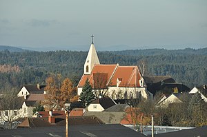
Waldhausen
Municipality in Lower Austria, Austria
Distance: Approx. 4 meters
Latitude and longitude: 48.51666667,15.25
Waldhausen is a municipality in the district of Zwettl in the Austrian state of Lower Austria.
Weather in this IP's area
broken clouds
2 Celsius
-3 Celsius
-1 Celsius
2 Celsius
1012 hPa
89 %
1012 hPa
929 hPa
10000 meters
6.38 m/s
13.91 m/s
264 degree
84 %