Country:
Region:
City:
Latitude and Longitude:
Time Zone:
Postal Code:
IP information under different IP Channel
ip-api
Country
Region
City
ASN
Time Zone
ISP
Blacklist
Proxy
Latitude
Longitude
Postal
Route
Luminati
Country
Region
ib
City
muro
ASN
Time Zone
Europe/Madrid
ISP
Vodafone Ono, S.A.
Latitude
Longitude
Postal
IPinfo
Country
Region
City
ASN
Time Zone
ISP
Blacklist
Proxy
Latitude
Longitude
Postal
Route
db-ip
Country
Region
City
ASN
Time Zone
ISP
Blacklist
Proxy
Latitude
Longitude
Postal
Route
ipdata
Country
Region
City
ASN
Time Zone
ISP
Blacklist
Proxy
Latitude
Longitude
Postal
Route
Popular places and events near this IP address
Pozuelo de Alarcón
Place in Community of Madrid, Spain
Distance: Approx. 3486 meters
Latitude and longitude: 40.43611111,-3.81388889
Pozuelo de Alarcón (Spanish pronunciation: [poˈθwelo ðe alaɾˈkon]) is a municipality in the Community of Madrid, Spain. Bordering the Moncloa-Aravaca district of Madrid proper to its west, Pozuelo de Alarcón is surrounded by large Mediterranean pine-tree forests: the Casa de Campo, the Monte del Pardo, and the Monte del Pilar. As of 2022, it ranks as the wealthiest municipality in Spain.

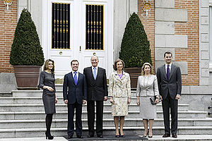
Palace of Zarzuela
Private residence of the Spanish royal family in Madrid, Spain
Distance: Approx. 1882 meters
Latitude and longitude: 40.48325,-3.80165
The Zarzuela Palace (Spanish: Palacio de la Zarzuela [paˈlaθjo ðe la θaɾˈθwela]) is the residence and working offices of the reigning monarch of Spain (King Felipe VI), although the official residence of the Spanish royal family is the Royal Palace of Madrid. The Zarzuela Palace is on the outskirts of Madrid, near the Royal Palace of El Pardo, which accommodates visiting heads of state. The palace is owned by the Spanish government and administered by a state agency named Patrimonio Nacional (National Heritage).

Aravaca
Distance: Approx. 2498 meters
Latitude and longitude: 40.45,-3.78333333
Aravaca is a ward (Barrio) of the city of Madrid, in Moncloa-Aravaca district. It is 9 kilometres (5.6 mi) from the city centre, on the other side of Casa de Campo park.
First Battle of the Corunna Road
Distance: Approx. 3002 meters
Latitude and longitude: 40.44083333,-3.81472222
The First Battle of the Corunna Road took place between 29 November and 3 December 1936 during the Spanish Civil War. The Nationalists tried to isolate Madrid from the west, cutting the Corunna Road, but the Republican army repelled the attack.

Technical Image Press Association
Distance: Approx. 3182 meters
Latitude and longitude: 40.4501,-3.7726
The Technical Image Press Association (TIPA) is an international, non-profit association advocating the interests of the photography and imaging magazine-publishing industry. The association represents 30 titles, published in eight European countries and seven non-European countries.
Valdemarín
Ward of Madrid in Spain
Distance: Approx. 2083 meters
Latitude and longitude: 40.47256111,-3.78023889
Valdemarín is a ward (barrio) of Madrid belonging to the district of Moncloa-Aravaca. Its code number is 95 and, as of 2006, its population was of 4,000.

Colegio Japonés de Madrid
Japanese international school in Spain
Distance: Approx. 2328 meters
Latitude and longitude: 40.4727916,-3.8296338
The Colegio Japonés de Madrid (CJM) (マドリッド日本人学校, Madoriddo Nihonjin Gakkō, Spanish: "Japanese College of Madrid") is a Japanese international school in the El Plantío area of Moncloa-Aravaca, Madrid, in the city's northwestern portion. Many Japanese families, particularly those with children, live in northwest Madrid, in proximity to the school. It was established on 1 September 1981 (Shōwa 56).

Avenida de Europa
Distance: Approx. 3142 meters
Latitude and longitude: 40.4393053,-3.7930537
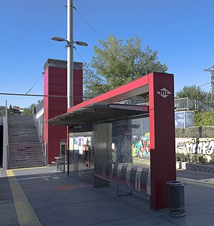
Avenida de Europa [aβeˈniða ðe ewˈɾo.pa] is a station on Line 2 of the Metro Ligero. It is in fare Zone B1.

Berna (Madrid Metro)
Distance: Approx. 2612 meters
Latitude and longitude: 40.4448676,-3.7911969
Berna [ˈbeɾ.na] is a station on Line 2 of the Metro Ligero. It is located in fare Zone B1.

Estación de Aravaca (Madrid Metro)
Distance: Approx. 2502 meters
Latitude and longitude: 40.4483271,-3.7859073
Estación de Aravaca [estaˈθjon de aɾaˈβaka] is a station on Line 2 of the Metro Ligero.

El Plantío
Ward of Madrid in Spain
Distance: Approx. 1935 meters
Latitude and longitude: 40.4708,-3.82556111
El Plantío is a ward (barrio) of Madrid belonging to the district of Moncloa-Aravaca. The Colegio Japonés de Madrid, a Japanese international school, is in El Plantío.
Embassy of North Korea, Madrid
Diplomatic mission
Distance: Approx. 2641 meters
Latitude and longitude: 40.47184,-3.7731
The Embassy of the Democratic People's Republic of Korea in Madrid was the diplomatic mission of North Korea to Spain. In February 2001, Spain and North Korea established diplomatic relations. In 2003, plans to open a diplomatic mission were halted due to North Korea's withdrawal from Nuclear Non Proliferation Treaty.
Weather in this IP's area
overcast clouds
12 Celsius
12 Celsius
11 Celsius
13 Celsius
1020 hPa
82 %
1020 hPa
941 hPa
10000 meters
2.06 m/s
70 degree
100 %
08:01:54
17:58:04

