Country:
 Hungary
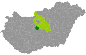
Region:
City:
Latitude and Longitude:
Time Zone:
Postal Code:
IP information under different IP Channel
ip-api
Country
Region
City
ASN
Time Zone
ISP
Blacklist
Proxy
Latitude
Longitude
Postal
Route
IPinfo
Country
Region
City
ASN
Time Zone
ISP
Blacklist
Proxy
Latitude
Longitude
Postal
Route
MaxMind
Country
Region
City
ASN
Time Zone
ISP
Blacklist
Proxy
Latitude
Longitude
Postal
Route
Luminati
Country
HURegion
fe
City
ivancsa
ASN
Time Zone
Europe/Budapest
ISP
Invitech ICT Services Kft.
Latitude
Longitude
Postal
db-ip
Country
Region
City
ASN
Time Zone
ISP
Blacklist
Proxy
Latitude
Longitude
Postal
Route
ipdata
Country
Region
City
ASN
Time Zone
ISP
Blacklist
Proxy
Latitude
Longitude
Postal
Route
Popular places and events near this IP address
Beloiannisz
Place in Central Transdanubia, Hungary
Distance: Approx. 3696 meters
Latitude and longitude: 47.1835,18.8241
Beloiannisz (Greek: Μπελογιάννης) is a village in Fejér county, Hungary. It was founded by Communist Greek refugees who left Greece after the civil war, and was named after Nikos Beloyannis (Beloiannisz is the Hungarian spelling of his name).

Adony
Town in Fejér, Hungary
Distance: Approx. 4660 meters
Latitude and longitude: 47.11895,18.86538
Adony (formerly Duna-Adony; German: Adam; Latin: Vetus Salina or Vetusallum) is a town in Fejér County, Hungary.
Lórév
Place in Pest county, Hungary
Distance: Approx. 6828 meters
Latitude and longitude: 47.11666667,18.9
Lórév (Serbian: Ловра, Lovra) is a village on Csepel Island in Hungary. It is situated in Pest County.

Iváncsa
Place in Fejér, Hungary
Distance: Approx. 447 meters
Latitude and longitude: 47.15401,18.82687
Iváncsa is a village in Fejér county, Hungary.

Pusztaszabolcs
Town in Fejér, Hungary
Distance: Approx. 5038 meters
Latitude and longitude: 47.14127,18.7594
Pusztaszabolcs is a town in Fejér County, Hungary.
Besnyő
Place in Central Transdanubia, Hungary
Distance: Approx. 5068 meters
Latitude and longitude: 47.1892,18.7898
Besnyő is a village in Dunaújváros District of Fejér County in Hungary.
Szigetbecse
Place in Central Hungary, Hungary
Distance: Approx. 9681 meters
Latitude and longitude: 47.13333333,18.95
Szigetbecse is a village in Pest county, Hungary.

Serbian Kovin Monastery
Distance: Approx. 9034 meters
Latitude and longitude: 47.1605,18.943
The Serbian Kovin monastery (Hungarian: Ráckeve) is the oldest monastery in Hungary and one of the two monasteries in the Diocese of Buda of the Serbian Orthodox Church. It is situated 40 km south of Budapest, on the island of Csepel, in the center of the little town of Ráckeve (Serbian: Srpski Kovin).
Adony Subregion
Distance: Approx. 4915 meters
Latitude and longitude: 47.1167,18.8667
Adony Subregion was a subregion in Fejér County, Hungary. Seat of the subregion was in Adony.
Ráckeve District
Districts of Hungary in Pest
Distance: Approx. 9666 meters
Latitude and longitude: 47.1667,18.95
Ráckeve (Hungarian: Ráckevei járás) is a district in southern part of Pest County. Ráckeve is also the name of the town where the district seat is found. The district is located in the Central Hungary Statistical Region.
Weather in this IP's area
clear sky
15 Celsius
14 Celsius
14 Celsius
17 Celsius
1023 hPa
38 %
1023 hPa
1010 hPa
10000 meters
6.03 m/s
7.82 m/s
120 degree
3 %
07:07:19
17:51:57