Country:
 Great Britain
Region:
City:
Latitude and Longitude:
Time Zone:
Postal Code:
IP information under different IP Channel
ip-api
Country
Region
City
ASN
Time Zone
ISP
Blacklist
Proxy
Latitude
Longitude
Postal
Route
IPinfo
Country
Region
City
ASN
Time Zone
ISP
Blacklist
Proxy
Latitude
Longitude
Postal
Route
MaxMind
Country
Region
City
ASN
Time Zone
ISP
Blacklist
Proxy
Latitude
Longitude
Postal
Route
Luminati
Country
GBRegion
eng
City
maidenhead
ASN
Time Zone
Europe/London
ISP
AllPoints Fibre Networks Limited
Latitude
Longitude
Postal
db-ip
Country
Region
City
ASN
Time Zone
ISP
Blacklist
Proxy
Latitude
Longitude
Postal
Route
ipdata
Country
Region
City
ASN
Time Zone
ISP
Blacklist
Proxy
Latitude
Longitude
Postal
Route
Popular places and events near this IP address

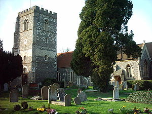
Dorney
Human settlement in England
Distance: Approx. 940 meters
Latitude and longitude: 51.502,-0.676
Dorney is a village and civil parish in Buckinghamshire, England. It borders the River Thames to the west and south, and is bisected by the Jubilee River. In 2011 it had a population of 752.

Bray Lock
Lock and weir on the River Thames in Buckinghamshire, England
Distance: Approx. 645 meters
Latitude and longitude: 51.50893,-0.69159
Bray Lock is a lock and weir on the River Thames in England near Bray and Dorney Reach, and is just above the M4 Bridge across the Thames. The lock is on the Buckinghamshire side of the river on the opposite bank from Bray itself and Maidenhead which are in Berkshire. Here, the county line stands roughly halfway between the lock and the opposite bank, following the course of the Thames itself.

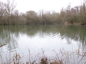
Monkey Island, Bray
Human settlement in England
Distance: Approx. 418 meters
Latitude and longitude: 51.5029,-0.6834
Monkey Island is an island in the River Thames in England, on the reach above Boveney Lock. Its nearest village is Bray, Berkshire. The dominant building on the island is a small hotel since the late 19th century.
Bray, Berkshire
Village in Berkshire, England
Distance: Approx. 842 meters
Latitude and longitude: 51.507,-0.7
Bray, occasionally Bray on Thames, is a suburban village and civil parish in the Windsor and Maidenhead district, in the ceremonial county of Berkshire. It sits on the banks of the River Thames, to the southeast of Maidenhead of which it is a suburb. The village is mentioned in the comedic song "The Vicar of Bray".

The Waterside Inn
Restaurant in Berkshire, England
Distance: Approx. 935 meters
Latitude and longitude: 51.5092,-0.699
The Waterside Inn, in Bray, Berkshire, England, is a restaurant founded by the brothers Michel and Albert Roux after the success of Le Gavroche. It is currently run by Michel's cousin, Alain. The restaurant has three Michelin stars, and in 2010 it became the first restaurant outside France to retain all three stars for twenty-five years.

Dorney Court
Stately home in Buckinghamshire, England
Distance: Approx. 941 meters
Latitude and longitude: 51.5024,-0.6759
Dorney Court is a Grade I listed early Tudor manor house, dating from around 1440, located in the village of Dorney, Buckinghamshire, England. It is owned and lived in by the Palmer family.

M4 Thames Bridge
Bridge in Buckinghamshire and Bray, Berkshire
Distance: Approx. 449 meters
Latitude and longitude: 51.50666667,-0.68583333
The M4 Thames Bridge Maidenhead is a motorway bridge between Dorney Reach, Buckinghamshire and Bray near Maidenhead, Berkshire in England built in the 1960s. The bridge carries the M4 Motorway across the River Thames, on the reach above Boveney Lock, and about 500 yards short of Bray Lock. It is one of three bridges carrying motorway traffic across the Thames, the others being the M25 Runnymede Bridge (just below Bell Weir Lock) and the M3 Chertsey Bridge.

Summerleaze Footbridge
Bridge in Buckinghamshire, England
Distance: Approx. 666 meters
Latitude and longitude: 51.4998,-0.6816
The Summerleaze Footbridge is a footbridge across the River Thames in England linking Dorney, Buckinghamshire and Bray, Berkshire; it is about two miles downstream of Maidenhead Bridge, on the reach above Boveney Lock. The footbridge was built as a gravel conveyor belt, taking gravel from the construction of Dorney Lake, a nearby purpose-built rowing lake, and takes its name "Summerleaze" from the firm who built it in 1996.

Headpile Eyot
Eyot in the River Thames in England
Distance: Approx. 819 meters
Latitude and longitude: 51.51,-0.6943
Headpile Eyot is long and narrow eyot in the River Thames, situated just above Bray Lock. It is also near the village of Bray, Berkshire. The island is small and covered with trees such as Horse chestnut and English oaks.
Pigeonhill Eyot
Island in the River Thames
Distance: Approx. 528 meters
Latitude and longitude: 51.508,-0.6884
Pigeonhill Eyot is an island in the River Thames in England just above Bray Lock, near Bray, Berkshire. It sits between the lock and Headpile Eyot and lock weirs run from the island to the Bray bank. The island is small and tree-covered and Bronze Age artifacts have been found here.

The Cut, Berkshire
River in Berkshire, England
Distance: Approx. 721 meters
Latitude and longitude: 51.49916667,-0.68138889
The Cut is a river in England that rises in North Ascot, Berkshire. It flows for around 14 miles (23 km), through the rural Northern Parishes of Winkfield, Warfield and Binfield in Bracknell Forest on its way down to Bray, where it meets the River Thames just above Queens Eyot on the reach below Bray Lock, having been joined by the Maidenhead Waterways. The Cut is so named because it was diverted eastwards artificially in the early nineteenth century from its original course westwards to the River Loddon via Stanlake Park south of Twyford to alleviate flood risk.
Bray Pit
Distance: Approx. 683 meters
Latitude and longitude: 51.5002,-0.6979
Bray Pit is a nature reserve on the edge of the village of Holyport in Berkshire, England. The nature reserve was under the management of the Berkshire, Buckinghamshire and Oxfordshire Wildlife Trust, but as of December 2019 is no longer listed on the Trust web site.
Weather in this IP's area
broken clouds
13 Celsius
12 Celsius
10 Celsius
14 Celsius
1031 hPa
80 %
1031 hPa
1028 hPa
10000 meters
3.6 m/s
50 degree
62 %
06:39:48
19:15:26