Country:
Region:
City:
Latitude and Longitude:
Time Zone:
Postal Code:
IP information under different IP Channel
ip-api
Country
Region
City
ASN
Time Zone
ISP
Blacklist
Proxy
Latitude
Longitude
Postal
Route
Luminati
Country
Region
ta
City
telaviv
ASN
Time Zone
Asia/Jerusalem
ISP
Gilat Telecom Ltd.
Latitude
Longitude
Postal
IPinfo
Country
Region
City
ASN
Time Zone
ISP
Blacklist
Proxy
Latitude
Longitude
Postal
Route
db-ip
Country
Region
City
ASN
Time Zone
ISP
Blacklist
Proxy
Latitude
Longitude
Postal
Route
ipdata
Country
Region
City
ASN
Time Zone
ISP
Blacklist
Proxy
Latitude
Longitude
Postal
Route
Popular places and events near this IP address

Holon
City in Israel
Distance: Approx. 606 meters
Latitude and longitude: 32.01666667,34.76666667
Holon (Hebrew: חוֹלוֹן [χoˈlon] ) is a city in the Tel Aviv District of Israel, located south of Tel Aviv. Holon is part of the Tel Aviv metropolitan area. In 2022 it had a population of 197,957, making it the tenth most populous city in Israel.

Gush Dan
Metropolitan area in Israel
Distance: Approx. 2369 meters
Latitude and longitude: 32.03333333,34.76666667
Gush Dan (Hebrew: גּוּשׁ דָּן, lit. 'Dan bloc') or Tel Aviv metropolitan area is a conurbation in Israel, located along the country's Mediterranean coastline. There is no single formal definition of Gush Dan, though the term is in frequent use by both governmental bodies and the general public. It ranges from combining Tel Aviv with cities that form an urban continuum with it, to the entire areas from both the Tel Aviv District and the Central District, or sometimes the whole Metropolitan Area of Tel Aviv, which includes a small part of the Southern District as well.

Bat Yam
City in Israel
Distance: Approx. 1995 meters
Latitude and longitude: 32.01666667,34.75
Bat Yam (Hebrew: בַּת יָם or בַּת־יָם ) is a city located on Israel's Mediterranean Sea coast, on the Central Coastal Plain just south of Tel Aviv. It is part of the Gush Dan metropolitan area and the Tel Aviv District. In 2020, it had a population of 160,000.

Holon Institute of Technology
Academic college in Israel
Distance: Approx. 386 meters
Latitude and longitude: 32.01432222,34.77381944
Holon Institute of Technology (HIT) is an Israeli independent public college primarily offering undergrad education. It also has a Master's degree program and does research in the fields of science, applied mathematics, engineering, digital medical technologies, instructional technologies, industrial engineering/technology management and design. It is funded by Israel's Council for Higher Education.

Mikveh Israel
Youth village in Tel Aviv, Israel
Distance: Approx. 2140 meters
Latitude and longitude: 32.02916667,34.78138889
Mikveh Israel (Hebrew: מִקְוֵה יִשְׂרָאֵל, lit. 'Hope of Israel') is a youth village and boarding school in the Tel Aviv District of central Israel, established in 1870. It was the first Jewish agricultural school in what is now Israel and indeed the first modern Jewish settlement in Palestine under the Ottoman Empire rule outside of Jerusalem, heralding a new era in the history of the region. In 2022 it had a population of 421.

Bat Yam Municipal Stadium
Distance: Approx. 1555 meters
Latitude and longitude: 32.003045,34.758167
The Bat Yam Municipal Stadium (Hebrew: האצטדיון העירוני בת ים, HaEtztadion HaIroni Bat Yam) is a football stadium in the Tel Aviv District city of Bat Yam, Israel. It has a capacity of 3,100. Opened in 1991, the stadium is located in the south-east of Bat Yam, and replaced the former municipal stadium that was in the south-west.
Talpiot College of Education
Distance: Approx. 751 meters
Latitude and longitude: 32.00945278,34.76328889
The Talpiot College of Education (המכללה האקדמית תלפיות) is a religious teacher training college in Holon, Israel. It prepares teachers “in the spirit of the Mamlachti dati (state religious) education system”. It was founded in 1937 by Jacob Alishkovsky and was originally called the "Talpiot Beit Midrash for Kindergarten Teachers".

Design Museum Holon
Museum in Israel
Distance: Approx. 687 meters
Latitude and longitude: 32.01096111,34.77760833
Design Museum Holon is the first museum in Israel dedicated to design.

2002 Rishon LeZion bombing
Palestinian suicide attack in Israel
Distance: Approx. 2284 meters
Latitude and longitude: 31.9918,34.7696
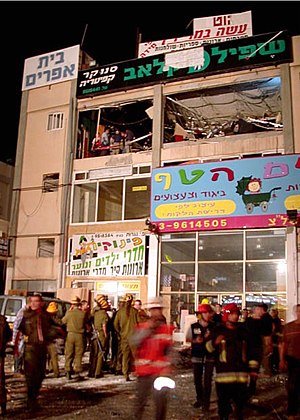
The 2002 Rishon LeZion bombing was a suicide bombing which occurred on 7 May 2002 at a crowded game club located in the new industrial area of Rishon Lezion, Israel. 16 people were killed in the attack and 55 were injured. The Islamic militant group Hamas claimed responsibility for the attack.

Bat Yam–Yoseftal railway station
Railway station in Israel
Distance: Approx. 862 meters
Latitude and longitude: 32.015,34.76194444
Bat Yam–Yoseftal railway station is a railway station on the Rosh HaAyin–Beersheba line. It is located at the Yoseftal interchange on the Ayalon Highway, on the border between Bat Yam and Holon, just south of Tel Aviv, Israel.

Bat Yam–Komemiyut railway station
Railway station in Israel
Distance: Approx. 1649 meters
Latitude and longitude: 32.00083333,34.75944444
Bat Yam–Komemiyut railway station is a railway station on the Rosh HaAyin–Beersheba line in Israel. It is located at the Komemiyut interchange of the Ayalon Highway, on the border between Bat Yam and Holon.
2013 Bat Yam bus bombing
Distance: Approx. 1857 meters
Latitude and longitude: 32.022,34.7545
On 22 December 2013, at approximately 2:30 pm, a pressure cooker bomb exploded on a public bus in Bat Yam, Israel. All casualties were averted because a few minutes earlier, a passenger on the bus had examined the contents of an unattended bag, and saw what looked like a bomb inside, which led all passengers and the driver to exit the vehicle. The bombing shattered or blew out all windows on the bus, and significantly damaged the interior.
Weather in this IP's area
moderate rain
17 Celsius
17 Celsius
16 Celsius
17 Celsius
1015 hPa
83 %
1015 hPa
1012 hPa
10000 meters
2.06 m/s
240 degree
75 %
06:12:38
16:39:56