Country:
Region:
City:
Latitude and Longitude:
Time Zone:
Postal Code:
IP information under different IP Channel
ip-api
Country
Region
City
ASN
Time Zone
ISP
Blacklist
Proxy
Latitude
Longitude
Postal
Route
Luminati
Country
Region
13
City
ermesinde
ASN
Time Zone
Europe/Lisbon
ISP
Servicos De Comunicacoes E Multimedia S.A.
Latitude
Longitude
Postal
IPinfo
Country
Region
City
ASN
Time Zone
ISP
Blacklist
Proxy
Latitude
Longitude
Postal
Route
db-ip
Country
Region
City
ASN
Time Zone
ISP
Blacklist
Proxy
Latitude
Longitude
Postal
Route
ipdata
Country
Region
City
ASN
Time Zone
ISP
Blacklist
Proxy
Latitude
Longitude
Postal
Route
Popular places and events near this IP address

Maia, Portugal
Municipality in Norte, Portugal
Distance: Approx. 5530 meters
Latitude and longitude: 41.23333333,-8.61666667
Maia (Portuguese pronunciation: [ˈmajɐ] ) is a municipality in the Porto Metropolitan Area, Grande Porto subregion, in Norte Region, Portugal. It is located 11 km north of central Porto. The population in 2011 was 135,306, in an area of 82.99 km2 (32.04 sq mi).
Estádio Prof. Dr. José Vieira de Carvalho
Distance: Approx. 5685 meters
Latitude and longitude: 41.23456944,-8.61821944
Estadio Prof. Dr. José Vieira de Carvalho is a multi-use stadium in Maia, Portugal.

Rio Tinto (Gondomar)
Civil parish in Norte, Portugal
Distance: Approx. 5121 meters
Latitude and longitude: 41.178,-8.56
Rio Tinto (Portuguese pronunciation: [ˈʁiu ˈtĩtu]) is a Portuguese city and parish, located in Gondomar Municipality, in northern Portugal. The population in 2011 was 50,713, in an area of 9.38 km2. Rio Tinto, which in Portuguese means red river, was elevated to city status in 1995, and the city of Rio Tinto includes two parishes (freguesias): Baguim do Monte and Rio Tinto, with a total of 65,000 inhabitants, being the most populous city in Gondomar municipality, and third largest in the Greater Porto agglomeration.

Pedrouços
Civil parish in Norte, Portugal
Distance: Approx. 5213 meters
Latitude and longitude: 41.186,-8.589
Pedrouços is a Portuguese parish located in the municipality of Maia. The population in 2011 was 12,149, in an area of 2.57 km². The place of Pedrouços was the most important and populous of the Águas Santas parish.
Ermesinde
Civil parish in Norte, Portugal
Distance: Approx. 752 meters
Latitude and longitude: 41.217,-8.55
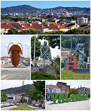
Ermesinde is a civil parish in the municipality (concelho) of Valongo, in continental Portugal, 9 kilometres (5.6 mi) northeast of Porto. The population in 2011 was 38940, in an area of 7.65 km2. It is the smallest by area, and the densest by population (approximately 5000 inhabitants per kilometer square).

Águas Santas
Civil parish in Norte, Portugal
Distance: Approx. 3506 meters
Latitude and longitude: 41.209,-8.589
Águas Santas is a Portuguese town and parish located in the municipality of Maia. The population in 2011 was 27,470, in an area of 8.23 km2, making it one of the most densely populated towns in the Porto District. It is located about 3.5 kilometers north of the city of Porto, near river Leça.

São Mamede de Infesta
Civil parish in Norte, Portugal
Distance: Approx. 4809 meters
Latitude and longitude: 41.2,-8.6
São Mamede de Infesta, or simply São Mamede, is a former civil parish in the municipality of Matosinhos in the Greater Porto area, Portugal. In 2013, the parish merged into the new parish São Mamede de Infesta e Senhora da Hora. It has a population of approximately 28,000 inhabitants and is located just north of the city of Porto.
Alfena
Civil parish in Norte, Portugal
Distance: Approx. 2764 meters
Latitude and longitude: 41.238,-8.525
Alfena is a Portuguese city and parish in the municipality of Valongo, Portugal. The population in 2010 was 18,130, in an area of 15.7 km2.
Lusíada University of Porto
University in Porto, Portugal
Distance: Approx. 5903 meters
Latitude and longitude: 41.17583333,-8.5825
The Lusíada University - North (former Universidade Lusíada do Porto) is a Portuguese private university located in Porto and founded in 1991.
Faculty of Architecture and Arts at the Lusíada University of Porto
Architecture school at the Lusíada University of Porto
Distance: Approx. 5799 meters
Latitude and longitude: 41.17666667,-8.58194444
The Faculty of Architecture and Arts at the Lusíada University of Porto (Portuguese: Faculdade de Arquitectura e Artes da Universidade Lusíada do Porto) is a private institution that offers undergraduate and postgraduate studies in architecture and design. Located in Porto, Portugal, FAAULP belongs to the Lusíada University of Porto.

Church of the Sacred Heart of Jesus (Ermesinde)
Church in Norte, Portugal
Distance: Approx. 1757 meters
Latitude and longitude: 41.20783333,-8.55297222
The Church of the Sacred Heart of Jesus (Portuguese: Igreja do Sagrado Coração de Jesus) is a Modernist church in the civil parish of Ermesinde, in the municipality of Valongo, in the Portuguese district of Porto. The religious temple actually goes by several names, including the Church of the Good Shepherd or Sanctuary of the Sacred Heart of Jesus, a Catholic shrine dedicated to the worship of the Sacred Heart of Jesus.

Valongo (parish)
Civil parish in Norte, Portugal
Distance: Approx. 5792 meters
Latitude and longitude: 41.191,-8.498
Valongo is a civil parish in the municipality (concelho) of Valongo, in continental Portugal. The population in 2021 was 25882, in an area of 20.24 km2. Valongo is most famous for its mountains and its bread.
Weather in this IP's area
light rain
14 Celsius
14 Celsius
14 Celsius
17 Celsius
1019 hPa
88 %
1019 hPa
1008 hPa
10000 meters
1.54 m/s
50 degree
07:25:06
17:13:40
