62.4.57.214 - IP Lookup: Free IP Address Lookup, Postal Code Lookup, IP Location Lookup, IP ASN, Public IP
Country:
Region:
City:
Location:
Time Zone:
Postal Code:
IP information under different IP Channel
ip-api
Country
Region
City
ASN
Time Zone
ISP
Blacklist
Proxy
Latitude
Longitude
Postal
Route
Luminati
Country
Region
16
City
podgorica
ASN
Time Zone
Europe/Podgorica
ISP
Drustvo za telekomunikacije MTEL DOO
Latitude
Longitude
Postal
IPinfo
Country
Region
City
ASN
Time Zone
ISP
Blacklist
Proxy
Latitude
Longitude
Postal
Route
IP2Location
62.4.57.214Country
Region
budva
City
budva
Time Zone
Europe/Podgorica
ISP
Language
User-Agent
Latitude
Longitude
Postal
db-ip
Country
Region
City
ASN
Time Zone
ISP
Blacklist
Proxy
Latitude
Longitude
Postal
Route
ipdata
Country
Region
City
ASN
Time Zone
ISP
Blacklist
Proxy
Latitude
Longitude
Postal
Route
Popular places and events near this IP address

Budva
Town and municipality in Coastal, Montenegro
Distance: Approx. 276 meters
Latitude and longitude: 42.28805556,18.8425
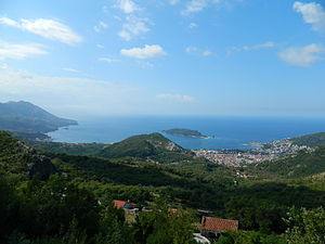
Budva (Montenegrin: Будва, pronounced [bûːdv̞a] or [bûdv̞a]) is a town in the Coastal region of Montenegro. It has 19,218 inhabitants, and it is the centre of Budva Municipality. The coastal area around Budva, called the Budva Riviera, is the center of Montenegrin tourism, known for its well-preserved medieval walled city, sandy beaches and diverse nightlife.

Budva Riviera
Montenegro on the Mediterranean
Distance: Approx. 545 meters
Latitude and longitude: 42.28477778,18.84625
The Budvanian Riviera (Serbian: Будванска ривијера, romanized: Budvanska rivijera) is a 35 km (22 mi) long strip of the Adriatic coast surrounding the town of Budva in western Montenegro. It is part of the Montenegrin Littoral geographical region. It is located roughly along the middle of the Montenegrin coast, and is a center for Montenegrin beach tourism.

Sveti Nikola Island
Island in Montenegro
Distance: Approx. 2346 meters
Latitude and longitude: 42.26666667,18.85
Sveti Nikola Island (Serbian: Острво Свети Никола, romanized: Ostrvo Sveti Nikola, lit. 'Island of Saint Nicholas') is an island in the Adriatic Sea, in the Montenegrin municipality of Budva.

Stadion Lugovi
Distance: Approx. 882 meters
Latitude and longitude: 42.286328,18.850715
Stadion Lugovi is a football stadium in Budva, Montenegro. It is currently used mostly for football matches and is the home ground of FK Mogren. The stadium holds 1,500 people.

Jaz Beach
Beach in Budva, Montenegro
Distance: Approx. 2925 meters
Latitude and longitude: 42.28333333,18.80472222
Jaz (Serbian Cyrillic: Јаз, pronounced [jâːz]) is a beach in the Budva Municipality in Montenegro. It is located 2.5 km west of central Budva. It consists of two areas, one of which measures about 850 metres (or slightly under 1 km) and the other, formerly a nudist beach, stretches around 450 metres (0.45 km).
Prijevor, Budva
Village in Coastal, Montenegro
Distance: Approx. 2806 meters
Latitude and longitude: 42.294902,18.807923
Prijevor (Montenegrin Cyrillic: Пријевор) is a village in the municipality of Budva, Montenegro.

Podmaine Monastery
Serbian Orthodox monastery near Budva, Montenegro
Distance: Approx. 1333 meters
Latitude and longitude: 42.2979,18.8445
The Podmaine Monastery (Serbian: Манастир Подмаине, romanized: Manastir Podmaine) is a Serbian Orthodox monastery built in the 15th century by the Crnojević noble family in Podmaine near Budva, Zeta (modern day Montenegro). The monastery has two churches, smaller and older church of Presentation of the Mother of God was built by Crnojević noble family in the 15th century while bigger church (of Dormition of the Mother of God) was built in 1747.
Top Hill
Distance: Approx. 1672 meters
Latitude and longitude: 42.293757,18.822293
Top Hill is a prominent open air nightclub in Budva, Montenegro.

Boreti
Village in Coastal, Montenegro
Distance: Approx. 1919 meters
Latitude and longitude: 42.283701,18.86301
Boreti (Montenegrin Cyrillic: Борети) is a coastal village and a popular tourist destination in the municipality of Budva, Montenegro.

Podlastva Monastery
Distance: Approx. 3527 meters
Latitude and longitude: 42.3073,18.8078
The Podlastva Monastery (Serbian: Манастир Подластва, romanized: Manastir Podlastva) is a medieval women's Serbian Orthodox monastery located in Lastva Grbaljska, in Grbalj, Montenegro. The monastery's church is dedicated to the Birth of the Most Holy Theotokos. According to a local legend, the Podlastva Monastery was established around 1350 by Emperor Dušan.
Viti Do
Village in Coastal, Montenegro
Distance: Approx. 3497 meters
Latitude and longitude: 42.280466,18.881694
Viti Do (Montenegrin: Вити До) is a village in the municipality of Budva, Montenegro.
Podostrog
Village in Coastal, Montenegro
Distance: Approx. 1540 meters
Latitude and longitude: 42.300223,18.840675
Podostrog (Montenegrin: Подострог) is a village in the municipality of Budva, Montenegro. There is a monastery by the name of Podmaine nearby.
Weather in this IP's area
clear sky
13 Celsius
11 Celsius
13 Celsius
13 Celsius
1025 hPa
41 %
1025 hPa
998 hPa
10000 meters
7.72 m/s
12.86 m/s
320 degree