62.4.42.244 - IP Lookup: Free IP Address Lookup, Postal Code Lookup, IP Location Lookup, IP ASN, Public IP
Country:
Region:
City:
Location:
Time Zone:
Postal Code:
ISP:
ASN:
language:
User-Agent:
Proxy IP:
Blacklist:
IP information under different IP Channel
ip-api
Country
Region
City
ASN
Time Zone
ISP
Blacklist
Proxy
Latitude
Longitude
Postal
Route
db-ip
Country
Region
City
ASN
Time Zone
ISP
Blacklist
Proxy
Latitude
Longitude
Postal
Route
IPinfo
Country
Region
City
ASN
Time Zone
ISP
Blacklist
Proxy
Latitude
Longitude
Postal
Route
IP2Location
62.4.42.244Country
Region
tivat
City
tivat
Time Zone
Europe/Podgorica
ISP
Language
User-Agent
Latitude
Longitude
Postal
ipdata
Country
Region
City
ASN
Time Zone
ISP
Blacklist
Proxy
Latitude
Longitude
Postal
Route
Popular places and events near this IP address

Bay of Kotor
Geographic region of Montenegro
Distance: Approx. 2625 meters
Latitude and longitude: 42.45,18.67
The Bay of Kotor (Serbo-Croatian: Boka kotorska / Бока которска, Italian: Bocche di Cattaro), also known as the Boka (Serbo-Croatian Cyrillic: Бока), is a winding bay of the Adriatic Sea in southwestern Montenegro and the region of Montenegro concentrated around the bay. It is also the southernmost part of the historical region of Dalmatia. At the entrance to the Bay there is Prevlaka, a small peninsula in southern Croatia.

Tivat
Town and municipality in Montenegro
Distance: Approx. 781 meters
Latitude and longitude: 42.43,18.7
Tivat (Serbo-Croatian: Tivat/Тиват, pronounced [tîv̞at]) is a town in Coastal region of Montenegro, located in the Bay of Kotor. As of 2011, its population was 9,367. Tivat is the centre of Tivat Municipality, which is the smallest municipality by area in Montenegro.

Sveti Marko Island
Island of Montenegro
Distance: Approx. 2839 meters
Latitude and longitude: 42.4111,18.6917
Sveti Marko Island (Montenegrin: Острво Свети Марко, romanized: Ostrvo Sveti Marko, lit. 'Island of Saint Mark'), historically known as Stradioti (Страдиоти), is an island on the Adriatic Sea, in the Montenegrin municipality of Tivat.

Vrmac
Mountain in Montenegro
Distance: Approx. 2967 meters
Latitude and longitude: 42.4489,18.728
Vrmac (Serbian Cyrillic: Врмац) is a mountain in south-western Montenegro, overlooking the coastal town of Tivat and a peninsula dividing Tivat Bay from Kotor Bay. It is an extension of Mount Lovćen, and its highest peak is Sveti Ilija (Saint Elijah), which is 785 meters high. It is located north of town of Tivat, and encloses town of Kotor from the south.
Mrčevac
Village in Coastal, Montenegro
Distance: Approx. 2648 meters
Latitude and longitude: 42.41861111,18.7175
Mrčevac (Montenegrin: Мрчевац) is a village in the municipality of Tivat, Montenegro.

Donja Lastva
Town in Coastal, Montenegro
Distance: Approx. 963 meters
Latitude and longitude: 42.44305556,18.68861111
Donja Lastva (Montenegrin: Donja Lastva) is a coastal settlement in the municipality of Tivat, Montenegro. It is also located north of Tivat in the Bay of Kotor.

Dvorana Župa Tivat
Distance: Approx. 1930 meters
Latitude and longitude: 42.42200833,18.70920278
Župa Hall (Montenegrin, Дворана Жупа, Dvorana Župa) is a sports arena in Tivat, Montenegro, located in the Tivat's settlement Župa, by which it got its name. The capacity of the hall is 750-900 seats. Župa Sports Hall is one kilometer from the center of Tivat.
Stadion u Parku
Football stadium in Tivat
Distance: Approx. 435 meters
Latitude and longitude: 42.432531,18.695344
Stadion u Parku is a football stadium in Tivat. It is currently used mostly for football and rugby matches and is the home ground of FK Arsenal and RFC Arsenal. The stadium holds 2,000 people.

Knightsbridge Schools International Montenegro
School in Montenegro
Distance: Approx. 100 meters
Latitude and longitude: 42.43552778,18.69638889
Knightsbridge Schools International Montenegro, also known as KSI Montenegro, is a co-educational, private international day school and boarding school for students aged 3–18. The school is located in Tivat, Montenegro. The school is part of Knightsbridge Schools International (KSI), a pair of international schools based in Colombia and Montenegro and is affiliated with Knightsbridge School in London.

Gospa od Milosti
Distance: Approx. 3209 meters
Latitude and longitude: 42.4107,18.6784
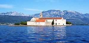
The Our Lady of Mercy (Montenegrin: Gospa od Milosti/Госпа од Милости), also known as Our Lady of Grace, is one of three islands in a unique series of islands near town of Tivat in the Bay of Kotor region of southwestern Montenegro. It is located in front of the largest island of the Bay, Sveti Marko Island. The island is about 160 meters long and sixty meters wide.
Bogdašići
Village in Coastal, Montenegro
Distance: Approx. 3211 meters
Latitude and longitude: 42.427531,18.733284
Bogdašići (Montenegrin: Богдашићи) is a small settlement in the municipality of Tivat, Montenegro. It is located east of Tivat.
Gornja Lastva
Village in Coastal, Montenegro
Distance: Approx. 2106 meters
Latitude and longitude: 42.453417,18.707301
Gornja Lastva (Montenegrin: Gornja Lastva) is a small settlement in the municipality of Tivat, Montenegro. It is located east of Tivat.
Weather in this IP's area
few clouds
14 Celsius
14 Celsius
14 Celsius
15 Celsius
1022 hPa
82 %
1022 hPa
969 hPa
10000 meters
4.12 m/s
160 degree
20 %