62.4.39.148 - IP Lookup: Free IP Address Lookup, Postal Code Lookup, IP Location Lookup, IP ASN, Public IP
Country:
Region:
City:
Location:
Time Zone:
Postal Code:
IP information under different IP Channel
ip-api
Country
Region
City
ASN
Time Zone
ISP
Blacklist
Proxy
Latitude
Longitude
Postal
Route
Luminati
Country
Region
16
City
podgorica
ASN
Time Zone
Europe/Podgorica
ISP
Drustvo za telekomunikacije MTEL DOO
Latitude
Longitude
Postal
IPinfo
Country
Region
City
ASN
Time Zone
ISP
Blacklist
Proxy
Latitude
Longitude
Postal
Route
IP2Location
62.4.39.148Country
Region
herceg-novi
City
igalo
Time Zone
Europe/Podgorica
ISP
Language
User-Agent
Latitude
Longitude
Postal
db-ip
Country
Region
City
ASN
Time Zone
ISP
Blacklist
Proxy
Latitude
Longitude
Postal
Route
ipdata
Country
Region
City
ASN
Time Zone
ISP
Blacklist
Proxy
Latitude
Longitude
Postal
Route
Popular places and events near this IP address
Herceg Novi
Town and municipality in Coastal, Montenegro
Distance: Approx. 2179 meters
Latitude and longitude: 42.45295,18.53120278
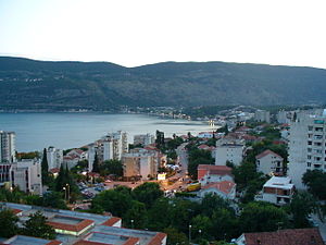
Herceg Novi (Montenegrin Cyrillic: Херцег Нови, pronounced [xěrtseɡ nôviː]) is a town in Coastal region of Montenegro located at the Western entrance to the Bay of Kotor and at the foot of Mount Orjen. It is the administrative center of the Herceg Novi Municipality with around 33,000 inhabitants. The town was founded as a fortress in 1382 by the King of Bosnia, Tvrtko I Kotromanić, and named after Saint Stephen but the name did not stick, instead it became known as Novi (transl. New), also Castelnuovo in Italian (transl. New Castle).

Njivice, Herceg Novi
Place in Coastal, Montenegro
Distance: Approx. 2739 meters
Latitude and longitude: 42.43611111,18.51388889
Njivice (Montenegrin Cyrillic: Њивице) is a village in the Herceg Novi Municipality in Montenegro. Located at the entrance into Boka Kotorska, it provides a view of the town of Herceg Novi and Mount Orjen. It is part of an area known as Provodina.

Sutorina
Village in Coastal, Montenegro
Distance: Approx. 1327 meters
Latitude and longitude: 42.44833333,18.50388889
Sutorina (Montenegrin: Суторина, pronounced [sûtɔrina]) is a village and a river located in Herceg Novi Municipality in southwestern Montenegro. The village is located near the border with Croatia, some three kilometers northwest of the Adriatic Sea in Igalo. The surrounding region, including a short stretch of the Adriatic coast, was named after the little vale of the river Sutorina west of Herceg Novi.

Stadion Solila
Football stadium in Igalo, Montenegro
Distance: Approx. 1011 meters
Latitude and longitude: 42.45183,18.501421
Stadion Solila is a football stadium in Igalo, Herceg Novi municipality, Montenegro. It is used mostly for football matches and is the home ground of FK Igalo. The stadium holds 1,600 seats.

Siege of Castelnuovo
Part of the Ottoman–Venetian War (1537–1540)
Distance: Approx. 2179 meters
Latitude and longitude: 42.45277778,18.53111111
The siege of Castelnuovo was an engagement during the Ottoman-Habsburg struggle for control of the Mediterranean, which took place in July 1539 at the walled town of Castelnuovo, present-day Herceg Novi, Montenegro. Castelnuovo had been conquered by elements of various Spanish tercios the year before during the failed campaign of the Holy League against the Ottoman Empire in Eastern Mediterranean waters. The walled town was besieged by land and sea by a powerful Ottoman army under Hayreddin Barbarossa, who offered an honourable surrender to the defenders.
University of Montenegro Faculty of Applied Physiotherapy
Distance: Approx. 587 meters
Latitude and longitude: 42.458515,18.513313
The University of Montenegro Faculty of Applied Physiotherapy (Montenegrin: Fakultet primijenjene fizioterapije Факултет примијењене физиотерапије) is one of the educational institutions of the University of Montenegro. The building is located in Igalo, and the Faculty is the only physical therapy school in Montenegro and the region.

Kanli Kula
Fortress in Herceg Novi, Montenegro, used as an open-air theatre
Distance: Approx. 2733 meters
Latitude and longitude: 42.4524,18.5381
Kanli Kula is a fortress with an open-air amphitheater in Herceg Novi, Montenegro. The name is of Turkish origin, and means "bloody tower".
Sušćepan
Village in Coastal, Montenegro
Distance: Approx. 785 meters
Latitude and longitude: 42.466753,18.509672
Sušćepan (Montenegrin: Сушћепан) is a village in the municipality of Herceg Novi, Montenegro.

Provodina
Village in Coastal, Montenegro
Distance: Approx. 2069 meters
Latitude and longitude: 42.44194444,18.50111111
Provodina (Montenegrin: Проводина) is a village in the municipality of Herceg Novi, Montenegro. The settlement of Provodina consists of several hamlets, the most important of which are Njivice and Žvinje. It is close to Igalo and has access to the Adriatic Sea.
Ratiševina
Village in Coastal, Montenegro
Distance: Approx. 2058 meters
Latitude and longitude: 42.478253,18.501787
Ratiševina (Montenegrin: Ратишевина) is a village in the municipality of Herceg Novi, Montenegro.
Trebesinj
Village in Coastal, Montenegro
Distance: Approx. 1967 meters
Latitude and longitude: 42.472269,18.523865
Trebesinj (Montenegrin: Требесињ) is a village in the municipality of Herceg Novi, Montenegro.
Church of the Holy Savior
Church in Herceg Novi, Montenegro
Distance: Approx. 1754 meters
Latitude and longitude: 42.45577,18.52704
Church of the Holy Savior (Serbian: Црква Светог Спаса, romanized: Crkva Svetog Spasa) is a temple of the Serbian Orthodox, Metropolitanate of Montenegro and the Littoral, in Herceg Novi, Montenegro. It is located in the settlement of Topla. The construction of this church began in 1709, next to the Church of St.
Weather in this IP's area
clear sky
12 Celsius
10 Celsius
12 Celsius
12 Celsius
1020 hPa
37 %
1020 hPa
980 hPa
10000 meters
7.72 m/s
13.89 m/s
310 degree

