Country:
Region:
City:
Latitude and Longitude:
Time Zone:
Postal Code:
IP information under different IP Channel
ip-api
Country
Region
City
ASN
Time Zone
ISP
Blacklist
Proxy
Latitude
Longitude
Postal
Route
Luminati
Country
ASN
Time Zone
Europe/Stockholm
ISP
Yelles AB
Latitude
Longitude
Postal
IPinfo
Country
Region
City
ASN
Time Zone
ISP
Blacklist
Proxy
Latitude
Longitude
Postal
Route
db-ip
Country
Region
City
ASN
Time Zone
ISP
Blacklist
Proxy
Latitude
Longitude
Postal
Route
ipdata
Country
Region
City
ASN
Time Zone
ISP
Blacklist
Proxy
Latitude
Longitude
Postal
Route
Popular places and events near this IP address

Leksand Municipality
Municipality in Dalarna County, Sweden
Distance: Approx. 9775 meters
Latitude and longitude: 60.73333333,15
Leksand Municipality (Leksands kommun) is a municipality in Dalarna County in central Sweden. Its seat is located in the town of Leksand. In 1974 "old" Leksand was amalgamated with Ål and reunited with Siljansnäs (which had been separated from it in 1875).
Leksand
Place in Dalarna, Sweden
Distance: Approx. 9775 meters
Latitude and longitude: 60.73333333,15
Leksand (Swedish pronunciation: [ˈlɛ̂kːsand] ) is a locality and the seat of Leksand Municipality in Dalarna County, Sweden, with 5,934 inhabitants in 2010. Leksand is situated on the southern branch of lake Siljan, where it flows into river Dalälven.
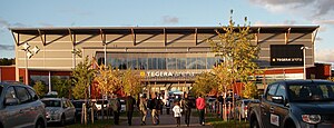
Tegera Arena
Distance: Approx. 9594 meters
Latitude and longitude: 60.735,14.98638889
Tegera Arena (formerly Ejendals Arena) is an arena in Leksand, Sweden primarily used for ice hockey. It was opened in October 2005, and is the home arena of Leksands IF. It holds 7,650 people.

Vikarbyn
Place in Dalarna, Sweden
Distance: Approx. 9909 meters
Latitude and longitude: 60.90916667,15.02083333
Vikarbyn is a locality situated in Rättvik Municipality, Dalarna County, Sweden with 1,171 inhabitants in 2010. Vikarbyn is situated by lake Siljan. In Vikarbyn, there is a school for pupils aged 7–11 years, a grocery store, a restaurant and two furnishing shops.
Siljansnäs
Place in Dalarna, Sweden
Distance: Approx. 8888 meters
Latitude and longitude: 60.78333333,14.85
Siljansnäs is a locality situated in Leksand Municipality, Dalarna County, Sweden with 1,268 inhabitants in 2010.
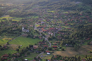
Tällberg
Place in Dalarna, Sweden
Distance: Approx. 585 meters
Latitude and longitude: 60.81666667,15
Tällberg (Swedish pronunciation: [ˈtɛ̂lːbærj]) is a small village located in Leksand Municipality, Dalarna County in Sweden. It is situated on the shore of Lake Siljan, in the northern part of Leksand. A special character of the village is that all houses and buildings are made of wood, such as timber or log.

Rättvik Church
Church in Rättvik, Sweden
Distance: Approx. 9543 meters
Latitude and longitude: 60.8909,15.0964
Rättvik Church (Swedish: Rättviks kyrka) is a church building in Rättvik in Sweden. It belongs to Rättvik Parish of the Church of Sweden.
Weather in this IP's area
overcast clouds
3 Celsius
1 Celsius
2 Celsius
4 Celsius
1011 hPa
69 %
1011 hPa
981 hPa
10000 meters
2.39 m/s
7.6 m/s
246 degree
100 %
08:03:58
15:25:36


