Country:
 Great Britain
Region:
City:
Latitude and Longitude:
Time Zone:
Postal Code:
IP information under different IP Channel
ip-api
Country
Region
City
ASN
Time Zone
ISP
Blacklist
Proxy
Latitude
Longitude
Postal
Route
IPinfo
Country
Region
City
ASN
Time Zone
ISP
Blacklist
Proxy
Latitude
Longitude
Postal
Route
MaxMind
Country
Region
City
ASN
Time Zone
ISP
Blacklist
Proxy
Latitude
Longitude
Postal
Route
Luminati
Country
GBRegion
eng
City
fulham
ASN
Time Zone
Europe/London
ISP
Zen Internet Ltd
Latitude
Longitude
Postal
db-ip
Country
Region
City
ASN
Time Zone
ISP
Blacklist
Proxy
Latitude
Longitude
Postal
Route
ipdata
Country
Region
City
ASN
Time Zone
ISP
Blacklist
Proxy
Latitude
Longitude
Postal
Route
Popular places and events near this IP address

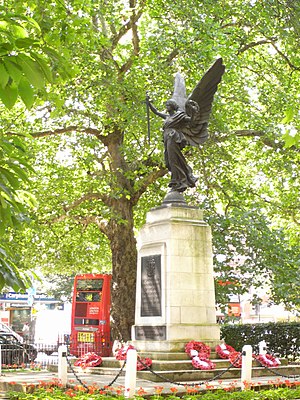
Shepherd's Bush tube station
London Underground station
Distance: Approx. 160 meters
Latitude and longitude: 51.5044,-0.2188
Shepherd's Bush is a London Underground station in the district of Shepherd's Bush in the London Borough of Hammersmith and Fulham. The station is on the Central line, between White City and Holland Park stations, and it lies in Travelcard Zone 2. The station originally opened in 1900, but was closed for eight months in 2008 while the surface station building was replaced with a completely new structure and the underground station refurbished.

Shepherd's Bush Empire
Music venue in West London, England
Distance: Approx. 241 meters
Latitude and longitude: 51.50349,-0.22433
Shepherd's Bush Empire (currently known as O2 Shepherd's Bush Empire for sponsorship reasons, and formerly known as the BBC Television Theatre) is a music venue in Shepherd's Bush, West London, run by the Academy Music Group. It was originally built in 1903 as a music hall for impresario Oswald Stoll, designed by theatre architect Frank Matcham; among its early performers was Charlie Chaplin. In 1953 it became the BBC Television Theatre.
Shepherd's Bush Green
Common land in Shepherd's Bush, London
Distance: Approx. 122 meters
Latitude and longitude: 51.50413,-0.22284
Shepherd's Bush Green (also known as Shepherd's Bush Common) is an approximately 8-acre (3.2 ha) triangular area of open grass surrounded by trees and roads with shops in Shepherd's Bush, an area of west London which takes its name from the Green. The Green is also a ward of the London Borough of Hammersmith and Fulham. The population of the ward at the 2011 Census was 12,175.
BPP University
Private university in the United Kingdom
Distance: Approx. 156 meters
Latitude and longitude: 51.505,-0.22305556
BPP University is a private university in the United Kingdom.
Shepherd's Bush Pavilion
Hotel; formerly a Cinema in London, England
Distance: Approx. 231 meters
Latitude and longitude: 51.504,-0.2244
The Shepherd's Bush Pavilion is a Grade II listed building, currently a hotel, formerly a cinema and bingo hall, in Shepherd's Bush, London. Built in 1923 as a cinema, it was badly damaged by a flying bomb in 1944. In 1955, it was restored and re-opened, but it changed ownership a number of times, and eventually in 1983 became a bingo hall.
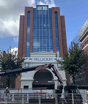
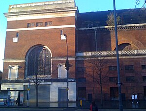
Shepherd's Bush Palladium
Cinema, later a pub in London, England
Distance: Approx. 253 meters
Latitude and longitude: 51.50369,-0.22462
The Shepherd's Bush Palladium (alternatively Shepherds Bush Palladium) was an historic building in Shepherd's Bush, London, originally built in 1910 as the Shepherd's Bush Cinematograph Theatre. The building had a number of owners over the years and finally stopped showing films in 1981. After standing empty for some time, it was eventually converted into a pub and for many years was owned and operated by the Walkabout chain of Australasian-themed bars.

Shepherd's Bush Conservation Area
Distance: Approx. 100 meters
Latitude and longitude: 51.50420556,-0.22253889
The Shepherd's Bush Conservation Area is a part of Shepherd's Bush, London, that has been established by the London Borough of Hammersmith and Fulham in order to promote the protection of local buildings of historic interest, and improve the character of the neighbourhood. Generally, in the United Kingdom, the term Conservation Area nearly always applies to an area (usually urban or the core of a village) considered worthy of preservation or enhancement because of its special architectural or historic interest, "the character or appearance of which it is desirable to preserve or enhance", as required by the Planning (Listed Buildings and Conservation Areas) Act 1990 (Section 69 and 70). More than 8000 have been designated.
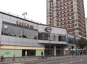
West 12
Shopping mall in London, England
Distance: Approx. 173 meters
Latitude and longitude: 51.503739,-0.218772
W12 (West 12 Shepherd's Bush, formerly the Concorde Centre) is a shopping centre in Shepherd's Bush in the London Borough of Hammersmith and Fulham that is open from 06:00-23:30 daily and includes shops like Lidl, One Below and Poundland. The modern development borders the south side of Shepherd's Bush Green and was designed in the 1960s.
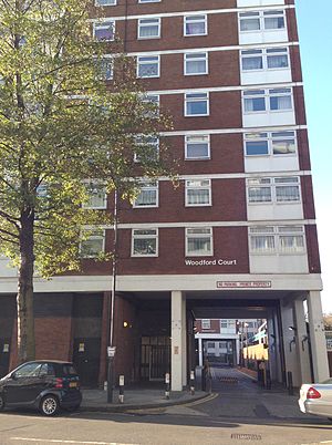
Woodford Court
Distance: Approx. 79 meters
Latitude and longitude: 51.50361111,-0.22083333
Woodford Court is a large public housing project completed in 1974 in Shepherd's Bush, London. It is located on the south side of Shepherd's Bush Green and falls just outside the Shepherd's Bush Conservation Area.
Roseford Court
Distance: Approx. 112 meters
Latitude and longitude: 51.503327,-0.221492
Roseford Court is a large tower block built as part of a public housing project in the 1970s in Shepherd's Bush, London. It is located on the south side of Shepherd's Bush Green and falls just outside the Shepherd's Bush Conservation Area. Although built as public housing, a number of the flats are now privately owned and are regularly offered for sale to the public.
Bush Court
Distance: Approx. 189 meters
Latitude and longitude: 51.50391,-0.218443
Bush Court is a large tower block built as part of a public housing project in the 1970s in Shepherd's Bush, London. It is located on the south side of Shepherd's Bush Green and falls just outside the Shepherd's Bush Conservation Area. Although built as public housing, a number of the flats are now privately owned and are regularly offered for sale to the public.

The Grampians, Shepherd's Bush
Distance: Approx. 204 meters
Latitude and longitude: 51.5026,-0.2222
The Grampians is grade II listed apartment building in Hammersmith, London. It was designed by Maurice Webb in the Art Deco style and built between 1935 and 1937 on top of the former route of the Kensington to Richmond LSWR line and opposite of the LSWR Shepherds Bush station which also had a tower block built on top of its site in the mid 1950s. The designs for the block were exhibited at the Royal Academy in 1935.
Weather in this IP's area
scattered clouds
14 Celsius
14 Celsius
12 Celsius
15 Celsius
1031 hPa
79 %
1031 hPa
1029 hPa
10000 meters
4.63 m/s
50 degree
47 %
06:37:55
19:13:33