Country:
 Austria
Region:
City:
Latitude and Longitude:
Time Zone:
Postal Code:
IP information under different IP Channel
ip-api
Country
Region
City
ASN
Time Zone
ISP
Blacklist
Proxy
Latitude
Longitude
Postal
Route
IPinfo
Country
Region
City
ASN
Time Zone
ISP
Blacklist
Proxy
Latitude
Longitude
Postal
Route
MaxMind
Country
Region
City
ASN
Time Zone
ISP
Blacklist
Proxy
Latitude
Longitude
Postal
Route
Luminati
Country
ATASN
Time Zone
Europe/Vienna
ISP
eww ag
Latitude
Longitude
Postal
db-ip
Country
Region
City
ASN
Time Zone
ISP
Blacklist
Proxy
Latitude
Longitude
Postal
Route
ipdata
Country
Region
City
ASN
Time Zone
ISP
Blacklist
Proxy
Latitude
Longitude
Postal
Route
Popular places and events near this IP address

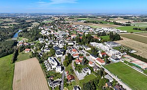
Wels
City in Upper Austria, Austria
Distance: Approx. 2080 meters
Latitude and longitude: 48.15,14.01666667
Wels (German pronunciation: [vɛls] ; Central Bavarian: Wös) is a city in Upper Austria, on the Traun River near Linz. It is the county seat of Wels-Land, and with a population of approximately 60,000, the eighth largest city in Austria.

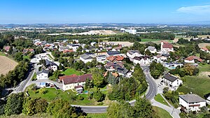
Thalheim bei Wels
Place in Upper Austria, Austria
Distance: Approx. 1322 meters
Latitude and longitude: 48.15138889,14.03833333
Thalheim bei Wels is a town in the Wels-Land District in the Austrian state of Upper Austria.
Wels-Land District
District in Upper Austria, Austria
Distance: Approx. 7026 meters
Latitude and longitude: 48.129,13.957
Bezirk Wels-Land is a district of the state of Upper Austria in Austria.
Bosch-Halle
Indoor sporting arena
Distance: Approx. 1851 meters
Latitude and longitude: 48.1522728,14.0177178
Bosch-Halle is an indoor sporting arena located in Wels, Austria. The capacity of the arena is 9.060 people.
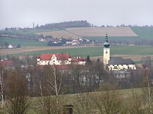
Schleißheim
Place in Upper Austria, Austria
Distance: Approx. 4228 meters
Latitude and longitude: 48.16083333,14.09333333
Schleißheim is a municipality in the district Wels-Land in the Austrian state of Upper Austria.
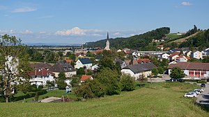
Marchtrenk
Place in Upper Austria, Austria
Distance: Approx. 6345 meters
Latitude and longitude: 48.19166667,14.11055556
Marchtrenk is a municipality with about 12.500 inhabitants in the district Wels-Land in the province Upper Austria of the Republic of Austria. It is situated on the river Traun.
Buchkirchen
Place in Upper Austria, Austria
Distance: Approx. 6866 meters
Latitude and longitude: 48.22388889,14.02
Buchkirchen is a municipality in the district of Wels-Land in the Austrian state of Upper Austria.
Weißkirchen an der Traun
Place in Upper Austria, Austria
Distance: Approx. 6821 meters
Latitude and longitude: 48.16472222,14.12833333
Weißkirchen an der Traun is a municipality in the district of Wels-Land in the Austrian state of Upper Austria.
Steinhaus, Austria
Place in Upper Austria, Austria
Distance: Approx. 5374 meters
Latitude and longitude: 48.11611111,14.02055556
Steinhaus is a municipality in the district of Wels-Land in the Austrian state of Upper Austria.

Wels Airport
Airport
Distance: Approx. 2234 meters
Latitude and longitude: 48.18305556,14.04083333
Wels Airfield (ICAO: LOLW) is an airfield serving Wels, a city in the Austrian state of Upper Austria. It is not used for commercial scheduled services but features business and general aviation as well as private and military training flights and medical transportation.

Wels Hauptbahnhof
Railway station in Upper Austria
Distance: Approx. 776 meters
Latitude and longitude: 48.16555556,14.02666667
Wels Hauptbahnhof, occasionally Wels Central Station or Wels central station is a railway station at Wels, which is the second largest city in the federal state of Upper Austria, in the north of Austria. Opened in 1851, the station is owned and operated by the Austrian Federal Railways (ÖBB). It forms part of the Western Railway, and is also a junction of the Wels–Passau railway, the Alm Valley railway, and the Aschach railway.
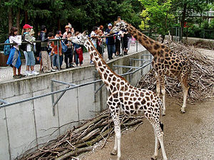
Schmiding Zoo
Zoo in Austria
Distance: Approx. 6889 meters
Latitude and longitude: 48.194444,13.956389
Schmiding Zoo is a zoo at Schloss Schmiding, a castle in Upper Austria, Austria. The origin of the zoo is from Europe's largest bird park, Vogelpark Schmiding, which opened the gates in 1982, and the zoo displays the largest walk-through aviary in the world (25.000 m³). The zoo also includes an aquarium, der Aquazoo, which is Austria's largest marine aquarium.
Weather in this IP's area
clear sky
13 Celsius
13 Celsius
12 Celsius
14 Celsius
1020 hPa
81 %
1020 hPa
983 hPa
10000 meters
1.79 m/s
3.13 m/s
113 degree
7 %
06:46:41
19:08:33