Country:
Region:
City:
Latitude and Longitude:
Time Zone:
Postal Code:
IP information under different IP Channel
ip-api
Country
Region
City
ASN
Time Zone
ISP
Blacklist
Proxy
Latitude
Longitude
Postal
Route
Luminati
Country
Region
64
City
novysaldorf
ASN
Time Zone
Europe/Prague
ISP
Vodafone Czech Republic a.s.
Latitude
Longitude
Postal
IPinfo
Country
Region
City
ASN
Time Zone
ISP
Blacklist
Proxy
Latitude
Longitude
Postal
Route
db-ip
Country
Region
City
ASN
Time Zone
ISP
Blacklist
Proxy
Latitude
Longitude
Postal
Route
ipdata
Country
Region
City
ASN
Time Zone
ISP
Blacklist
Proxy
Latitude
Longitude
Postal
Route
Popular places and events near this IP address

Znojmo
Town in the Czech Republic
Distance: Approx. 2496 meters
Latitude and longitude: 48.85555556,16.04888889
Znojmo (Czech pronunciation: [ˈznoimo]; German: Znaim) is a town in the South Moravian Region of the Czech Republic. It has about 34,000 inhabitants. Znojmo is the historical and cultural centre of southwestern Moravia and the second most populated town in the South Moravian Region.

Nevoga Arena
Distance: Approx. 3127 meters
Latitude and longitude: 48.8603458,16.0435688
Nevoga Arena, also known as Zimní stadion Znojmo, is an indoor sporting arena located in Znojmo, Czech Republic, which is currently home to the Orli Znojmo ice hockey team of the Chance Liga. The arena has a capacity of 4,800 people and was built in 1970.

Dobšice (Znojmo District)
Municipality in South Moravian, Czech Republic
Distance: Approx. 2505 meters
Latitude and longitude: 48.84833333,16.08527778
Dobšice (German: Klein Teßwitz) is a municipality and village in Znojmo District in the South Moravian Region of the Czech Republic. It has about 2,300 inhabitants.
Dyje (Znojmo District)
Municipality in South Moravian, Czech Republic
Distance: Approx. 4465 meters
Latitude and longitude: 48.84722222,16.11638889
Dyje (German: Mühlfraun) is a municipality and village in Znojmo District in the South Moravian Region of the Czech Republic. It has about 500 inhabitants. Dyje lies approximately 7 kilometres (4 mi) east of Znojmo, 53 km (33 mi) south-west of Brno, and 185 km (115 mi) south-east of Prague.

Havraníky
Municipality in South Moravian, Czech Republic
Distance: Approx. 4480 meters
Latitude and longitude: 48.81138889,16.00833333
Havraníky is a municipality and village in Znojmo District in the South Moravian Region of the Czech Republic. It has about 300 inhabitants. Havraníky lies approximately 5 kilometres (3 mi) south of Znojmo, 62 km (39 mi) south-west of Brno, and 183 km (114 mi) south-east of Prague.

Nový Šaldorf-Sedlešovice
Municipality in South Moravian, Czech Republic
Distance: Approx. 624 meters
Latitude and longitude: 48.82888889,16.06194444
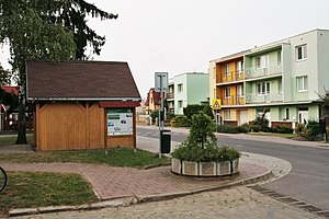
Nový Šaldorf-Sedlešovice is a municipality in Znojmo District in the South Moravian Region of the Czech Republic. It has about 1,800 inhabitants.

Suchohrdly
Municipality in South Moravian, Czech Republic
Distance: Approx. 4190 meters
Latitude and longitude: 48.86611111,16.08888889
Suchohrdly (German: Zuckerhandl) is a municipality and village in Znojmo District in the South Moravian Region of the Czech Republic. It has about 1,400 inhabitants. Suchohrdly lies approximately 3 kilometres (2 mi) north-east of Znojmo, 53 km (33 mi) south-west of Brno, and 182 km (113 mi) south-east of Prague.

Rotunda of Saint Catherine
Distance: Approx. 2635 meters
Latitude and longitude: 48.85555556,16.04361111
The Rotunda of St. Catherine (Czech: Rotunda sv. Kateřiny), known as the Znojmo Rotunda (Znojemská rotunda), is a Romanesque rotunda located in Znojmo, Czech Republic.

Archangel Michael's Church (Znojmo)
Distance: Approx. 2828 meters
Latitude and longitude: 48.85833333,16.04722222
Church of Saint Michael the Archangel (Czech: Kostel svatého Michala) is a church in Znojmo in the South Moravian Region of the Czech Republic.

Znojmo Castle
Castle in Znojmo, Czech Republic
Distance: Approx. 2684 meters
Latitude and longitude: 48.85569167,16.04248889
Znojmo Castle is a castle in Znojmo in the South Moravian Region of the Czech Republic.

Znojmo Town Hall Tower
Distance: Approx. 2491 meters
Latitude and longitude: 48.85548611,16.04880833
The Znojmo town hall tower (Czech: Znojemská radniční věž) is a Gothic tower situated in the city of Znojmo, a historic city in Moravia, Czech Republic. The tower was contracted by Znojmo counselors in 1445 and was built by a local stonemason Nicholas of Edelspitz (Sedlešovice) in 1445–1448. The unique slim tower has a complex, elegant roof construction containing two galleries with characteristic Gothic spires.
Městský stadion (Znojmo)
Distance: Approx. 2741 meters
Latitude and longitude: 48.85831111,16.05201944
Městský stadion, also known as Městský stadion v Horním parku (formerly known as Stadion v Husových sadech), is a multi-purpose stadium in Znojmo, Czech Republic. It is mainly used for football matches and is the home ground of 1. SC Znojmo.
Weather in this IP's area
overcast clouds
11 Celsius
10 Celsius
8 Celsius
12 Celsius
1030 hPa
51 %
1030 hPa
1004 hPa
10000 meters
4.95 m/s
10.05 m/s
114 degree
89 %
06:54:08
16:24:59
